
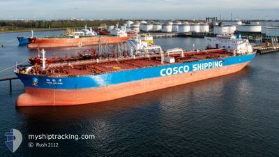
TONG LIN WAN
Tanker
Current Trip
| Time Travelled | 18 h, 5 mins |
|---|---|
| Remaining Time | 8 h, 25 mins |
| Distance Travelled | 135.45 nm |
| Remaining Distance | 61.54 nm |
| AVG Speed | 8.6 Knots |
| MAX Speed | 13.5 Knots |
| AVG Wind | 14 knots |
| MAX Wind | 29.2 knots |
| MIN Temp | 11.4°C / 52.52°F |
| MAX Temp | 16.8°C / 62.24°F |
| Dybgang | 10.3 m |
| Position Modtaget | 1 m siden |
Current Position
| Longitude | 140.07080° |
|---|---|
| Latitude | 34.80445° |
| Status | Under way using engine |
| Fart | 10.2 Knots |
| Kurs | 268.9° |
| Område | North Pacific Ocean |
| Station | T-AIS |
| Position Modtaget | 1 m siden |
Info
Information
The current position of TONG LIN WAN is in North Pacific Ocean with coordinates 34.80445° / 140.07080° as reported on 2024-05-09 18:19 by AIS to our vessel tracker app. The vessel's current speed is 10.2 Knots and is heading at the port of KAWASAKI. The estimated time of arrival as calculated by MyShipTracking vessel tracking app is 2024-05-10 02:46 LT
The vessel TONG LIN WAN (IMO: 9652014, MMSI: 477686100) is a Tanker It's sailing under the flag of [HK] Hong Kong.
In this page you can find informations about the vessels current position, last detected port calls, and current voyage information. If the vessels is not in coverage by AIS you will find the latest position.
The current position of TONG LIN WAN is detected by our AIS receivers and we are not responsible for the reliability of the data. The last position was recorded while the vessel was in Coverage by the Ais receivers of our vessel tracking app.
The current draught of TONG LIN WAN as reported by AIS is 10.3 meters
Weather
| Temperature | 16.2°C / 61.16°F |
|---|---|
| Wind Speed | 6 knots |
| Direction | 357° N |
| Pressure | 1019.5 hPa |
| Humidity | 54.1 % |
| Cloud Coverage | --- |
Featured Company
Last Port Calls
| Port | Arrival | Departure | Time In Port |
|---|---|---|---|
| 2024-05-07 01:35 | 2024-05-09 00:16 | 1 d | |
| 2024-04-08 22:01 | 2024-04-10 11:19 | 1 d | |
| 2024-04-08 01:10 | 2024-04-08 21:19 | 20 h | |
| 2024-03-24 03:41 | 2024-03-25 09:34 | 1 d | |
| 2024-03-22 01:08 | 2024-03-24 02:39 | 2 d | |
| 2024-03-10 16:31 |
Last Trips
| Origin | Departure | Destination | Arrival | Distance | |
|---|---|---|---|---|---|
| 2024-04-10 15:19 | 2024-05-07 10:35 | 7156.01 nm | |||
| 2024-04-09 01:19 | 2024-04-09 02:01 | 1.36 nm | |||
| 2024-03-25 17:34 | 2024-04-08 05:10 | 3709.32 nm | |||
| 2024-03-24 10:39 | 2024-03-24 11:41 | 7.57 nm | |||
| 2024-03-11 00:31 | 2024-03-22 09:08 | 2939.85 nm |
Events
| Tid | Hændelsen | Detaljer | Position / Dest | Info |
|---|---|---|---|---|
| 2024-05-09 16:55 | START Sejllads | 13.74 nm, South East of CHIKURA |
34.83369 / 140.19814
KAWASAKI,JAPAN
|
Fart: 3.2 kn Kurs: 346° |
| 2024-05-09 11:58 | STOP Sejllads | 18.64 nm, South East of CHIKURA |
34.68060 / 140.13647
KAWASAKI,JAPAN
|
Fart: 0.3 kn Kurs: 354° |
| 2024-05-09 03:49 | Dybgangen er ændret | 10.3 12.1 |
35.57107 / 141.09863
KAWASAKI,JAPAN
|
Fart: 11.4 kn Kurs: 216.3° |
| 2024-05-09 03:49 | Destination er ændret | KAWASAKI,JAPAN KASHIMA,JAPAN |
35.57107 / 141.09863
KAWASAKI,JAPAN
|
Fart: 11.4 kn Kurs: 216.3° |
| 2024-05-09 03:49 | ETA er ændret | 2024/05/09 14:00 2024/05/06 06:00 |
35.57107 / 141.09863
KAWASAKI,JAPAN
|
Fart: 11.4 kn Kurs: 216.3° |
| 2024-05-09 03:10 | Status er ændret | Under way using engine Default |
35.68618 / 141.15899
KASHIMA,JAPAN
|
Fart: 13 kn Kurs: 181° |
| 2024-05-09 02:53 | Indenfor Dækning |
35.68618 / 141.15899
North Pacific Ocean
|
Fart: 13 kn Kurs: 180.8° |
|
| 2024-05-09 00:48 | Status er ændret | Default Under way using engine |
35.98136 / 140.76656
KASHIMA,JAPAN
|
Fart: 10.7 kn Kurs: 80.3° |
| 2024-05-09 00:41 | Status er ændret | Under way using engine Default |
35.98042 / 140.73857
KASHIMA,JAPAN
|
Fart: 10.5 kn Kurs: 80° |
| 2024-05-09 00:41 | Udenfor Dækning |
35.98042 / 140.73857
North Pacific Ocean
|
Fart: 10.7 kn Kurs: 80.3° |