

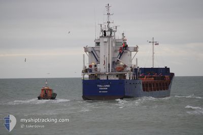
TOLLUND
General Cargo

Current Trip
| Time Travelled | 2 days |
|---|---|
| Remaining Time | --- |
| Distance Travelled | 181.81 nm |
| Remaining Distance | --- |
| AVG Speed | 10.3 Knots |
| MAX Speed | 11.2 Knots |
| AVG Wind | 8.8 knots |
| MAX Wind | 17.5 knots |
| MIN Temp | -5.1°C / 22.82°F |
| MAX Temp | 0.3°C / 32.54°F |
| Dybgang | 5.4 m |
| Position Modtaget | 4 d siden |
Current Position
| Longitude | --- |
|---|---|
| Latitude | --- |
| Status | Under way using engine |
| Fart | 9 Knots |
| Kurs | 24.3° |
| Område | Baltic Sea |
| Station | T-AIS |
| Position Modtaget | 4 d siden |
Information
The current position of TOLLUND is in Baltic Sea with coordinates 54.86577° / 19.12849° as reported on 2025-02-15 19:36 by AIS to our vessel tracker app. The vessel's current speed is 9 Knots and is heading at the port of GDANSK. The estimated time of arrival as calculated by MyShipTracking vessel tracking app is 2025-02-13 10:00 LT
The vessel TOLLUND (IMO: 9088287, MMSI: 261159000) is a General Cargo that was built in 1994 ( 31 år gamle ). It's sailing under the flag of [PL] Poland.
In this page you can find informations about the vessels current position, last detected port calls, and current voyage information. If the vessels is not in coverage by AIS you will find the latest position.
The current position of TOLLUND is detected by our AIS receivers and we are not responsible for the reliability of the data. The last position was recorded while the vessel was in Coverage by the Ais receivers of our vessel tracking app.
The current draught of TOLLUND as reported by AIS is 5.4 meters
Weather
| Temperature | -2.1°C / 28.22°F |
|---|---|
| Wind Speed | 6 knots |
| Direction | 239° WSW |
| Pressure | 1032.9 hPa |
| Humidity | 80.7 % |
| Cloud Coverage | 100 % |


Featured Company
Last Port Calls
| Port | Arrival | Departure | Time In Port |
|---|---|---|---|
| 2025-02-16 09:21 | 2025-02-17 19:29 | 1 d | |
| 2025-02-13 10:52 | 2025-02-15 15:58 | 2 d | |
| 2025-01-25 04:41 | 2025-01-27 14:05 | 2 d | |
| 2025-01-22 11:24 | 2025-01-23 22:13 | 1 d | |
| 2024-12-26 18:38 | 2024-12-30 21:03 | 4 d | |
| 2024-12-10 14:36 | 2024-12-10 22:01 | 7 h | |
| 2024-12-10 11:07 | 2024-12-10 11:27 | 20 m | |
| 2024-12-05 19:06 | 2024-12-05 19:25 | 19 m | |
| 2024-12-04 01:09 | 2024-12-04 05:00 | 3 h |
Last Trips
| Origin | Departure | Destination | Arrival | Distance | |
|---|---|---|---|---|---|
| 2025-02-15 16:58 | 2025-02-16 11:21 | 153.34 nm | |||
| 2025-01-27 16:05 | 2025-02-13 11:52 | 2105.73 nm | |||
| 2025-01-24 00:13 | 2025-01-25 06:41 | 174.08 nm | |||
| 2024-12-30 21:03 | 2025-01-22 13:24 | 3262.72 nm | |||
| 2024-12-10 22:01 | 2024-12-26 18:38 | 2150.64 nm | |||
| 2024-12-10 11:27 | 2024-12-10 14:36 | 14.79 nm | |||
| 2024-12-05 19:25 | 2024-12-10 11:07 | 0.79 nm | |||
| 2024-12-04 06:00 | 2024-12-05 19:06 | 339.65 nm | |||
| 2024-11-30 22:32 | 2024-12-04 02:09 | 610.82 nm |
Events
| Tid | Hændelsen | Detaljer | Position / Dest | Info |
|---|---|---|---|---|
| 2025-02-18 12:21 | STOP Sejllads | 11.63 nm, North West of RIGA |
57.11140 / 23.90603
GDANSK
|
Fart: 0.3 kn Kurs: 295° |
| 2025-02-17 19:29 | Afsejlet fra sidste havn |
|
56.53085 / 20.95897
GDANSK
|
Fart: 7.2 kn Kurs: 291° |
| 2025-02-17 19:21 | START Sejllads |
56.52507 / 20.98556
[LV] LIEPAJA
|
Fart: 6.5 kn Kurs: 285° |
|
| 2025-02-16 09:25 | STOP Sejllads |
56.52697 / 20.99587
[LV] LIEPAJA
|
Fart: 0.1 kn Kurs: 184° |
|
| 2025-02-16 09:21 | Skibe i havn |
|
56.52702 / 20.99542
[LV] LIEPAJA
|
Fart: 0.9 kn Kurs: 140° |
| 2025-02-15 19:43 | Status er ændret | Default Under way using engine |
54.88273 / 19.14206
GDANSK
|
Fart: 9 kn Kurs: 24.3° |
| 2025-02-15 19:36 | Udenfor Dækning |
54.86577 / 19.12849
Baltic Sea
|
Fart: 9 kn Kurs: 24.3° |
|
| 2025-02-15 19:26 | Status er ændret | Under way using engine Default |
54.84373 / 19.11149
GDANSK
|
Fart: 9.2 kn Kurs: 29° |
| 2025-02-15 19:24 | Status er ændret | Default Under way using engine |
54.83806 / 19.10583
GDANSK
|
Fart: 9.2 kn Kurs: 29° |
| 2025-02-15 17:02 | Status er ændret | Under way using engine Moored |
54.51678 / 18.78569
GDANSK
|
Fart: 10 kn Kurs: 35.4° |