
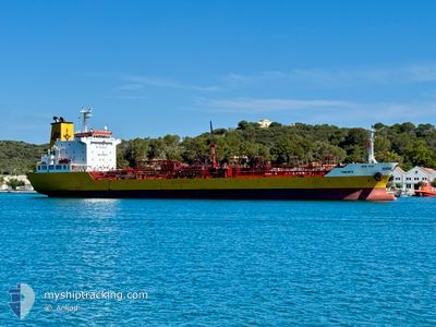
TINERFE
Oil/Chemical Tanker
Current Trip
| Time Travelled | 1 day |
|---|---|
| Remaining Time | 8 h, 25 mins |
| Distance Travelled | 270.19 nm |
| Remaining Distance | 153.21 nm |
| AVG Speed | 10.9 Knots |
| MAX Speed | 13.4 Knots |
| AVG Wind | 10.7 knots |
| MAX Wind | 20 knots |
| MIN Temp | 16.4°C / 61.52°F |
| MAX Temp | 26°C / 78.8°F |
| Dybgang | 9.2 m |
| Position Modtaget | 7 h, 15 m siden |
Current Position
| Longitude | -1.17862° |
|---|---|
| Latitude | 36.94400° |
| Status | Under way using engine |
| Fart | 12.2 Knots |
| Kurs | 52.8° |
| Område | Mediterranean Sea - Western Basin |
| Station | T-AIS |
| Position Modtaget | 7 h, 15 m siden |
Info
Information
The current position of TINERFE is in Mediterranean Sea - Western Basin with coordinates 36.94400° / -1.17862° as reported on 2024-09-08 02:18 by AIS to our vessel tracker app. The vessel's current speed is 12.2 Knots and is heading at the port of IBIZA. The estimated time of arrival as calculated by MyShipTracking vessel tracking app is 2024-09-08 17:58 LT
The vessel TINERFE (IMO: 9498107, MMSI: 255831000) is a Oil/Chemical Tanker that was built in 2009 ( 15 år gamle ). It's sailing under the flag of [PT] Portugal.
In this page you can find informations about the vessels current position, last detected port calls, and current voyage information. If the vessels is not in coverage by AIS you will find the latest position.
The current position of TINERFE is detected by our AIS receivers and we are not responsible for the reliability of the data. The last position was recorded while the vessel was in Coverage by the Ais receivers of our vessel tracking app.
The current draught of TINERFE as reported by AIS is 9.2 meters
Weather
| Temperature | 25.9°C / 78.62°F |
|---|---|
| Wind Speed | 9 knots |
| Direction | 180° S |
| Pressure | 1011 hPa |
| Humidity | 75 % |
| Cloud Coverage | 100 % |
Featured Company
Last Port Calls
| Port | Arrival | Departure | Time In Port |
|---|---|---|---|
| 2024-09-05 21:45 | 2024-09-06 23:14 | 1 d | |
| 2024-09-02 19:15 | 2024-09-03 16:19 | 21 h | |
| 2024-09-01 12:41 | 2024-09-02 06:08 | 17 h | |
| 2024-08-30 04:19 | 2024-08-31 22:13 | 1 d | |
| 2024-08-28 21:18 | 2024-08-29 10:44 | 13 h | |
| 2024-08-27 02:37 | 2024-08-28 06:40 | 1 d | |
| 2024-08-24 16:05 | 2024-08-26 00:59 | 1 d | |
| 2024-08-22 16:22 | 2024-08-23 17:09 | 1 d | |
| 2024-08-18 19:15 | 2024-08-19 12:22 | 17 h | |
| 2024-08-16 07:23 | 2024-08-17 09:33 | 1 d |
Most Visited Ports (Last year)
| Port | Arrivals | |
|---|---|---|
| 30 | ||
| 26 | ||
| 25 | ||
| 20 | ||
| 17 | ||
| 15 |
Last Trips
| Origin | Departure | Destination | Arrival | Distance | |
|---|---|---|---|---|---|
| 2024-09-03 18:19 | 2024-09-05 23:45 | 544.55 nm | |||
| 2024-09-02 08:08 | 2024-09-02 21:15 | 160.50 nm | |||
| 2024-09-01 00:13 | 2024-09-01 14:41 | 167.32 nm | |||
| 2024-08-29 12:44 | 2024-08-30 06:19 | 167.15 nm | |||
| 2024-08-28 08:40 | 2024-08-28 23:18 | 162.53 nm | |||
| 2024-08-26 02:59 | 2024-08-27 04:37 | 302.93 nm | |||
| 2024-08-23 19:09 | 2024-08-24 18:05 | 74.82 nm | |||
| 2024-08-19 14:22 | 2024-08-22 18:22 | 169.97 nm | |||
| 2024-08-17 11:33 | 2024-08-18 21:15 | 411.08 nm | |||
| 2024-08-15 23:53 | 2024-08-16 09:23 | 116.47 nm |
Events
| Tid | Hændelsen | Detaljer | Position / Dest | Info |
|---|---|---|---|---|
| 2024-09-08 02:23 | Status er ændret | Default Under way using engine |
36.95468 / -1.16029
ES IBZ
|
Fart: 12.2 kn Kurs: 52.8° |
| 2024-09-08 02:18 | Udenfor Dækning |
36.94400 / -1.17862
Mediterranean Sea - Western Basin
ES IBZ
|
Fart: 12.2 kn Kurs: 52.8° |
|
| 2024-09-08 02:04 | Status er ændret | Under way using engine Default |
36.91622 / -1.22538
ES IBZ
|
Fart: 12 kn Kurs: 54° |
| 2024-09-08 02:03 | Status er ændret | Default Under way using engine |
36.91458 / -1.22818
ES IBZ
|
Fart: 12 kn Kurs: 55.2° |
| 2024-09-08 01:36 | Fundet i havområde | Spanish part of the Mediterranean Sea - Western Basin |
36.86055 / -1.31616
Mediterranean Sea - Western Basin
ES IBZ
|
Fart: 11.5 kn Kurs: 52.8° |
| 2024-09-08 01:36 | Status er ændret | Under way using engine Default |
36.86023 / -1.31669
ES IBZ
|
Fart: 11.5 kn Kurs: 51° |
| 2024-09-08 01:35 | Indenfor Dækning |
36.86055 / -1.31616
Mediterranean Sea - Western Basin
ES IBZ
|
Fart: 11.5 kn Kurs: 52.8° |
|
| 2024-09-08 01:31 | Status er ændret | Default Under way using engine |
36.85065 / -1.33184
ES IBZ
|
Fart: 11.5 kn Kurs: 52° |
| 2024-09-08 01:31 | Status er ændret | Under way using engine Default |
36.84996 / -1.33295
ES IBZ
|
Fart: 11.6 kn Kurs: 51° |
| 2024-09-07 16:40 | Udenfor Dækning |
36.24410 / -3.34678
Alboran Sea
ES IBZ
|
Fart: 12.4 kn Kurs: 83.9° |