
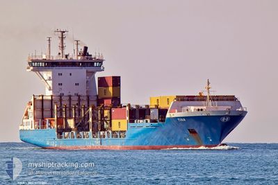
TINA
Container Ship
Current Trip
| Trip Time | 7 h, 44 mins |
|---|---|
| Trip Distance | 103.34 nm |
| AVG Speed | 12.9 Knots |
| MAX Speed | 14.4 Knots |
| Dybgang | 7.9 m |
| AVG Wind | 12.2 knots |
| MAX Wind | 21.3 knots |
| MIN Temp | 9.7°C / 49.46°F |
| MAX Temp | 12.5°C / 54.5°F |
| Position Modtaget | 1 h, 4 m siden |
Current Position
| Longitude | --- |
|---|---|
| Latitude | --- |
| Status | Under way using engine |
| Fart | 14.2 Knots |
| Kurs | 249.2° |
| Område | Mediterranean Sea - Western Basin |
| Station | T-AIS |
| Position Modtaget | 1 h, 4 m siden |
Info
Information
The current position of TINA is in Mediterranean Sea - Western Basin with coordinates 38.32077° / -0.44022° as reported on 2026-01-07 19:53 by AIS to our vessel tracker app. The vessel's current speed is 14.2 Knots and is currently inside the port of ALICANTE.
The vessel TINA (IMO: 9277383, MMSI: 244198000) is a Container Ship that was built in 2003 ( 23 år gamle ). It's sailing under the flag of [NL] Netherlands.
In this page you can find informations about the vessels current position, last detected port calls, and current voyage information. If the vessels is not in coverage by AIS you will find the latest position.
The current position of TINA is detected by our AIS receivers and we are not responsible for the reliability of the data. The last position was recorded while the vessel was in Coverage by the Ais receivers of our vessel tracking app.
The current draught of TINA as reported by AIS is 7.9 meters
Weather
| Temperature | 10°C / 50°F |
|---|---|
| Wind Speed | 16 knots |
| Direction | 306° NW |
| Pressure | 1024.8 hPa |
| Humidity | 52 % |
| Cloud Coverage | --- |
Featured Company
Last Port Calls
| Port | Arrival | Departure | Time In Port |
|---|---|---|---|
| 2026-01-07 21:14 | |||
| 2026-01-06 01:14 | 2026-01-07 13:30 | 1 d | |
| 2026-01-02 11:57 | 2026-01-03 14:42 | 1 d | |
| 2025-12-29 14:46 | 2025-12-30 02:07 | 11 h | |
| 2025-12-27 06:47 | 2025-12-27 17:22 | 10 h | |
| 2025-12-24 08:03 | 2025-12-24 21:02 | 12 h | |
| 2025-12-22 23:27 | 2025-12-23 20:00 | 20 h | |
| 2025-12-22 09:56 | 2025-12-22 18:32 | 8 h | |
| 2025-12-21 13:38 | 2025-12-22 01:05 | 11 h | |
| 2025-12-20 23:55 | 2025-12-21 10:29 | 10 h |
Last Trips
| Origin | Departure | Destination | Arrival | Distance | |
|---|---|---|---|---|---|
| 2026-01-07 13:30 | 2026-01-07 21:14 | 103.34 nm | |||
| 2026-01-03 14:42 | 2026-01-06 01:14 | 362.91 nm | |||
| 2025-12-30 02:07 | 2026-01-02 11:57 | 527.14 nm | |||
| 2025-12-27 17:22 | 2025-12-29 14:46 | 499.09 nm | |||
| 2025-12-24 21:02 | 2025-12-27 06:47 | 215.83 nm | |||
| 2025-12-23 20:00 | 2025-12-24 08:03 | 165.72 nm | |||
| 2025-12-22 18:32 | 2025-12-22 23:27 | 69.55 nm | |||
| 2025-12-22 01:05 | 2025-12-22 09:56 | 104.49 nm | |||
| 2025-12-21 10:29 | 2025-12-21 13:38 | 11.77 nm | |||
| 2025-12-19 20:54 | 2025-12-20 23:55 | 292.19 nm |
Events
| Tid | Hændelsen | Detaljer | Position / Dest | Info |
|---|---|---|---|---|
| 2026-01-07 20:39 | STOP Sejllads |
38.32938 / -.49921
[ES] ALICANTE
|
Fart: Kurs: 205° |
|
| 2026-01-07 20:14 | Skibe i havn |
|
38.32099 / -.49819
[ES] ALICANTE
|
Fart: 7.4 kn Kurs: 271° |
| 2026-01-07 19:59 | Status er ændret | Default Under way using engine |
38.31558 / -.46604
ESALC
|
Fart: 14.2 kn Kurs: 249.2° |
| 2026-01-07 19:53 | Ændre havområde | Spanish part of the Mediterranean Sea - Western Basin Spanish part of the Balearic Sea |
38.32077 / -.44022
Mediterranean Sea - Western Basin
ESALC
|
Fart: 14.2 kn Kurs: 249.2° |
| 2026-01-07 19:53 | Udenfor Dækning |
38.32077 / -.44022
Mediterranean Sea - Western Basin
[ES] ALICANTE
|
Fart: 14.2 kn Kurs: 249.2° |
|
| 2026-01-07 19:50 | Status er ændret | Under way using engine Default |
38.32479 / -.42649
ESALC
|
Fart: 14.4 kn Kurs: 249° |
| 2026-01-07 19:43 | Indenfor Dækning |
38.32077 / -.44022
Mediterranean Sea - Western Basin
ESALC
|
Fart: 14.2 kn Kurs: 249.2° |
|
| 2026-01-07 16:07 | Status er ændret | Default Under way using engine |
38.80333 / .32333
ESALC
|
Fart: 14 kn Kurs: 145.3° |
| 2026-01-07 16:01 | Status er ændret | Under way using engine Default |
38.82185 / .30680
ESALC
|
Fart: 14 kn Kurs: 144° |
| 2026-01-07 16:01 | Udenfor Dækning |
38.82185 / .30680
Balearic Sea
ESALC
|
Fart: 14 kn Kurs: 145.3° |