
TIAN QI
Cargo
Current Trip
FANGCHENG
| Time Travelled | 7 days |
|---|---|
| Remaining Time | --- |
| Distance Travelled | 1086.95 nm |
| Remaining Distance | --- |
| AVG Speed | 12.6 Knots |
| MAX Speed | 14.8 Knots |
| AVG Wind | 8.7 knots |
| MAX Wind | 14 knots |
| MIN Temp | 10.2°C / 50.36°F |
| MAX Temp | 29.3°C / 84.74°F |
| Dybgang | 9 m |
| Position Modtaget | 27 d siden |
Current Position
| Longitude | 118.49846° |
|---|---|
| Latitude | 23.94747° |
| Status | Under way using engine |
| Fart | 11.3 Knots |
| Kurs | 63.5° |
| Område | South China Sea |
| Station | T-AIS |
| Position Modtaget | 27 d siden |
Info
Information
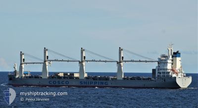
The current position of TIAN QI is in South China Sea with coordinates 23.94747° / 118.49846° as reported on 2024-04-08 01:53 by AIS to our vessel tracker app. The vessel's current speed is 11.3 Knots
The vessel TIAN QI (IMO: 9722742, MMSI: 412478720) is a Cargo It's sailing under the flag of [CN] China.
In this page you can find informations about the vessels current position, last detected port calls, and current voyage information. If the vessels is not in coverage by AIS you will find the latest position.
The current position of TIAN QI is detected by our AIS receivers and we are not responsible for the reliability of the data. The last position was recorded while the vessel was in Coverage by the Ais receivers of our vessel tracking app.
The current draught of TIAN QI as reported by AIS is 9 meters
Weather
| Temperature | 29.3°C / 84.74°F |
|---|---|
| Wind Speed | 3 knots |
| Direction | 321° NW |
| Pressure | 1010.2 hPa |
| Humidity | 70 % |
| Cloud Coverage | 24 % |
Featured Company
Most Visited Ports (Last year)
| Port | Arrivals | |
|---|---|---|
| 3 | ||
| 2 | ||
| 2 | ||
| 2 | ||
| 1 | ||
| 1 |
Events
| Tid | Hændelsen | Detaljer | Position / Dest | Info |
|---|---|---|---|---|
| 2024-05-02 02:36 | START Sejllads | 0.4 nm, South West of ZHANGJIAGANG |
31.96968 / 120.40889
FANGCHENG
|
Fart: 5.4 kn Kurs: 92° |
| 2024-04-28 01:38 | STOP Sejllads | 0.23 nm, South East of ZHANGJIAGANG |
31.97350 / 120.41573
FANGCHENG
|
Fart: 0.2 kn Kurs: 262° |
| 2024-04-27 23:40 | START Sejllads | 0.18 nm, North East of JIANGYIN |
31.92796 / 120.17896
FANGCHENG
|
Fart: 3.6 kn Kurs: 77° |
| 2024-04-27 23:35 | Afsejlet fra sidste havn |
|
31.92796 / 120.17896
FANGCHENG
|
Fart: Kurs: 95° |