
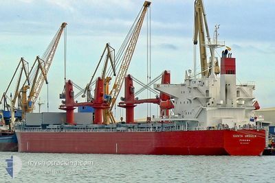
THOR MONADIC
Bulk Carrier
Current Trip
| Time Travelled | 25 days |
|---|---|
| Remaining Time | --- |
| Distance Travelled | 6139.27 nm |
| Remaining Distance | --- |
| AVG Speed | 9.9 Knots |
| MAX Speed | 13.5 Knots |
| AVG Wind | 11.6 knots |
| MAX Wind | 31.3 knots |
| MIN Temp | 16°C / 60.8°F |
| MAX Temp | 31.5°C / 88.7°F |
| Dybgang | 12.9 m |
| Position Modtaget | 3 d siden |
Current Position
| Longitude | 16.79759° |
|---|---|
| Latitude | -33.38492° |
| Status | Under way using engine |
| Fart | 9.4 Knots |
| Kurs | 319.5° |
| Område | South Atlantic Ocean |
| Station | T-AIS |
| Position Modtaget | 3 d siden |
Info
Information
The current position of THOR MONADIC is in South Atlantic Ocean with coordinates -33.38492° / 16.79759° as reported on 2024-05-02 13:03 by AIS to our vessel tracker app. The vessel's current speed is 9.4 Knots and is heading at the port of SUEZ CANAL. The estimated time of arrival as calculated by MyShipTracking vessel tracking app is 2024-05-26 18:00 LT
The vessel THOR MONADIC (IMO: 9331220, MMSI: 564411000) is a Bulk Carrier that was built in 2006 ( 18 år gamle ). It's sailing under the flag of [SG] Singapore.
In this page you can find informations about the vessels current position, last detected port calls, and current voyage information. If the vessels is not in coverage by AIS you will find the latest position.
The current position of THOR MONADIC is detected by our AIS receivers and we are not responsible for the reliability of the data. The last position was recorded while the vessel was in Coverage by the Ais receivers of our vessel tracking app.
The current draught of THOR MONADIC as reported by AIS is 12.9 meters
Weather
| Temperature | 19.8°C / 67.64°F |
|---|---|
| Wind Speed | 11 knots |
| Direction | 169° S |
| Pressure | 1016.4 hPa |
| Humidity | 72.4 % |
| Cloud Coverage | 100 % |
Featured Company
Last Port Calls
| Port | Arrival | Departure | Time In Port |
|---|---|---|---|
| 2024-04-05 18:48 | 2024-04-11 03:29 | 5 d | |
| 2024-03-26 21:31 | 2024-04-04 09:46 | 8 d | |
| 2024-03-08 18:46 | 2024-03-11 09:46 | 2 d |
Most Visited Ports (Last year)
| Port | Arrivals | |
|---|---|---|
| 2 | ||
| 1 | ||
| 1 | ||
| 1 | ||
| 1 | ||
| 1 |
Last Trips
| Origin | Departure | Destination | Arrival | Distance | |
|---|---|---|---|---|---|
| 2024-04-04 15:16 | 2024-04-06 00:18 | 84.45 nm | |||
| 2024-03-11 13:46 | 2024-03-27 03:01 | 3020.96 nm | |||
| 2024-02-02 00:10 | 2024-03-08 22:46 | 3839.14 nm |
Events
| Tid | Hændelsen | Detaljer | Position / Dest | Info |
|---|---|---|---|---|
| 2024-05-02 13:11 | Status er ændret | Default Under way using engine |
-33.36820 / 16.78144
EGPSE
|
Fart: 9.4 kn Kurs: 319.5° |
| 2024-05-02 13:03 | Udenfor Dækning |
-33.38492 / 16.79759
South Atlantic Ocean
EGPSE
|
Fart: 9.4 kn Kurs: 319.5° |
|
| 2024-05-02 13:00 | Status er ændret | Under way using engine Default |
-33.39113 / 16.80333
EGPSE
|
Fart: 9.4 kn Kurs: 322° |
| 2024-05-02 12:59 | Status er ændret | Default Under way using engine |
-33.39248 / 16.80469
EGPSE
|
Fart: 9.2 kn Kurs: 320.6° |
| 2024-05-02 12:42 | Status er ændret | Under way using engine Default |
-33.42837 / 16.83860
EGPSE
|
Fart: 9 kn Kurs: 321° |
| 2024-05-02 12:39 | Indenfor Dækning |
-33.42837 / 16.83860
South Atlantic Ocean
EGPSE
|
Fart: 9.2 kn Kurs: 323.3° |
|
| 2024-05-02 07:07 | Status er ændret | Default Under way using engine |
-34.09505 / 17.52433
EGPSE
|
Fart: 9.9 kn Kurs: 314.1° |
| 2024-05-02 07:02 | Udenfor Dækning |
-34.10460 / 17.53752
South Atlantic Ocean
EGPSE
|
Fart: 9.9 kn Kurs: 314.1° |
|
| 2024-05-02 06:41 | Status er ændret | Under way using engine Default |
-34.14527 / 17.58895
EGPSE
|
Fart: 10.2 kn Kurs: 315° |
| 2024-05-02 06:34 | Status er ændret | Default Under way using engine |
-34.15887 / 17.60628
EGPSE
|
Fart: 9.1 kn Kurs: 318.3° |