
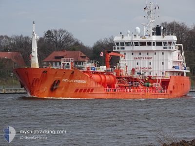
THEODOR ESSBERGER
Oil/Chemical Tanker
Current Trip
| Time Travelled | 3 days |
|---|---|
| Remaining Time | --- |
| Distance Travelled | 126.81 nm |
| Remaining Distance | 44.22 nm |
| AVG Speed | 10.8 Knots |
| MAX Speed | 15.3 Knots |
| AVG Wind | 10.2 knots |
| MAX Wind | 19 knots |
| MIN Temp | 6.3°C / 43.34°F |
| MAX Temp | 11.4°C / 52.52°F |
| Dybgang | 6.6 m |
| Position Modtaget | 2 m siden |
Current Position
| Longitude | --- |
|---|---|
| Latitude | --- |
| Status | At anchor |
| Fart | |
| Kurs | 265° |
| Område | North Sea |
| Station | T-AIS |
| Position Modtaget | 2 m siden |
Info
Information
The current position of THEODOR ESSBERGER is in North Sea with coordinates 51.41582° / 1.40427° as reported on 2024-12-27 12:30 by AIS to our vessel tracker app. The vessel's current speed is 0 Knots and is heading at the port of SOUTH STIFFORD. The estimated time of arrival as calculated by MyShipTracking vessel tracking app is 2024-12-24 17:00 LT
The vessel THEODOR ESSBERGER (IMO: 9403906, MMSI: 255806146) is a Oil/Chemical Tanker that was built in 2008 ( 16 år gamle ). It's sailing under the flag of [PT] Portugal.
In this page you can find informations about the vessels current position, last detected port calls, and current voyage information. If the vessels is not in coverage by AIS you will find the latest position.
The current position of THEODOR ESSBERGER is detected by our AIS receivers and we are not responsible for the reliability of the data. The last position was recorded while the vessel was in Coverage by the Ais receivers of our vessel tracking app.
The current draught of THEODOR ESSBERGER as reported by AIS is 6.6 meters
Weather
| Temperature | 8.8°C / 47.84°F |
|---|---|
| Wind Speed | 2 knots |
| Direction | 109° ESE |
| Pressure | 1034 hPa |
| Humidity | 82.9 % |
| Cloud Coverage | 100 % |
Featured Company
Last Port Calls
| Port | Arrival | Departure | Time In Port |
|---|---|---|---|
| 2024-12-22 10:05 | 2024-12-24 09:47 | 1 d | |
| 2024-12-19 18:53 | 2024-12-22 09:15 | 2 d | |
| 2024-12-17 22:53 | 2024-12-18 16:19 | 17 h | |
| 2024-12-15 11:48 | 2024-12-16 22:32 | 1 d | |
| 2024-12-12 16:23 | 2024-12-14 08:52 | 1 d | |
| 2024-12-08 20:59 | 2024-12-09 23:46 | 1 d | |
| 2024-12-05 12:51 | 2024-12-06 19:50 | 1 d | |
| 2024-12-02 09:00 | 2024-12-02 09:52 | 51 m | |
| 2024-12-02 08:08 | 2024-12-02 08:38 | 29 m | |
| 2024-12-01 00:45 | 2024-12-01 01:11 | 26 m |
Last Trips
| Origin | Departure | Destination | Arrival | Distance | |
|---|---|---|---|---|---|
| 2024-12-22 10:15 | 2024-12-22 11:05 | 5.46 nm | |||
| 2024-12-18 16:19 | 2024-12-19 19:53 | 218.30 nm | |||
| 2024-12-16 23:32 | 2024-12-17 22:53 | 224.28 nm | |||
| 2024-12-14 09:52 | 2024-12-15 12:48 | 263.97 nm | |||
| 2024-12-10 00:46 | 2024-12-12 17:23 | 387.26 nm | |||
| 2024-12-06 20:50 | 2024-12-08 21:59 | 364.09 nm | |||
| 2024-12-02 09:52 | 2024-12-05 13:51 | 785.56 nm | |||
| 2024-12-02 08:38 | 2024-12-02 09:00 | 1.87 nm | |||
| 2024-12-01 01:11 | 2024-12-02 08:08 | 0.65 nm | |||
| 2024-12-01 00:23 | 2024-12-01 00:45 | 1.45 nm |
Events
| Tid | Hændelsen | Detaljer | Position / Dest | Info |
|---|---|---|---|---|
| 2024-12-27 10:10 | Status er ændret | At anchor Default |
51.41652 / 1.40223
GBGYS
|
Fart: 0.2 kn Kurs: 144° |
| 2024-12-27 10:07 | Status er ændret | Default At anchor |
51.41647 / 1.40208
GBGYS
|
Fart: 0.2 kn Kurs: 137° |
| 2024-12-27 09:34 | Status er ændret | At anchor Default |
51.41620 / 1.40147
GBGYS
|
Fart: Kurs: 96° |
| 2024-12-27 09:31 | Status er ændret | Default At anchor |
51.41620 / 1.40148
GBGYS
|
Fart: Kurs: 98° |
| 2024-12-27 07:19 | Status er ændret | At anchor Default |
51.41570 / 1.40132
GBGYS
|
Fart: 0.1 kn Kurs: 92° |
| 2024-12-27 07:13 | Status er ændret | Default At anchor |
51.41570 / 1.40132
GBGYS
|
Fart: 0.1 kn Kurs: 90° |
| 2024-12-25 19:26 | Status er ændret | At anchor Default |
51.41593 / 1.40122
GBGYS
|
Fart: Kurs: 107° |
| 2024-12-25 19:23 | Status er ændret | Default At anchor |
51.41598 / 1.40117
GBGYS
|
Fart: 0.1 kn Kurs: 99° |
| 2024-12-24 19:43 | Status er ændret | At anchor Under way using engine |
51.41713 / 1.40298
GBGYS
|
Fart: 1 kn Kurs: 191° |
| 2024-12-24 19:40 | STOP Sejllads | 5.5 nm, North of RAMSGATE |
51.41648 / 1.40228
GBGYS
|
Fart: 0.3 kn Kurs: 226° |