
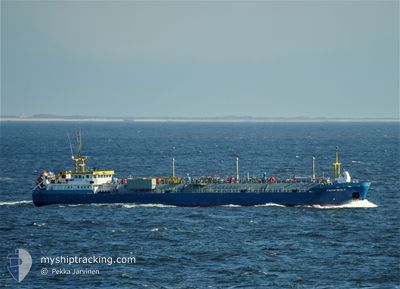
TEMPEST
Lpg Tanker
Current Trip
| Time Travelled | 15 h, 52 mins |
|---|---|
| Remaining Time | 15 h, 46 mins |
| Distance Travelled | 140.25 nm |
| Remaining Distance | 122.84 nm |
| AVG Speed | 8.8 Knots |
| MAX Speed | 11.5 Knots |
| AVG Wind | 15.7 knots |
| MAX Wind | 22.7 knots |
| MIN Temp | 3.2°C / 37.76°F |
| MAX Temp | 6.3°C / 43.34°F |
| Dybgang | 3.2 m |
| Position Modtaget | 7 m siden |
Current Position
| Longitude | --- |
|---|---|
| Latitude | --- |
| Status | Under way using engine |
| Fart | 9.1 Knots |
| Kurs | 227.4° |
| Område | North Sea |
| Station | T-AIS |
| Position Modtaget | 7 m siden |
Info
Information
The current position of TEMPEST is in North Sea with coordinates 51.03910° / 1.40842° as reported on 2026-01-08 06:05 by AIS to our vessel tracker app. The vessel's current speed is 9.1 Knots and is heading at the port of FAWLEY. The estimated time of arrival as calculated by MyShipTracking vessel tracking app is 2026-01-08 21:59 LT
The vessel TEMPEST (IMO: 9424754, MMSI: 244285000) is a Lpg Tanker that was built in 2008 ( 18 år gamle ). It's sailing under the flag of [NL] Netherlands.
In this page you can find informations about the vessels current position, last detected port calls, and current voyage information. If the vessels is not in coverage by AIS you will find the latest position.
The current position of TEMPEST is detected by our AIS receivers and we are not responsible for the reliability of the data. The last position was recorded while the vessel was in Coverage by the Ais receivers of our vessel tracking app.
The current draught of TEMPEST as reported by AIS is 3.2 meters
Weather
| Temperature | 4.5°C / 40.1°F |
|---|---|
| Wind Speed | 3 knots |
| Direction | 76° ENE |
| Pressure | 1005.5 hPa |
| Humidity | 86.9 % |
| Cloud Coverage | 100 % |
Featured Company
Last Port Calls
| Port | Arrival | Departure | Time In Port |
|---|---|---|---|
| 2026-01-03 09:26 | 2026-01-07 15:21 | 4 d | |
| 2026-01-01 02:05 | 2026-01-02 03:49 | 1 d | |
| 2025-12-28 15:17 | 2025-12-30 07:38 | 1 d | |
| 2025-12-23 21:21 | 2025-12-27 07:28 | 3 d | |
| 2025-12-20 16:43 | 2025-12-22 18:34 | 2 d | |
| 2025-12-17 19:56 | 2025-12-19 14:36 | 1 d | |
| 2025-12-07 20:32 | 2025-12-09 17:08 | 1 d | |
| 2025-12-04 19:03 | 2025-12-05 12:41 | 17 h | |
| 2025-11-25 22:33 | 2025-11-26 10:45 | 12 h | |
| 2025-11-22 11:40 | 2025-11-24 16:03 | 2 d |
Last Trips
| Origin | Departure | Destination | Arrival | Distance | |
|---|---|---|---|---|---|
| 2026-01-02 03:49 | 2026-01-03 09:26 | 264.15 nm | |||
| 2025-12-30 07:38 | 2026-01-01 02:05 | 257.09 nm | |||
| 2025-12-27 07:28 | 2025-12-28 15:17 | 265.54 nm | |||
| 2025-12-22 18:34 | 2025-12-23 21:21 | 258.29 nm | |||
| 2025-12-19 14:36 | 2025-12-20 16:43 | 265.50 nm | |||
| 2025-12-09 17:08 | 2025-12-17 19:56 | 268.64 nm | |||
| 2025-12-05 12:41 | 2025-12-07 20:32 | 268.50 nm | |||
| 2025-11-26 10:45 | 2025-12-04 19:03 | 257.63 nm | |||
| 2025-11-24 16:03 | 2025-11-25 22:33 | 253.03 nm | |||
| 2025-11-21 02:44 | 2025-11-22 11:40 | 258.76 nm |
Events
| Tid | Hændelsen | Detaljer | Position / Dest | Info |
|---|---|---|---|---|
| 2026-01-08 06:05 | Status er ændret | Under way using engine Default |
51.03910 / 1.40842
GBFAW
|
Fart: 9.1 kn Kurs: 228° |
| 2026-01-08 06:05 | Status er ændret | Default Under way using engine |
51.04055 / 1.41091
GBFAW
|
Fart: 9.1 kn Kurs: 228.2° |
| 2026-01-08 05:57 | Ændre havområde | United Kingdom part of the English Channel United Kingdom part of the North Sea |
51.05324 / 1.43280
English Channel
GBFAW
|
Fart: 9.1 kn Kurs: 228.2° |
| 2026-01-08 05:56 | Status er ændret | Under way using engine Default |
51.05492 / 1.43571
GBFAW
|
Fart: 8.8 kn Kurs: 226° |
| 2026-01-08 05:29 | Status er ændret | Default Under way using engine |
51.09763 / 1.51393
GBFAW
|
Fart: 7.8 kn Kurs: 228° |
| 2026-01-08 05:20 | Status er ændret | Under way using engine Default |
51.11076 / 1.53736
GBFAW
|
Fart: 7.6 kn Kurs: 228° |
| 2026-01-08 05:17 | Status er ændret | Default Under way using engine |
51.11483 / 1.54469
GBFAW
|
Fart: 7.7 kn Kurs: 230.2° |
| 2026-01-08 02:52 | ETA er ændret | 2026/01/08 14:30 2026/01/08 10:00 |
51.35242 / 1.83844
GBFAW
|
Fart: 8.5 kn Kurs: 202.9° |
| 2026-01-08 02:10 | Ændre havområde | United Kingdom part of the North Sea Dutch part of the North Sea |
51.44899 / 1.90767
North Sea
GBFAW
|
Fart: 9.6 kn Kurs: 214.1° |
| 2026-01-08 02:10 | Status er ændret | Under way using engine Default |
51.44899 / 1.90767
GBFAW
|
Fart: 9.5 kn Kurs: 202° |