
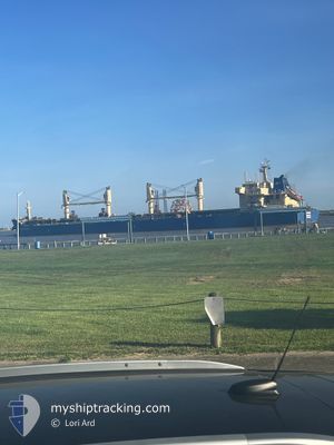
TB PISCES
Cargo
Current Trip
| Time Travelled | 37 days |
|---|---|
| Remaining Time | --- |
| Distance Travelled | 8204.93 nm |
| Remaining Distance | --- |
| AVG Speed | 9.1 Knots |
| MAX Speed | 10.5 Knots |
| AVG Wind | 10.7 knots |
| MAX Wind | 27 knots |
| MIN Temp | 14.2°C / 57.56°F |
| MAX Temp | 31.6°C / 88.88°F |
| Dybgang | 12.2 m |
| Position Modtaget | 2 d siden |
Current Position
| Longitude | 32.94473° |
|---|---|
| Latitude | -31.64337° |
| Status | Under way using engine |
| Fart | 9.5 Knots |
| Kurs | 68.5° |
| Område | Indian Ocean |
| Station | T-AIS |
| Position Modtaget | 2 d siden |
Info
Information
The current position of TB PISCES is in Indian Ocean with coordinates -31.64337° / 32.94473° as reported on 2024-09-05 13:56 by AIS to our vessel tracker app. The vessel's current speed is 9.5 Knots and is heading at the port of VISAKHAPATNAM. The estimated time of arrival as calculated by MyShipTracking vessel tracking app is 2024-09-22 14:30 LT
The vessel TB PISCES (IMO: 9626962, MMSI: 563227200) is a Cargo It's sailing under the flag of [SG] Singapore.
In this page you can find informations about the vessels current position, last detected port calls, and current voyage information. If the vessels is not in coverage by AIS you will find the latest position.
The current position of TB PISCES is detected by our AIS receivers and we are not responsible for the reliability of the data. The last position was recorded while the vessel was in Coverage by the Ais receivers of our vessel tracking app.
The current draught of TB PISCES as reported by AIS is 12.2 meters
Weather
| Temperature | 20.5°C / 68.9°F |
|---|---|
| Wind Speed | 9 knots |
| Direction | 324° NW |
| Pressure | 1013.7 hPa |
| Humidity | 86.9 % |
| Cloud Coverage | 6 % |
Featured Company
Last Port Calls
| Port | Arrival | Departure | Time In Port |
|---|---|---|---|
| 2024-07-26 15:08 | 2024-08-01 22:30 | 6 d | |
| 2024-07-26 13:12 | 2024-07-26 14:14 | 1 h | |
| 2024-07-19 16:46 | |||
| 2024-07-02 09:46 | 2024-07-13 07:15 | 10 d |
Most Visited Ports (Last year)
| Port | Arrivals | |
|---|---|---|
| 2 | ||
| 1 | ||
| 1 |
Last Trips
| Origin | Departure | Destination | Arrival | Distance | |
|---|---|---|---|---|---|
| 2024-07-26 09:14 | 2024-07-26 10:08 | 4.76 nm | |||
| 2024-07-19 11:46 | 2024-07-26 08:12 | 320.06 nm |
Events
| Tid | Hændelsen | Detaljer | Position / Dest | Info |
|---|---|---|---|---|
| 2024-09-05 13:56 | Udenfor Dækning |
-31.64337 / 32.94473
Indian Ocean
VIZAG
|
Fart: 9.5 kn Kurs: 68.5° |
|
| 2024-09-05 11:36 | ETA er ændret | 2024/09/22 14:30 2024/09/22 02:30 |
-31.78640 / 32.58494
VIZAG
|
Fart: 8.4 kn Kurs: 65.9° |
| 2024-09-05 10:49 | Indenfor Dækning |
-31.83214 / 32.46981
Indian Ocean
VIZAG
|
Fart: 8.9 kn Kurs: 65.6° |
|
| 2024-09-04 14:15 | Udenfor Dækning |
-33.03528 / 29.44481
Indian Ocean
VIZAG
|
Fart: 10.4 kn Kurs: 64.4° |
|
| 2024-09-04 14:15 | Fundet i havområde | South African part of the Indian Ocean |
-33.03528 / 29.44481
Indian Ocean
VIZAG
|
Fart: 10.4 kn Kurs: 64.4° |
| 2024-09-04 14:15 | Indenfor Dækning |
-33.03528 / 29.44481
Indian Ocean
VIZAG
|
Fart: 10.4 kn Kurs: 64.4° |
|
| 2024-09-02 08:31 | Udenfor Dækning |
-35.08862 / 19.06119
South Atlantic Ocean
VIZAG
|
Fart: 10.2 kn Kurs: 105° |
|
| 2024-09-02 02:30 | ETA er ændret | 2024/09/22 02:30 2024/09/15 12:00 |
-34.86595 / 17.90599
VIZAG
|
Fart: 9.4 kn Kurs: 115.7° |
| 2024-09-02 01:14 | Fundet i havområde | South African part of the South Atlantic Ocean |
-34.75621 / 17.70040
South Atlantic Ocean
VIZAG
|
Fart: 9.5 kn Kurs: 123.3° |
| 2024-09-02 01:14 | Indenfor Dækning |
-34.75621 / 17.70040
South Atlantic Ocean
VIZAG
|
Fart: 9.5 kn Kurs: 123.3° |