
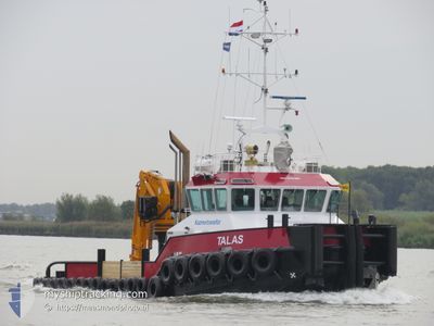
TALAS
Tug
Current Trip
NMDC
| Time Travelled | 47 days |
|---|---|
| Remaining Time | --- |
| Distance Travelled | 979.64 nm |
| Remaining Distance | --- |
| AVG Speed | 6.3 Knots |
| MAX Speed | 14 Knots |
| AVG Wind | 8.8 knots |
| MAX Wind | 34 knots |
| MIN Temp | 21.5°C / 70.7°F |
| MAX Temp | 32°C / 89.6°F |
| Dybgang | 3 m |
| Position Modtaget | Nu |
Current Position
| Longitude | 54.59704° |
|---|---|
| Latitude | 24.74281° |
| Status | Under way using engine |
| Fart | 7.5 Knots |
| Kurs | 341.9° |
| Område | Persian Gulf |
| Station | T-AIS |
| Position Modtaget | Nu |
Info
Information
The current position of TALAS is in Persian Gulf with coordinates 24.74281° / 54.59704° as reported on 2024-05-06 08:07 by AIS to our vessel tracker app. The vessel's current speed is 7.5 Knots
The vessel TALAS (IMO: 9787950, MMSI: 325132600) is a Tug It's sailing under the flag of [DM] Dominica.
In this page you can find informations about the vessels current position, last detected port calls, and current voyage information. If the vessels is not in coverage by AIS you will find the latest position.
The current position of TALAS is detected by our AIS receivers and we are not responsible for the reliability of the data. The last position was recorded while the vessel was in Coverage by the Ais receivers of our vessel tracking app.
The current draught of TALAS as reported by AIS is 3 meters
Weather
| Temperature | 29.7°C / 85.46°F |
|---|---|
| Wind Speed | 4 knots |
| Direction | 74° ENE |
| Pressure | 1008.5 hPa |
| Humidity | 56.7 % |
| Cloud Coverage | --- |
Featured Company
Last Trips
| Origin | Departure | Destination | Arrival | Distance |
|---|
Events
| Tid | Hændelsen | Detaljer | Position / Dest | Info |
|---|---|---|---|---|
| 2024-05-06 07:29 | START Sejllads | 6.32 nm, South of KHALIFA |
24.70371 / 54.64816
NMDC
|
Fart: 4.9 kn Kurs: 219° |
| 2024-05-06 06:56 | STOP Sejllads | 6.22 nm, South of KHALIFA |
24.70514 / 54.64970
NMDC
|
Fart: 0.2 kn Kurs: 309° |
| 2024-05-06 05:28 | START Sejllads | 11.21 nm, South West of KHALIFA |
24.70401 / 54.49677
NMDC
|
Fart: 6.9 kn Kurs: 26.2° |
| 2024-05-06 05:25 | STOP Sejllads | 11.34 nm, South West of KHALIFA |
24.70220 / 54.49523
NMDC
|
Fart: 0.1 kn Kurs: 70° |
| 2024-05-06 05:21 | START Sejllads | 11.67 nm, South West of KHALIFA |
24.69817 / 54.49104
NMDC
|
Fart: 6.4 kn Kurs: 20.5° |
| 2024-05-06 05:04 | STOP Sejllads | 11.8 nm, South West of KHALIFA |
24.69487 / 54.49053
NMDC
|
Fart: 0.3 kn Kurs: 130° |
| 2024-05-06 04:38 | START Sejllads | 9.21 nm, South West of KHALIFA |
24.72882 / 54.52302
NMDC
|
Fart: 7 kn Kurs: 258.9° |
| 2024-05-06 04:26 | STOP Sejllads | 9.06 nm, South West of KHALIFA |
24.73004 / 54.52538
NMDC
|
Fart: 0.3 kn Kurs: 235° |
| 2024-05-06 03:58 | START Sejllads | 7.52 nm, South West of KHALIFA |
24.73910 / 54.55236
NMDC
|
Fart: 6.6 kn Kurs: 2° |
| 2024-05-06 02:29 | STOP Sejllads | 7.62 nm, South West of KHALIFA |
24.73743 / 54.55139
NMDC
|
Fart: 0.3 kn Kurs: 222° |