
TAI SUMMIT
Cargo
Current Trip
| Time Travelled | 25 days |
|---|---|
| Remaining Time | 15 days |
| Distance Travelled | 1971.57 nm |
| Remaining Distance | 4410.54 nm |
| AVG Speed | 11.3 Knots |
| MAX Speed | 15.6 Knots |
| AVG Wind | 13 knots |
| MAX Wind | 28 knots |
| MIN Temp | 4.7°C / 40.46°F |
| MAX Temp | 23°C / 73.4°F |
| Dybgang | 10.9 m |
| Position Modtaget | 1 d siden |
Current Position
| Longitude | --- |
|---|---|
| Latitude | --- |
| Status | Under way using engine |
| Fart | 14.1 Knots |
| Kurs | 60.3° |
| Område | North Pacific Ocean |
| Station | T-AIS |
| Position Modtaget | 1 d siden |
Info
Information
The current position of TAI SUMMIT is in North Pacific Ocean with coordinates 35.38587° / 141.19882° as reported on 2024-12-03 04:04 by AIS to our vessel tracker app. The vessel's current speed is 14.1 Knots and is heading at the port of LOS ANGELES. The estimated time of arrival as calculated by MyShipTracking vessel tracking app is 2024-12-19 22:12 LT
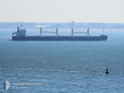
The vessel TAI SUMMIT (IMO: 9727144, MMSI: 374458000) is a Cargo It's sailing under the flag of [PA] Panama.
In this page you can find informations about the vessels current position, last detected port calls, and current voyage information. If the vessels is not in coverage by AIS you will find the latest position.
The current position of TAI SUMMIT is detected by our AIS receivers and we are not responsible for the reliability of the data. The last position was recorded while the vessel was in Coverage by the Ais receivers of our vessel tracking app.
The current draught of TAI SUMMIT as reported by AIS is 10.9 meters
Weather
| Temperature | 14.3°C / 57.74°F |
|---|---|
| Wind Speed | 17 knots |
| Direction | 323° NW |
| Pressure | 1010 hPa |
| Humidity | 64.7 % |
| Cloud Coverage | 100 % |
Featured Company
Events
| Tid | Hændelsen | Detaljer | Position / Dest | Info |
|---|---|---|---|---|
| 2024-12-03 04:06 | Status er ændret | Default Under way using engine |
35.39051 / 141.20874
LONG BEACH
|
Fart: 14.1 kn Kurs: 60.3° |
| 2024-12-03 04:04 | Udenfor Dækning |
35.38587 / 141.19882
North Pacific Ocean
LONG BEACH
|
Fart: 14.1 kn Kurs: 60.3° |
|
| 2024-12-02 21:49 | Ændre havområde | Japanese part of the North Pacific Ocean Japanese part of the Philippine Sea |
34.66033 / 139.64631
North Pacific Ocean
LONG BEACH
|
Fart: 14.5 kn Kurs: 73.4° |
| 2024-12-02 21:44 | Dybgangen er ændret | 10.9 11.8 |
34.65369 / 139.62313
LONG BEACH
|
Fart: 14.7 kn Kurs: 71.3° |
| 2024-12-02 21:44 | Destination er ændret | LONG BEACH COBUN |
34.65369 / 139.62313
LONG BEACH
|
Fart: 14.7 kn Kurs: 71.3° |
| 2024-12-02 21:44 | ETA er ændret | 2024/12/20 14:00 2024/07/15 23:00 |
34.65369 / 139.62313
LONG BEACH
|
Fart: 14.7 kn Kurs: 71.3° |
| 2024-12-02 21:25 | Ændre havområde | Japanese part of the Philippine Sea High seas of the North Pacific Ocean |
34.63177 / 139.53385
Philippine Sea
|
Fart: 14.3 kn Kurs: 76.6° |
| 2024-12-02 21:24 | Status er ændret | Under way using engine Default |
34.63076 / 139.52870
COBUN
|
Fart: 14.2 kn Kurs: 80° |
| 2024-12-02 21:24 | Indenfor Dækning |
34.63177 / 139.53385
Philippine Sea
|
Fart: 14.3 kn Kurs: 76.6° |
|
| 2024-11-29 04:12 | START Sejllads | 0.65 nm, East of JIANGSU HANTONG |
32.11634 / 119.91168
COBUN
|
Fart: 5 kn Kurs: 140° |