
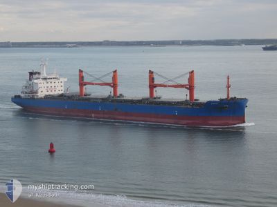
SYNVAL
Cargo
Current Trip
BR IQI
| Time Travelled | 2 days |
|---|---|
| Remaining Time | --- |
| Distance Travelled | 789.68 nm |
| Remaining Distance | --- |
| AVG Speed | 11.6 Knots |
| MAX Speed | 13 Knots |
| AVG Wind | 14.8 knots |
| MAX Wind | 23 knots |
| MIN Temp | 14°C / 57.2°F |
| MAX Temp | 17.5°C / 63.5°F |
| Dybgang | 10.6 m |
| Position Modtaget | 1 m siden |
Current Position
| Longitude | 10.83737° |
|---|---|
| Latitude | 54.82304° |
| Status | Under way using engine |
| Fart | 10.5 Knots |
| Kurs | 1.7° |
| Område | Kattegat |
| Station | T-AIS |
| Position Modtaget | 1 m siden |
Info
Information
The current position of SYNVAL is in Kattegat with coordinates 54.82304° / 10.83737° as reported on 2024-07-02 16:38 by AIS to our vessel tracker app. The vessel's current speed is 10.5 Knots
The vessel SYNVAL (IMO: 9763708, MMSI: 538009837) is a Cargo It's sailing under the flag of [MH] Marshall Is.
In this page you can find informations about the vessels current position, last detected port calls, and current voyage information. If the vessels is not in coverage by AIS you will find the latest position.
The current position of SYNVAL is detected by our AIS receivers and we are not responsible for the reliability of the data. The last position was recorded while the vessel was in Coverage by the Ais receivers of our vessel tracking app.
The current draught of SYNVAL as reported by AIS is 10.6 meters
Weather
| Temperature | 15.9°C / 60.62°F |
|---|---|
| Wind Speed | 19 knots |
| Direction | 285° WNW |
| Pressure | 1006.6 hPa |
| Humidity | 73.1 % |
| Cloud Coverage | 100 % |
Featured Company
Last Port Calls
| Port | Arrival | Departure | Time In Port |
|---|---|---|---|
| 2024-06-27 16:13 | 2024-06-29 22:46 | 2 d | |
| 2024-06-18 09:47 | 2024-06-22 12:23 | 4 d | |
| 2024-05-21 04:14 | 2024-05-22 22:45 | 1 d | |
| 2024-05-17 22:33 | 2024-05-19 13:15 | 1 d | |
| 2024-05-01 08:33 | 2024-05-03 08:30 | 1 d |
Most Visited Ports (Last year)
| Port | Arrivals | |
|---|---|---|
| 5 | ||
| 2 | ||
| 2 | ||
| 1 | ||
| 1 | ||
| 1 |
Last Trips
| Origin | Departure | Destination | Arrival | Distance | |
|---|---|---|---|---|---|
| 2024-06-22 14:23 | 2024-06-27 19:13 | 601.89 nm | |||
| 2024-05-22 19:45 | 2024-06-18 11:47 | 7551.98 nm | |||
| 2024-05-19 10:15 | 2024-05-21 01:14 | 482.42 nm | |||
| 2024-05-03 05:30 | 2024-05-17 19:33 | 1842.82 nm | |||
| 2024-04-29 12:57 | 2024-05-01 05:33 | 411.51 nm |
Events
| Tid | Hændelsen | Detaljer | Position / Dest | Info |
|---|---|---|---|---|
| 2024-07-02 16:07 | Ændre havområde | Danish part of the Kattegat Danish part of the Baltic Sea |
54.73821 / 10.79144
Kattegat
BR IQI
|
Fart: 10.5 kn Kurs: 13.6° |
| 2024-07-02 15:19 | Fundet i havområde | Danish part of the Baltic Sea |
54.63791 / 10.90243
Baltic Sea
BR IQI
|
Fart: 10.7 kn Kurs: 301.4° |
| 2024-07-02 13:35 | Fundet i havområde | German part of the Baltic Sea |
54.54271 / 11.36720
Baltic Sea
BR IQI
|
Fart: 10.3 kn Kurs: 295.9° |
| 2024-07-02 10:53 | Ændre havområde | Danish part of the Baltic Sea German part of the Baltic Sea |
54.44255 / 12.14073
Baltic Sea
BR IQI
|
Fart: 11 kn Kurs: 266.9° |
| 2024-07-02 10:48 | Dybgangen er ændret | 10.6 10 |
54.44382 / 12.16713
BR IQI
|
Fart: 10.7 kn Kurs: 252° |
| 2024-07-02 10:48 | ETA er ændret | 2024/07/18 05:00 |
54.44382 / 12.16713
BR IQI
|
Fart: 10.7 kn Kurs: 252° |
| 2024-07-02 10:42 | Dybgangen er ændret | 10 10.6 |
54.45531 / 12.18984
BR IQI
|
Fart: 10.9 kn Kurs: 209.9° |
| 2024-07-02 10:30 | Ændre havområde | German part of the Baltic Sea Danish part of the Baltic Sea |
54.48987 / 12.20801
Baltic Sea
BR IQI
|
Fart: 11.4 kn Kurs: 196.2° |
| 2024-07-02 10:18 | Dybgangen er ændret | 10.6 10.8 |
54.52820 / 12.22800
BR IQI
|
Fart: 11.6 kn Kurs: 196.9° |
| 2024-07-02 09:29 | Ændre havområde | Danish part of the Baltic Sea German part of the Baltic Sea |
54.64750 / 12.39195
Baltic Sea
BR IQI
|
Fart: 11.7 kn Kurs: 236.1° |