
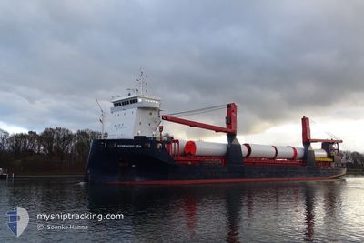
FWN SEA
Cargo
Current Trip
PANAMA CANAL
| Time Travelled | 25 days |
|---|---|
| Remaining Time | --- |
| Distance Travelled | 7151.52 nm |
| Remaining Distance | --- |
| AVG Speed | 12.3 Knots |
| MAX Speed | 16.3 Knots |
| AVG Wind | 13.1 knots |
| MAX Wind | 32.9 knots |
| MIN Temp | 10.4°C / 50.72°F |
| MAX Temp | 30.2°C / 86.36°F |
| Dybgang | 5.5 m |
| Position Modtaget | 3 m siden |
Current Position
| Longitude | -126.61393° |
|---|---|
| Latitude | 31.62633° |
| Status | Under way using engine |
| Fart | 12.8 Knots |
| Kurs | 118.9° |
| Område | North Pacific Ocean |
| Station | T-AIS |
| Position Modtaget | 3 m siden |
Info
Information
The current position of FWN SEA is in North Pacific Ocean with coordinates 31.62633° / -126.61393° as reported on 2024-06-06 16:12 by AIS to our vessel tracker app. The vessel's current speed is 12.8 Knots
The vessel FWN SEA (IMO: 9721657, MMSI: 244770273) is a Cargo It's sailing under the flag of [NL] Netherlands.
In this page you can find informations about the vessels current position, last detected port calls, and current voyage information. If the vessels is not in coverage by AIS you will find the latest position.
The current position of FWN SEA is detected by our AIS receivers and we are not responsible for the reliability of the data. The last position was recorded while the vessel was in Coverage by the Ais receivers of our vessel tracking app.
The current draught of FWN SEA as reported by AIS is 5.5 meters
Weather
| Temperature | 16.1°C / 60.98°F |
|---|---|
| Wind Speed | 17 knots |
| Direction | 1° N |
| Pressure | 1017.2 hPa |
| Humidity | 84.8 % |
| Cloud Coverage | --- |
Featured Company
Last Port Calls
| Port | Arrival | Departure | Time In Port |
|---|---|---|---|
| 2024-05-10 10:52 | 2024-05-12 17:01 | 2 d | |
| 2024-05-05 18:48 | 2024-05-07 08:52 | 1 d | |
| 2024-04-28 15:51 | 2024-04-30 08:56 | 1 d | |
| 2024-04-20 07:48 | 2024-04-20 19:36 | 11 h | |
| 2024-04-15 23:47 | 2024-04-17 03:39 | 1 d | |
| 2024-04-06 12:00 | 2024-04-12 09:14 | 5 d | |
| 2024-04-06 10:23 |
Last Trips
| Origin | Departure | Destination | Arrival | Distance | |
|---|---|---|---|---|---|
| 2024-05-07 08:52 | 2024-05-10 10:52 | 878.10 nm | |||
| 2024-04-30 08:56 | 2024-05-05 18:48 | 685.47 nm | |||
| 2024-04-20 19:36 | 2024-04-28 15:51 | 103.22 nm | |||
| 2024-04-17 03:39 | 2024-04-20 07:48 | 962.95 nm | |||
| 2024-04-12 09:14 | 2024-04-15 23:47 | 237.18 nm | |||
| 2024-04-06 10:23 | 2024-04-06 12:00 | 10.16 nm |
Events
| Tid | Hændelsen | Detaljer | Position / Dest | Info |
|---|---|---|---|---|
| 2024-06-06 13:46 | Indenfor Dækning |
31.86622 / -127.14977
North Pacific Ocean
PANAMA CANAL
|
Fart: 13.1 kn Kurs: 116.9° |
|
| 2024-06-06 12:40 | Udenfor Dækning |
31.97600 / -127.40402
North Pacific Ocean
PANAMA CANAL
|
Fart: 12.8 kn Kurs: 117.4° |
|
| 2024-06-06 11:47 | ETA er ændret | 2024/06/16 23:00 2024/06/17 22:00 |
32.06745 / -127.60193
PANAMA CANAL
|
Fart: 13 kn Kurs: 118.5° |
| 2024-06-06 11:17 | Fundet i havområde | High seas of the North Pacific Ocean |
32.12118 / -127.71378
North Pacific Ocean
PANAMA CANAL
|
Fart: 13 kn Kurs: 119.7° |
| 2024-06-06 11:17 | Status er ændret | Under way using engine Default |
32.12118 / -127.71378
PANAMA CANAL
|
Fart: 13.2 kn Kurs: 118° |
| 2024-06-06 10:58 | Indenfor Dækning |
32.12118 / -127.71378
North Pacific Ocean
PANAMA CANAL
|
Fart: 13 kn Kurs: 119.7° |