
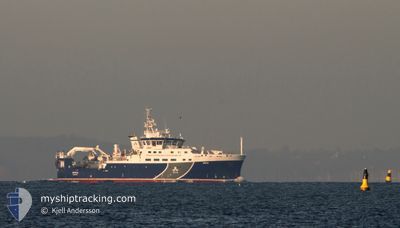
SVEA
Other Type
Current Trip
SURVEY
| Time Travelled | 22 h, 50 mins |
|---|---|
| Remaining Time | --- |
| Distance Travelled | 164.75 nm |
| Remaining Distance | --- |
| AVG Speed | 8.7 Knots |
| MAX Speed | 10.6 Knots |
| AVG Wind | 15.5 knots |
| MAX Wind | 21 knots |
| MIN Temp | -1.8°C / 28.76°F |
| MAX Temp | 4.8°C / 40.64°F |
| Dybgang | 6.1 m |
| Position Modtaget | 1 m siden |
Current Position
| Longitude | --- |
|---|---|
| Latitude | --- |
| Status | Under way using engine |
| Fart | 9.8 Knots |
| Kurs | 110.7° |
| Område | Baltic Sea |
| Station | T-AIS |
| Position Modtaget | 1 m siden |
Info
Information
The current position of SVEA is in Baltic Sea with coordinates 55.27856° / 12.73290° as reported on 2025-03-17 06:39 by AIS to our vessel tracker app. The vessel's current speed is 9.8 Knots
The vessel SVEA (IMO: 9829332, MMSI: 265009000) is a Other Type It's sailing under the flag of [SE] Sweden.
In this page you can find informations about the vessels current position, last detected port calls, and current voyage information. If the vessels is not in coverage by AIS you will find the latest position.
The current position of SVEA is detected by our AIS receivers and we are not responsible for the reliability of the data. The last position was recorded while the vessel was in Coverage by the Ais receivers of our vessel tracking app.
The current draught of SVEA as reported by AIS is 6.1 meters
Weather
| Temperature | 0.5°C / 32.9°F |
|---|---|
| Wind Speed | 13 knots |
| Direction | 33° NNE |
| Pressure | 1030.1 hPa |
| Humidity | 55 % |
| Cloud Coverage | --- |
Featured Company
Last Port Calls
| Port | Arrival | Departure | Time In Port |
|---|---|---|---|
| 2025-03-13 20:07 | 2025-03-16 08:50 | 2 d | |
| 2025-03-13 10:16 | 2025-03-13 13:26 | 3 h | |
| 2025-03-04 20:18 | 2025-03-08 07:17 | 3 d | |
| 2025-02-18 22:10 | 2025-02-19 19:26 | 21 h | |
| 2025-02-13 07:25 | 2025-02-14 22:45 | 1 d | |
| 2025-02-03 14:36 | 2025-02-06 14:26 | 2 d | |
| 2025-01-27 19:14 | 2025-01-27 20:33 | 1 h | |
| 2025-01-17 23:39 | 2025-01-20 18:16 | 2 d | |
| 2025-01-17 13:39 | 2025-01-17 18:26 | 4 h | |
| 2025-01-16 12:47 | 2025-01-17 09:28 | 20 h |
Most Visited Ports (Last year)
| Port | Arrivals | |
|---|---|---|
| 14 | ||
| 13 | ||
| 4 | ||
| 4 | ||
| 3 | ||
| 3 |
Last Trips
| Origin | Departure | Destination | Arrival | Distance | |
|---|---|---|---|---|---|
| 2025-03-13 13:26 | 2025-03-13 20:07 | 58.37 nm | |||
| 2025-03-08 07:17 | 2025-03-13 10:16 | 981.58 nm | |||
| 2025-02-19 19:26 | 2025-03-04 20:18 | 1282.81 nm | |||
| 2025-02-14 22:45 | 2025-02-18 22:10 | 724.94 nm | |||
| 2025-02-06 14:26 | 2025-02-13 07:25 | 1222.79 nm | |||
| 2025-01-27 20:33 | 2025-02-03 14:36 | 824.02 nm | |||
| 2025-01-20 18:16 | 2025-01-27 19:14 | 983.65 nm | |||
| 2025-01-17 18:26 | 2025-01-17 23:39 | 55.65 nm | |||
| 2025-01-17 09:28 | 2025-01-17 13:39 | 8.10 nm | |||
| 2025-01-09 20:27 | 2025-01-16 12:47 | 1321.37 nm |
Events
| Tid | Hændelsen | Detaljer | Position / Dest | Info |
|---|---|---|---|---|
| 2025-03-17 06:16 | Ændre havområde | Swedish part of the Baltic Sea Danish part of the Baltic Sea |
55.30588 / 12.64057
Baltic Sea
|
Fart: 9.8 kn Kurs: 156.6° |
| 2025-03-17 06:10 | Ændre havområde | Danish part of the Baltic Sea Swedish part of the Kattegat |
55.32194 / 12.63899
Baltic Sea
|
Fart: 9.8 kn Kurs: 190.5° |
| 2025-03-17 05:10 | Ændre havområde | Swedish part of the Kattegat Danish part of the Kattegat |
55.47735 / 12.69544
Kattegat
|
Fart: 8.2 kn Kurs: 199.8° |
| 2025-03-17 04:58 | Ændre havområde | Danish part of the Kattegat Swedish part of the Kattegat |
55.50395 / 12.71729
Kattegat
|
Fart: 9.2 kn Kurs: 221.2° |
| 2025-03-17 01:07 | Ændre havområde | Swedish part of the Kattegat Danish part of the Kattegat |
56.02832 / 12.65706
Kattegat
|
Fart: 9.6 kn Kurs: 161.7° |
| 2025-03-16 23:40 | Ændre havområde | Danish part of the Kattegat Swedish part of the Kattegat |
56.19745 / 12.39343
Kattegat
|
Fart: 9.9 kn Kurs: 164.3° |
| 2025-03-16 14:11 | Status er ændret | Under way using engine Restricted manoeuverability |
57.64801 / 11.66516
SURVEY
|
Fart: 2 kn Kurs: 184° |
| 2025-03-16 13:11 | START Sejllads | 1.46 nm, South of FOTO |
57.64359 / 11.66562
SURVEY
|
Fart: 3.1 kn Kurs: 234° |
| 2025-03-16 08:35 | STOP Sejllads | 1.41 nm, South of FOTO |
57.64509 / 11.66918
SURVEY
|
Fart: 0.2 kn Kurs: 184° |
| 2025-03-16 08:34 | Status er ændret | Restricted manoeuverability Under way using engine |
57.64532 / 11.66937
SURVEY
|
Fart: 1.1 kn Kurs: 205° |