

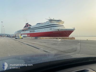
SUPERFAST III
Ro-Ro/Passenger Ship

Current Trip
| Time Travelled | 13 h, 44 mins |
|---|---|
| Remaining Time | --- |
| Distance Travelled | 312.10 nm |
| Remaining Distance | --- |
| AVG Speed | 22.8 Knots |
| MAX Speed | 24.1 Knots |
| AVG Wind | 2.8 knots |
| MAX Wind | 6.4 knots |
| MIN Temp | 9.3°C / 48.74°F |
| MAX Temp | 11.5°C / 52.7°F |
| Dybgang | 6.5 m |
| Position Modtaget | 7 m siden |
Current Position
| Longitude | --- |
|---|---|
| Latitude | --- |
| Status | Under way using engine |
| Fart | 23.2 Knots |
| Kurs | 128.7° |
| Område | Adriatic Sea |
| Station | T-AIS |
| Position Modtaget | 7 m siden |
Information
The current position of SUPERFAST III is in Adriatic Sea with coordinates 40.47089° / 18.88397° as reported on 2025-02-22 03:18 by AIS to our vessel tracker app. The vessel's current speed is 23.2 Knots
The vessel SUPERFAST III (IMO: 9216028, MMSI: 237280000) is a Ro-Ro/Passenger Ship that was built in 2000 ( 25 år gamle ). It's sailing under the flag of [GR] Greece.
In this page you can find informations about the vessels current position, last detected port calls, and current voyage information. If the vessels is not in coverage by AIS you will find the latest position.
The current position of SUPERFAST III is detected by our AIS receivers and we are not responsible for the reliability of the data. The last position was recorded while the vessel was in Coverage by the Ais receivers of our vessel tracking app.
The current draught of SUPERFAST III as reported by AIS is 6.5 meters
Weather
| Temperature | 11.4°C / 52.52°F |
|---|---|
| Wind Speed | 6 knots |
| Direction | 186° S |
| Pressure | 1029.8 hPa |
| Humidity | 47.5 % |
| Cloud Coverage | 62 % |


Featured Company
Last Port Calls
| Port | Arrival | Departure | Time In Port |
|---|---|---|---|
| 2025-02-21 10:54 | 2025-02-21 14:41 | 3 h | |
| 2025-02-20 14:42 | 2025-02-20 17:23 | 2 h | |
| 2025-02-19 17:04 | 2025-02-19 19:29 | 2 h | |
| 2025-02-17 20:58 | 2025-02-18 18:09 | 21 h | |
| 2025-02-16 17:30 | 2025-02-16 20:59 | 3 h | |
| 2025-02-15 15:23 | 2025-02-15 17:54 | 2 h | |
| 2025-02-14 10:56 | 2025-02-14 14:37 | 3 h | |
| 2025-02-13 14:21 | 2025-02-13 17:11 | 2 h | |
| 2025-02-12 17:03 | 2025-02-12 19:27 | 2 h | |
| 2025-02-10 21:29 | 2025-02-11 17:25 | 19 h |
Most Visited Ports (Last year)
| Port | Arrivals | |
|---|---|---|
| 113 | ||
| 102 | ||
| 71 | ||
| 1 | ||
| 1 |
Last Trips
| Origin | Departure | Destination | Arrival | Distance | |
|---|---|---|---|---|---|
| 2025-02-20 17:23 | 2025-02-21 10:54 | 401.27 nm | |||
| 2025-02-19 19:29 | 2025-02-20 14:42 | 402.84 nm | |||
| 2025-02-18 18:09 | 2025-02-19 17:04 | 514.04 nm | |||
| 2025-02-16 20:59 | 2025-02-17 20:58 | 518.34 nm | |||
| 2025-02-15 17:54 | 2025-02-16 17:30 | 523.24 nm | |||
| 2025-02-14 14:37 | 2025-02-15 15:23 | 520.87 nm | |||
| 2025-02-13 17:11 | 2025-02-14 10:56 | 403.21 nm | |||
| 2025-02-12 19:27 | 2025-02-13 14:21 | 402.96 nm | |||
| 2025-02-11 17:25 | 2025-02-12 17:03 | 520.86 nm | |||
| 2025-02-09 20:22 | 2025-02-10 21:29 | 519.06 nm |
Events
| Tid | Hændelsen | Detaljer | Position / Dest | Info |
|---|---|---|---|---|
| 2025-02-22 03:04 | Ændre havområde | Albanian part of the Adriatic Sea Italian part of the Adriatic Sea |
40.52442 / 18.79473
Adriatic Sea
GRIGO
|
Fart: 23.4 kn Kurs: 128.6° |
| 2025-02-22 01:53 | Status er ændret | Under way using engine Default |
40.81258 / 18.31694
GRIGO
|
Fart: 23.3 kn Kurs: 127° |
| 2025-02-22 01:39 | Indenfor Dækning |
40.80391 / 18.33152
Adriatic Sea
GRIGO
|
Fart: 23.5 kn Kurs: 128.1° |
|
| 2025-02-22 00:43 | Status er ændret | Default Under way using engine |
41.09865 / 17.83515
GRIGO
|
Fart: 24.1 kn Kurs: 127.7° |
| 2025-02-22 00:34 | Udenfor Dækning |
41.13349 / 17.77582
Adriatic Sea
GRIGO
|
Fart: 24.1 kn Kurs: 127.7° |
|
| 2025-02-21 23:45 | Status er ændret | Under way using engine Default |
41.33230 / 17.43978
GRIGO
|
Fart: 22.9 kn Kurs: 128° |
| 2025-02-21 23:45 | Indenfor Dækning |
41.32673 / 17.44931
Adriatic Sea
GRIGO
|
Fart: 23.4 kn Kurs: 127.4° |
|
| 2025-02-21 22:09 | Status er ændret | Default Under way using engine |
41.71606 / 16.78713
GRIGO
|
Fart: 23.4 kn Kurs: 127.6° |
| 2025-02-21 22:00 | Udenfor Dækning |
41.74963 / 16.72989
Adriatic Sea
GRIGO
|
Fart: 23.4 kn Kurs: 127.6° |
|
| 2025-02-21 18:37 | Ændre havområde | Italian part of the Adriatic Sea Croatian part of the Adriatic Sea |
42.59363 / 15.40625
Adriatic Sea
GRIGO
|
Fart: 23 kn Kurs: 131.9° |