

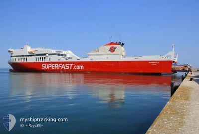
SUPERFAST II
Ro-Ro/Passenger Ship
Current Trip
| Time Travelled | 6 h, 58 mins |
|---|---|
| Remaining Time | --- |
| Distance Travelled | 135.52 nm |
| Remaining Distance | --- |
| AVG Speed | 22.7 Knots |
| MAX Speed | 23.7 Knots |
| AVG Wind | 10.6 knots |
| MAX Wind | 17.9 knots |
| MIN Temp | 8.6°C / 47.48°F |
| MAX Temp | 11.2°C / 52.16°F |
| Dybgang | 6.2 m |
| Position Modtaget | 2 h, 48 m siden |
Current Position
| Longitude | --- |
|---|---|
| Latitude | --- |
| Status | Under way using engine |
| Fart | 22 Knots |
| Kurs | 127° |
| Område | Adriatic Sea |
| Station | T-AIS |
| Position Modtaget | 2 h, 48 m siden |
Information
The current position of SUPERFAST II is in Adriatic Sea with coordinates 40.47933° / 18.65850° as reported on 2025-02-19 23:13 by AIS to our vessel tracker app. The vessel's current speed is 22 Knots
The vessel SUPERFAST II (IMO: 9458511, MMSI: 240951000) is a Ro-Ro/Passenger Ship that was built in 2009 ( 16 år gamle ). It's sailing under the flag of [GR] Greece.
In this page you can find informations about the vessels current position, last detected port calls, and current voyage information. If the vessels is not in coverage by AIS you will find the latest position.
The current position of SUPERFAST II is detected by our AIS receivers and we are not responsible for the reliability of the data. The last position was recorded while the vessel was in Coverage by the Ais receivers of our vessel tracking app.
The current draught of SUPERFAST II as reported by AIS is 6.2 meters
Weather
| Temperature | 11.2°C / 52.16°F |
|---|---|
| Wind Speed | 4 knots |
| Direction | 30° NNE |
| Pressure | 1025.5 hPa |
| Humidity | 47.7 % |
| Cloud Coverage | 9 % |
Featured Company
Last Port Calls
| Port | Arrival | Departure | Time In Port |
|---|---|---|---|
| 2025-02-19 08:20 | 2025-02-19 19:04 | 10 h | |
| 2025-02-18 21:43 | 2025-02-18 22:53 | 1 h | |
| 2025-02-18 10:14 | 2025-02-18 15:47 | 5 h | |
| 2025-02-17 08:00 | 2025-02-17 18:57 | 10 h | |
| 2025-02-16 11:15 | 2025-02-16 15:47 | 4 h | |
| 2025-02-15 08:40 | 2025-02-15 19:17 | 10 h | |
| 2025-02-14 10:39 | 2025-02-14 15:42 | 5 h | |
| 2025-02-13 07:46 | 2025-02-13 18:52 | 11 h | |
| 2025-02-12 10:36 | 2025-02-12 15:37 | 5 h | |
| 2025-02-11 08:00 | 2025-02-11 19:08 | 11 h |
Most Visited Ports (Last year)
| Port | Arrivals | |
|---|---|---|
| 168 | ||
| 151 | ||
| 65 | ||
| 4 |
Last Trips
| Origin | Departure | Destination | Arrival | Distance | |
|---|---|---|---|---|---|
| 2025-02-19 00:53 | 2025-02-19 09:20 | 192.15 nm | |||
| 2025-02-18 17:47 | 2025-02-18 23:43 | 121.84 nm | |||
| 2025-02-17 19:57 | 2025-02-18 12:14 | 307.05 nm | |||
| 2025-02-16 17:47 | 2025-02-17 09:00 | 307.09 nm | |||
| 2025-02-15 20:17 | 2025-02-16 13:15 | 307.38 nm | |||
| 2025-02-14 17:42 | 2025-02-15 09:40 | 310.71 nm | |||
| 2025-02-13 19:52 | 2025-02-14 12:39 | 308.04 nm | |||
| 2025-02-12 17:37 | 2025-02-13 08:46 | 310.86 nm | |||
| 2025-02-11 20:08 | 2025-02-12 12:36 | 306.82 nm | |||
| 2025-02-10 17:53 | 2025-02-11 09:00 | 307.07 nm |
Events
| Tid | Hændelsen | Detaljer | Position / Dest | Info |
|---|---|---|---|---|
| 2025-02-19 23:22 | Status er ændret | Default Under way using engine |
40.44846 / 18.71730
ITBRI>GRIGO
|
Fart: 22 kn Kurs: 127° |
| 2025-02-19 23:13 | Udenfor Dækning |
40.47933 / 18.65850
Adriatic Sea
ITBRI>GRIGO
|
Fart: 22 kn Kurs: 127° |
|
| 2025-02-19 23:01 | Indenfor Dækning |
40.52254 / 18.57949
Adriatic Sea
ITBRI>GRIGO
|
Fart: 22.4 kn Kurs: 125.2° |
|
| 2025-02-19 21:28 | Status er ændret | Default Under way using engine |
40.80993 / 17.91421
ITBRI>GRIGO
|
Fart: 22.9 kn Kurs: 116.7° |
| 2025-02-19 21:00 | Udenfor Dækning |
40.88966 / 17.70525
Adriatic Sea
ITBRI>GRIGO
|
Fart: 22.9 kn Kurs: 116.7° |
|
| 2025-02-19 19:54 | Destination er ændret | ITBRI>GRIGO GRIGO>ITBRI |
41.07753 / 17.20283
ITBRI>GRIGO
|
Fart: 23.6 kn Kurs: 115.6° |
| 2025-02-19 19:54 | ETA er ændret | 2025/02/20 03:30 2025/02/19 07:00 |
41.07753 / 17.20283
ITBRI>GRIGO
|
Fart: 23.6 kn Kurs: 115.6° |
| 2025-02-19 19:46 | Status er ændret | Under way using engine Default |
41.09864 / 17.14403
GRIGO>ITBRI
|
Fart: 23.5 kn Kurs: 111° |
| 2025-02-19 19:29 | Indenfor Dækning |
41.09864 / 17.14403
Adriatic Sea
|
Fart: 23.7 kn Kurs: 114.7° |
|
| 2025-02-19 19:04 | Afsejlet fra sidste havn |
|
41.14999 / 16.84476
GRIGO>ITBRI
|
Fart: 6.2 kn Kurs: 312° |