

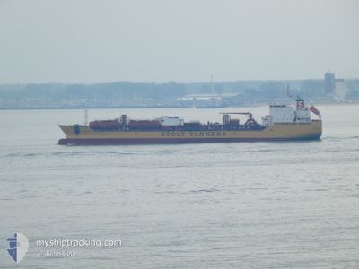
STOLT SUN
Oil/Chemical Tanker

Current Trip
| Trip Time | 10 days |
|---|---|
| Trip Distance | 940.63 nm |
| AVG Speed | 10 Knots |
| MAX Speed | 15 Knots |
| Dybgang | 10.4 m |
| AVG Wind | 13.3 knots |
| MAX Wind | 36.8 knots |
| MIN Temp | 6.7°C / 44.06°F |
| MAX Temp | 25.3°C / 77.54°F |
| Position Modtaget | 23 d siden |
Current Position
| Longitude | --- |
|---|---|
| Latitude | --- |
| Status | Under way using engine |
| Fart | 11.1 Knots |
| Kurs | 318.9° |
| Område | South China Sea |
| Station | T-AIS |
| Position Modtaget | 23 d siden |
Information
The current position of STOLT SUN is in South China Sea with coordinates 22.74153° / 120.03070° as reported on 2025-02-17 19:12 by AIS to our vessel tracker app. The vessel's current speed is 11.1 Knots and is currently inside the port of JIANGYIN.
The vessel STOLT SUN (IMO: 9149512, MMSI: 319459000) is a Oil/Chemical Tanker that was built in 2000 ( 25 år gamle ). It's sailing under the flag of [KY] Cayman Is.
In this page you can find informations about the vessels current position, last detected port calls, and current voyage information. If the vessels is not in coverage by AIS you will find the latest position.
The current position of STOLT SUN is detected by our AIS receivers and we are not responsible for the reliability of the data. The last position was recorded while the vessel was in Coverage by the Ais receivers of our vessel tracking app.
The current draught of STOLT SUN as reported by AIS is 10.4 meters
Weather
| Temperature | 7°C / 44.6°F |
|---|---|
| Wind Speed | 10 knots |
| Direction | 65° ENE |
| Pressure | 1023.6 hPa |
| Humidity | 81.8 % |
| Cloud Coverage | 100 % |


Featured Company
Most Visited Ports (Last year)
| Port | Arrivals | |
|---|---|---|
| 8 | ||
| 3 | ||
| 3 | ||
| 3 | ||
| 2 | ||
| 2 |
Last Trips
| Origin | Departure | Destination | Arrival | Distance | |
|---|---|---|---|---|---|
| 2025-02-27 19:05 | 2025-03-10 15:37 | 940.63 nm | |||
| 2025-02-25 16:10 | 2025-02-26 16:18 | 68.05 nm | |||
| 2025-02-19 07:33 | 2025-02-24 14:00 | 678.84 nm | |||
| 2025-02-18 01:33 | 2025-02-18 15:05 | 133.10 nm | |||
| 2024-12-21 14:27 | 2025-02-17 09:25 | 12560.40 nm |
Events
| Tid | Hændelsen | Detaljer | Position / Dest | Info |
|---|---|---|---|---|
| 2025-03-10 07:37 | STOP Sejllads |
31.92562 / 120.21920
[CN] JIANGYIN
|
Fart: 0.2 kn Kurs: 251° |
|
| 2025-03-10 07:37 | Skibe i havn |
|
31.92562 / 120.21920
[CN] JIANGYIN
|
Fart: 3.7 kn Kurs: 255° |
| 2025-03-09 18:35 | START Sejllads | 20.62 nm, North East of SHENGSI |
31.03022 / 122.63854
TAICHUNG
|
Fart: 5.5 kn Kurs: 198° |
| 2025-03-04 23:25 | STOP Sejllads | 21.16 nm, North East of SHENGSI |
31.03978 / 122.64057
TAICHUNG
|
Fart: Kurs: 341° |