
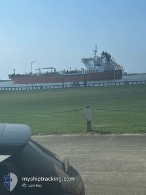
STI WESTMINSTER
Tanker
Current Trip
| Time Travelled | 7 days |
|---|---|
| Remaining Time | --- |
| Distance Travelled | 2235.61 nm |
| Remaining Distance | --- |
| AVG Speed | 12.1 Knots |
| MAX Speed | 15.2 Knots |
| AVG Wind | 11.9 knots |
| MAX Wind | 33 knots |
| MIN Temp | 15.6°C / 60.08°F |
| MAX Temp | 23.4°C / 74.12°F |
| Dybgang | 11.3 m |
| Position Modtaget | 4 d siden |
Current Position
| Longitude | --- |
|---|---|
| Latitude | --- |
| Status | Under way using engine |
| Fart | 12.4 Knots |
| Kurs | 51.8° |
| Område | North Atlantic Ocean |
| Station | T-AIS |
| Position Modtaget | 4 d siden |
Info
Information
The current position of STI WESTMINSTER is in North Atlantic Ocean with coordinates 23.65999° / -81.30930° as reported on 2025-03-02 13:56 by AIS to our vessel tracker app. The vessel's current speed is 12.4 Knots and is heading at the port of AMSTERDAM. The estimated time of arrival as calculated by MyShipTracking vessel tracking app is 2025-03-15 14:00 LT
The vessel STI WESTMINSTER (IMO: 9706437, MMSI: 538005539) is a Tanker It's sailing under the flag of [MH] Marshall Is.
In this page you can find informations about the vessels current position, last detected port calls, and current voyage information. If the vessels is not in coverage by AIS you will find the latest position.
The current position of STI WESTMINSTER is detected by our AIS receivers and we are not responsible for the reliability of the data. The last position was recorded while the vessel was in Coverage by the Ais receivers of our vessel tracking app.
The current draught of STI WESTMINSTER as reported by AIS is 11.3 meters
Weather
| Temperature | 19.9°C / 67.82°F |
|---|---|
| Wind Speed | 33 knots |
| Direction | 173° S |
| Pressure | 1005.2 hPa |
| Humidity | 88.3 % |
| Cloud Coverage | 100 % |
Featured Company
Last Port Calls
| Port | Arrival | Departure | Time In Port |
|---|---|---|---|
| 2025-02-26 01:32 | 2025-02-27 21:21 | 1 d | |
| 2025-02-24 08:45 | 2025-02-25 23:08 | 1 d | |
| 2025-01-24 09:54 | 2025-01-25 05:31 | 19 h | |
| 2025-01-10 20:43 | 2025-01-11 17:38 | 20 h | |
| 2025-01-06 06:39 | 2025-01-07 15:59 | 1 d |
Most Visited Ports (Last year)
| Port | Arrivals | |
|---|---|---|
| 3 | ||
| 3 | ||
| 2 | ||
| 2 | ||
| 2 | ||
| 2 |
Last Trips
| Origin | Departure | Destination | Arrival | Distance | |
|---|---|---|---|---|---|
| 2025-02-25 17:08 | 2025-02-25 19:32 | 14.37 nm | |||
| 2025-01-24 23:31 | 2025-02-24 02:45 | 4755.50 nm | |||
| 2025-01-11 12:38 | 2025-01-24 03:54 | 2774.32 nm | |||
| 2025-01-07 10:59 | 2025-01-10 15:43 | 475.66 nm | |||
| 2024-12-27 16:06 | 2025-01-06 01:39 | 1374.01 nm |
Events
| Tid | Hændelsen | Detaljer | Position / Dest | Info |
|---|---|---|---|---|
| 2025-03-02 14:01 | Status er ændret | Default Under way using engine |
23.67125 / -81.29377
NLAMS
|
Fart: 12.4 kn Kurs: 51.8° |
| 2025-03-02 13:56 | Udenfor Dækning |
23.65999 / -81.30930
North Atlantic Ocean
NLAMS
|
Fart: 12.4 kn Kurs: 51.8° |
|
| 2025-03-02 13:41 | Ændre havområde | Cuban part of the North Atlantic Ocean United States part of the Gulf of Mexico |
23.63460 / -81.36128
North Atlantic Ocean
NLAMS
|
Fart: 13 kn Kurs: 80.7° |
| 2025-03-02 13:38 | Status er ændret | Under way using engine Default |
23.63326 / -81.37240
NLAMS
|
Fart: 13.2 kn Kurs: 83° |
| 2025-03-02 13:25 | Indenfor Dækning |
23.63460 / -81.36128
North Atlantic Ocean
NLAMS
|
Fart: 13 kn Kurs: 80.7° |
|
| 2025-02-28 02:16 | Status er ændret | Default Restricted manoeuverability |
29.11940 / -93.65816
NLAMS
|
Fart: 11.8 kn Kurs: 189.3° |
| 2025-02-28 02:07 | Udenfor Dækning |
29.14170 / -93.66510
Gulf of Mexico
NLAMS
|
Fart: 11.8 kn Kurs: 189.3° |
|
| 2025-02-28 01:28 | Status er ændret | Restricted manoeuverability Default |
29.26660 / -93.65104
NLAMS
|
Fart: 9.9 kn Kurs: 154° |
| 2025-02-28 01:15 | Status er ændret | Default Restricted manoeuverability |
29.30230 / -93.67077
NLAMS
|
Fart: 8.2 kn Kurs: 160.4° |
| 2025-02-28 00:36 | Status er ændret | Restricted manoeuverability Under way using engine |
29.37877 / -93.67293
NLAMS
|
Fart: 9.6 kn Kurs: 186.5° |