
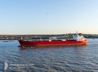
STI CLAPHAM
Tanker
Current Trip
| Time Travelled | 28 days |
|---|---|
| Remaining Time | --- |
| Distance Travelled | 3539.19 nm |
| Remaining Distance | 74.72 nm |
| AVG Speed | 12.1 Knots |
| MAX Speed | 16 Knots |
| AVG Wind | 12.1 knots |
| MAX Wind | 31.8 knots |
| MIN Temp | 9.3°C / 48.74°F |
| MAX Temp | 29.1°C / 84.38°F |
| Dybgang | 9.4 m |
| Position Modtaget | 2 m siden |
Current Position
| Longitude | 2.56045° |
|---|---|
| Latitude | 51.39916° |
| Status | At anchor |
| Fart | 0.2 Knots |
| Kurs | 304° |
| Område | North Sea |
| Station | T-AIS |
| Position Modtaget | 2 m siden |
Info
Information
The current position of STI CLAPHAM is in North Sea with coordinates 51.39916° / 2.56045° as reported on 2024-05-02 04:56 by AIS to our vessel tracker app. The vessel's current speed is 0.2 Knots and is heading at the port of ANTWERP. The estimated time of arrival as calculated by MyShipTracking vessel tracking app is 2024-04-29 17:00 LT
The vessel STI CLAPHAM (IMO: 9696577, MMSI: 538005407) is a Tanker It's sailing under the flag of [MH] Marshall Is.
In this page you can find informations about the vessels current position, last detected port calls, and current voyage information. If the vessels is not in coverage by AIS you will find the latest position.
The current position of STI CLAPHAM is detected by our AIS receivers and we are not responsible for the reliability of the data. The last position was recorded while the vessel was in Coverage by the Ais receivers of our vessel tracking app.
The current draught of STI CLAPHAM as reported by AIS is 9.4 meters
Weather
| Temperature | 11.7°C / 53.06°F |
|---|---|
| Wind Speed | 5 knots |
| Direction | 225° SW |
| Pressure | 998.5 hPa |
| Humidity | 98.1 % |
| Cloud Coverage | 83 % |
Featured Company
Last Port Calls
| Port | Arrival | Departure | Time In Port |
|---|---|---|---|
| 2024-04-01 08:57 | 2024-04-03 09:45 | 2 d | |
| 2024-03-29 13:16 | 2024-04-01 08:29 | 2 d | |
| 2024-03-23 08:36 | 2024-03-25 10:25 | 2 d | |
| 2024-03-18 05:16 | 2024-03-21 18:31 | 3 d |
Last Trips
| Origin | Departure | Destination | Arrival | Distance | |
|---|---|---|---|---|---|
| 2024-04-01 10:29 | 2024-04-01 10:57 | 3.58 nm | |||
| 2024-03-25 11:25 | 2024-03-29 14:16 | 16.80 nm | |||
| 2024-03-21 19:31 | 2024-03-23 09:36 | 461.94 nm | |||
| 2024-02-29 03:41 | 2024-03-18 06:16 | 1351.47 nm |
Events
| Tid | Hændelsen | Detaljer | Position / Dest | Info |
|---|---|---|---|---|
| 2024-05-02 02:53 | Status er ændret | At anchor Default |
51.39897 / 2.55728
BEANR
|
Fart: Kurs: -1° |
| 2024-05-02 02:50 | Status er ændret | Default At anchor |
51.39834 / 2.55667
BEANR
|
Fart: Kurs: 45° |
| 2024-05-02 02:29 | Status er ændret | At anchor Default |
51.39889 / 2.55699
BEANR
|
Fart: 0.2 kn Kurs: 62° |
| 2024-05-02 02:26 | Status er ændret | Default At anchor |
51.39885 / 2.55693
BEANR
|
Fart: Kurs: 56° |
| 2024-05-02 01:17 | Status er ændret | At anchor Default |
51.39870 / 2.55622
BEANR
|
Fart: Kurs: 40° |
| 2024-05-02 01:14 | Status er ændret | Default At anchor |
51.39868 / 2.55624
BEANR
|
Fart: Kurs: 39° |
| 2024-05-02 00:41 | Status er ændret | At anchor Default |
51.39872 / 2.55615
BEANR
|
Fart: Kurs: 40° |
| 2024-05-02 00:38 | Status er ændret | Default At anchor |
51.39877 / 2.55611
BEANR
|
Fart: Kurs: 38° |
| 2024-05-01 18:23 | Status er ændret | At anchor Default |
51.40117 / 2.56029
BEANR
|
Fart: Kurs: 280° |
| 2024-05-01 18:20 | Status er ændret | Default At anchor |
51.40115 / 2.56029
BEANR
|
Fart: Kurs: 281° |