
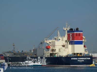
STENA CONDUCTOR
Tanker
Current Trip
| Time Travelled | 1 day |
|---|---|
| Remaining Time | --- |
| Distance Travelled | 400.56 nm |
| Remaining Distance | --- |
| AVG Speed | 11.8 Knots |
| MAX Speed | 14.9 Knots |
| AVG Wind | 13.4 knots |
| MAX Wind | 20.6 knots |
| MIN Temp | 12.2°C / 53.96°F |
| MAX Temp | 22.1°C / 71.78°F |
| Dybgang | 8 m |
| Position Modtaget | Nu |
Current Position
| Longitude | 2.05101° |
|---|---|
| Latitude | 51.49550° |
| Status | Under way using engine |
| Fart | 12.9 Knots |
| Kurs | 227.5° |
| Område | North Sea |
| Station | T-AIS |
| Position Modtaget | Nu |
Info
Information
The current position of STENA CONDUCTOR is in North Sea with coordinates 51.49550° / 2.05101° as reported on 2024-05-14 03:20 by AIS to our vessel tracker app. The vessel's current speed is 12.9 Knots and is heading at the port of TARRAGONA. The estimated time of arrival as calculated by MyShipTracking vessel tracking app is 2024-05-20 11:00 LT
The vessel STENA CONDUCTOR (IMO: 9934888, MMSI: 352001328) is a Tanker It's sailing under the flag of [PA] Panama.
In this page you can find informations about the vessels current position, last detected port calls, and current voyage information. If the vessels is not in coverage by AIS you will find the latest position.
The current position of STENA CONDUCTOR is detected by our AIS receivers and we are not responsible for the reliability of the data. The last position was recorded while the vessel was in Coverage by the Ais receivers of our vessel tracking app.
The current draught of STENA CONDUCTOR as reported by AIS is 8 meters
Weather
| Temperature | 13.5°C / 56.3°F |
|---|---|
| Wind Speed | 14 knots |
| Direction | 122° ESE |
| Pressure | 1002 hPa |
| Humidity | 92.8 % |
| Cloud Coverage | 66 % |
Featured Company
Events
| Tid | Hændelsen | Detaljer | Position / Dest | Info |
|---|---|---|---|---|
| 2024-05-14 03:00 | ETA er ændret | 2024/05/20 11:00 2024/05/19 06:00 |
51.54790 / 2.13701
ES TAR
|
Fart: 13 kn Kurs: 223° |
| 2024-05-14 02:18 | Destination er ændret | ES TAR DRIFTING NORTH SEA |
51.66644 / 2.30255
ES TAR
|
Fart: 13.9 kn Kurs: 220.5° |
| 2024-05-14 02:18 | ETA er ændret | 2024/05/19 06:00 2024/05/13 06:00 |
51.66644 / 2.30255
ES TAR
|
Fart: 13.9 kn Kurs: 220.5° |
| 2024-05-14 01:46 | Ændre havområde | United Kingdom part of the North Sea Belgian part of the North Sea |
51.76145 / 2.42936
North Sea
|
Fart: 14.4 kn Kurs: 219.1° |
| 2024-05-14 01:16 | Fundet i havområde | Belgian part of the North Sea |
51.86339 / 2.53627
North Sea
|
Fart: 14.7 kn Kurs: 205.9° |
| 2024-05-14 00:52 | Ændre havområde | Dutch part of the North Sea United Kingdom part of the North Sea |
51.95233 / 2.60335
North Sea
|
Fart: 14.7 kn Kurs: 189.2° |
| 2024-05-13 23:49 | Status er ændret | Under way using engine Default |
52.20128 / 2.67959
DRIFTING NORTH SEA
|
Fart: 14.4 kn Kurs: 200° |
| 2024-05-13 23:36 | Status er ændret | Default Under way using engine |
52.25068 / 2.71224
DRIFTING NORTH SEA
|
Fart: 14.3 kn Kurs: 199.7° |
| 2024-05-13 23:20 | Ændre havområde | United Kingdom part of the North Sea Dutch part of the North Sea |
52.31113 / 2.74769
North Sea
|
Fart: 14 kn Kurs: 203.6° |
| 2024-05-13 23:20 | Status er ændret | Under way using engine Default |
52.31113 / 2.74769
DRIFTING NORTH SEA
|
Fart: 14.1 kn Kurs: 206° |