
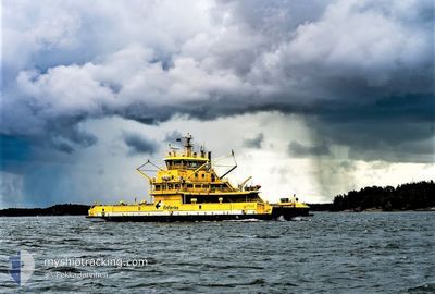
STELLA
Ro-Ro/Passenger Ship
Current Trip
| Time Travelled | --- |
|---|---|
| Remaining Time | --- |
| Distance Travelled | --- |
| Remaining Distance | --- |
| AVG Speed | --- |
| MAX Speed | --- |
| AVG Wind | --- |
| MAX Wind | --- |
| MIN Temp | --- |
| MAX Temp | --- |
| Dybgang | 4.2 m |
| Position Modtaget | 5 m siden |
Current Position
| Longitude | --- |
|---|---|
| Latitude | --- |
| Status | Under way using engine |
| Fart | 1 Knots |
| Kurs | 134° |
| Område | Gulf of Bothnia |
| Station | T-AIS |
| Position Modtaget | 5 m siden |
Info
Information
The current position of STELLA is in Gulf of Bothnia with coordinates 60.18569° / 21.58476° as reported on 2025-01-11 07:21 by AIS to our vessel tracker app. The vessel's current speed is 1 Knots
The vessel STELLA (IMO: 9624691, MMSI: 230634000) is a Ro-Ro/Passenger Ship that was built in 2012 ( 13 år gamle ). It's sailing under the flag of [FI] Finland.
In this page you can find informations about the vessels current position, last detected port calls, and current voyage information. If the vessels is not in coverage by AIS you will find the latest position.
The current position of STELLA is detected by our AIS receivers and we are not responsible for the reliability of the data. The last position was recorded while the vessel was in Coverage by the Ais receivers of our vessel tracking app.
The current draught of STELLA as reported by AIS is 4.2 meters
Weather
| Temperature | -1.8°C / 28.76°F |
|---|---|
| Wind Speed | 22 knots |
| Direction | 32° NNE |
| Pressure | 1008.1 hPa |
| Humidity | 94.6 % |
| Cloud Coverage | 100 % |
Featured Company
Last Port Calls
Most Visited Ports (Last year)
| Port | Arrivals |
|---|
Last Trips
| Origin | Departure | Destination | Arrival | Distance |
|---|
Events
| Tid | Hændelsen | Detaljer | Position / Dest | Info |
|---|---|---|---|---|
| 2025-01-11 07:26 | STOP Sejllads | 21.35 nm, South West of NAANTALI |
60.18561 / 21.58498
GALTBY-KITTUIS
|
Fart: Kurs: 134° |
| 2025-01-11 06:55 | START Sejllads | 20.59 nm, South of VUOSNAINEN |
60.18080 / 21.45522
GALTBY-KITTUIS
|
Fart: 10.7 kn Kurs: 114.8° |
| 2025-01-11 06:47 | STOP Sejllads | 20.13 nm, South of VUOSNAINEN |
60.18650 / 21.43933
GALTBY-KITTUIS
|
Fart: Kurs: 310° |
| 2025-01-11 06:18 | START Sejllads | 21.35 nm, South West of NAANTALI |
60.18780 / 21.57996
GALTBY-KITTUIS
|
Fart: 9.9 kn Kurs: 294.8° |
| 2025-01-11 06:07 | STOP Sejllads | 21.35 nm, South West of NAANTALI |
60.18560 / 21.58496
GALTBY-KITTUIS
|
Fart: 0.1 kn Kurs: 135° |
| 2025-01-11 05:55 | START Sejllads | 19.93 nm, South East of VUOSNAINEN |
60.21435 / 21.56024
GALTBY-KITTUIS
|
Fart: 7.8 kn Kurs: 157.3° |
| 2025-01-11 05:51 | STOP Sejllads | 19.82 nm, South East of VUOSNAINEN |
60.21603 / 21.55885
GALTBY-KITTUIS
|
Fart: 0.2 kn Kurs: 336° |
| 2025-01-11 05:37 | START Sejllads | 21.29 nm, South West of NAANTALI |
60.18838 / 21.58152
GALTBY-KITTUIS
|
Fart: 9.1 kn Kurs: 336.3° |
| 2025-01-11 05:17 | STOP Sejllads | 21.35 nm, South West of NAANTALI |
60.18560 / 21.58495
GALTBY-KITTUIS
|
Fart: 0.3 kn Kurs: 135° |
| 2025-01-11 04:49 | START Sejllads | 20.22 nm, South of VUOSNAINEN |
60.18537 / 21.44283
GALTBY-KITTUIS
|
Fart: 9.3 kn Kurs: 121.9° |