
STEENBOK
Dredging or underwater ops
Current Trip
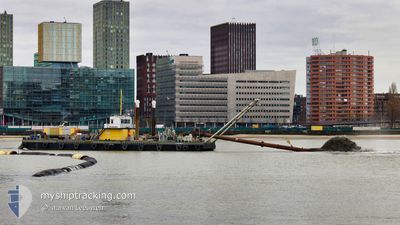
RIJNHAVEN
| Time Travelled | 2 days |
|---|---|
| Remaining Time | --- |
| Distance Travelled | 2.97 nm |
| Remaining Distance | --- |
| AVG Speed | 4.8 Knots |
| MAX Speed | 5.8 Knots |
| AVG Wind | 5.2 knots |
| MAX Wind | 8.5 knots |
| MIN Temp | 21.9°C / 71.42°F |
| MAX Temp | 23.1°C / 73.58°F |
| Dybgang | 1.2 m |
| Position Modtaget | 2 d siden |
Current Position
| Longitude | 4.57026° |
|---|---|
| Latitude | 51.91179° |
| Status | Not under command |
| Fart | |
| Kurs | --- |
| Område | North Sea |
| Station | T-AIS |
| Position Modtaget | 2 d siden |
Info
Information
The current position of STEENBOK is in North Sea with coordinates 51.91179° / 4.57026° as reported on 2024-05-01 14:52 by AIS to our vessel tracker app. The vessel's current speed is 0 Knots
The vessel STEENBOK (MMSI: 244670223) is a Dredging or underwater ops It's sailing under the flag of [NL] Netherlands.
In this page you can find informations about the vessels current position, last detected port calls, and current voyage information. If the vessels is not in coverage by AIS you will find the latest position.
The current position of STEENBOK is detected by our AIS receivers and we are not responsible for the reliability of the data. The last position was recorded while the vessel was in Coverage by the Ais receivers of our vessel tracking app.
The current draught of STEENBOK as reported by AIS is 1.2 meters
Weather
| Temperature | 24°C / 75.2°F |
|---|---|
| Wind Speed | 7 knots |
| Direction | 356° N |
| Pressure | 1004.5 hPa |
| Humidity | 58.5 % |
| Cloud Coverage | 55 % |
Featured Company
Last Port Calls
| Port | Arrival | Departure | Time In Port |
|---|---|---|---|
| 2024-05-01 11:52 |
Most Visited Ports (Last year)
| Port | Arrivals | |
|---|---|---|
| 2 | ||
| 1 |
Last Trips
| Origin | Departure | Destination | Arrival | Distance |
|---|
Events
| Tid | Hændelsen | Detaljer | Position / Dest | Info |
|---|---|---|---|---|
| 2024-05-01 14:52 | Udenfor Dækning |
51.91179 / 4.57026
North Sea
|
Fart: Kurs: 511° |
|
| 2024-05-01 12:34 | STOP Sejllads | 0.3 nm, North West of KRIMPEN |
51.91121 / 4.56965
RIJNHAVEN
|
Fart: 0.3 kn Kurs: 511° |
| 2024-05-01 11:52 | Afsejlet fra sidste havn |
|
51.91416 / 4.51087
RIJNHAVEN
|
Fart: 4.5 kn Kurs: 129.7° |
| 2024-05-01 11:33 | START Sejllads |
51.90747 / 4.48719
[NL] ROTTERDAM CENTRUM
|
Fart: 5 kn Kurs: 50.9° |
|
| 2024-05-01 11:15 | STOP Sejllads |
51.90597 / 4.48499
[NL] ROTTERDAM CENTRUM
|
Fart: 0.2 kn Kurs: 511° |
|
| 2024-05-01 11:07 | START Sejllads |
51.90274 / 4.48670
[NL] ROTTERDAM CENTRUM
|
Fart: 3.6 kn Kurs: 249° |
|
| 2024-05-01 05:14 | Indenfor Dækning |
51.90406 / 4.49155
North Sea
[NL] ROTTERDAM CENTRUM
|
Fart: Kurs: 511° |
|
| 2024-04-30 18:20 | Udenfor Dækning |
51.90405 / 4.49156
North Sea
[NL] ROTTERDAM CENTRUM
|
Fart: Kurs: 511° |
|
| 2024-04-30 03:23 | Indenfor Dækning |
51.90332 / 4.49198
North Sea
[NL] ROTTERDAM CENTRUM
|
Fart: Kurs: 511° |
|
| 2024-04-29 15:13 | Udenfor Dækning |
51.90333 / 4.49196
North Sea
[NL] ROTTERDAM CENTRUM
|
Fart: Kurs: 511° |