
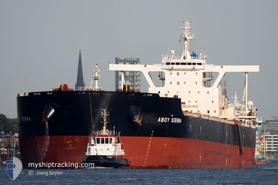
STAR SIENNA
Cargo
Current Trip
CN TGS
| Time Travelled | 38 days |
|---|---|
| Remaining Time | --- |
| Distance Travelled | 10604.67 nm |
| Remaining Distance | --- |
| AVG Speed | 11.4 Knots |
| MAX Speed | 15.1 Knots |
| AVG Wind | 14.7 knots |
| MAX Wind | 29.1 knots |
| MIN Temp | 15°C / 59°F |
| MAX Temp | 31°C / 87.8°F |
| Dybgang | 18 m |
| Position Modtaget | 5 d siden |
Current Position
| Longitude | 104.23850° |
|---|---|
| Latitude | 1.26669° |
| Status | Under way using engine |
| Fart | 13.8 Knots |
| Kurs | 81.9° |
| Område | Singapore Strait |
| Station | T-AIS |
| Position Modtaget | 5 d siden |
Info
Information
The current position of STAR SIENNA is in Singapore Strait with coordinates 1.26669° / 104.23850° as reported on 2024-06-02 02:46 by AIS to our vessel tracker app. The vessel's current speed is 13.8 Knots
The vessel STAR SIENNA (IMO: 9756224, MMSI: 636021265) is a Cargo It's sailing under the flag of [LR] Liberia.
In this page you can find informations about the vessels current position, last detected port calls, and current voyage information. If the vessels is not in coverage by AIS you will find the latest position.
The current position of STAR SIENNA is detected by our AIS receivers and we are not responsible for the reliability of the data. The last position was recorded while the vessel was in Coverage by the Ais receivers of our vessel tracking app.
The current draught of STAR SIENNA as reported by AIS is 18 meters
Weather
| Temperature | 26.4°C / 79.52°F |
|---|---|
| Wind Speed | 12 knots |
| Direction | 359° N |
| Pressure | 1007.8 hPa |
| Humidity | 85.9 % |
| Cloud Coverage | 20 % |
Featured Company
Most Visited Ports (Last year)
| Port | Arrivals | |
|---|---|---|
| 3 | ||
| 2 | ||
| 1 | ||
| 1 | ||
| 1 | ||
| 1 |
Last Trips
| Origin | Departure | Destination | Arrival | Distance |
|---|
Events
| Tid | Hændelsen | Detaljer | Position / Dest | Info |
|---|---|---|---|---|
| 2024-06-04 08:46 | START Sejllads |
9.31333 / 110.71167
CN TGS
|
Fart: 6 kn Kurs: 45° |
|
| 2024-06-04 06:37 | STOP Sejllads |
9.29833 / 110.71000
CN TGS
|
Fart: Kurs: -1° |
|
| 2024-06-02 02:49 | Status er ændret | Default Under way using engine |
1.26842 / 104.24978
CN TGS
|
Fart: 13.8 kn Kurs: 81.9° |
| 2024-06-02 02:46 | Udenfor Dækning |
1.26669 / 104.23850
Singapore Strait
CN TGS
|
Fart: 13.8 kn Kurs: 81.9° |
|
| 2024-06-02 02:25 | Ændre havområde | Malaysian part of the Singapore Strait Indonesian part of the Singapore Strait |
1.25870 / 104.16014
Singapore Strait
CN TGS
|
Fart: 13.6 kn Kurs: 92.8° |
| 2024-06-02 01:53 | Status er ændret | Under way using engine At anchor |
1.25443 / 104.04778
CN TGS
|
Fart: 11 kn Kurs: 89.3° |
| 2024-06-02 01:35 | Ændre havområde | Indonesian part of the Singapore Strait Singaporean part of the Singapore Strait |
1.25528 / 104.00295
Singapore Strait
CN TGS
|
Fart: 6.8 kn Kurs: 131.6° |
| 2024-06-02 01:19 | START Sejllads | 2.3 nm, South of TANAH MERAH |
1.27608 / 104.00458
CN TGS
|
Fart: 3.1 kn Kurs: 200° |
| 2024-06-01 19:38 | ETA er ændret | 2024/06/11 12:00 2024/06/01 07:00 |
1.27811 / 104.00587
CN TGS
|
Fart: 0.1 kn Kurs: 311° |
| 2024-06-01 19:31 | Destination er ændret | CN TGS SGSIN PEBGB |
1.27818 / 104.00598
CN TGS
|
Fart: 0.1 kn Kurs: 307° |