
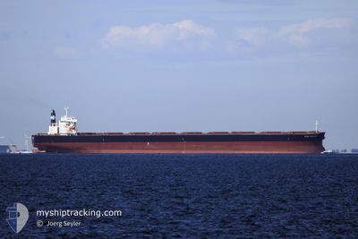
STAR PRINCESS
Bulk Carrier
Current Trip
| Time Travelled | 9 days |
|---|---|
| Remaining Time | --- |
| Distance Travelled | 2646.91 nm |
| Remaining Distance | --- |
| AVG Speed | 10.8 Knots |
| MAX Speed | 13.8 Knots |
| AVG Wind | 13.9 knots |
| MAX Wind | 24 knots |
| MIN Temp | 18.2°C / 64.76°F |
| MAX Temp | 29.6°C / 85.28°F |
| Dybgang | 15.1 m |
| Position Modtaget | 8 d siden |
Current Position
| Longitude | 154.06687° |
|---|---|
| Latitude | -27.61097° |
| Status | Under way using engine |
| Fart | 10.1 Knots |
| Kurs | 355° |
| Område | Coral Sea |
| Station | T-AIS |
| Position Modtaget | 8 d siden |
Info
Information
The current position of STAR PRINCESS is in Coral Sea with coordinates -27.61097° / 154.06687° as reported on 2024-04-26 23:22 by AIS to our vessel tracker app. The vessel's current speed is 10.1 Knots and is heading at the port of XINSHA. The estimated time of arrival as calculated by MyShipTracking vessel tracking app is 2024-05-14 10:00 LT
The vessel STAR PRINCESS (IMO: 9296200, MMSI: 311000151) is a Bulk Carrier that was built in 2003 ( 21 år gamle ). It's sailing under the flag of [BS] Bahamas.
In this page you can find informations about the vessels current position, last detected port calls, and current voyage information. If the vessels is not in coverage by AIS you will find the latest position.
The current position of STAR PRINCESS is detected by our AIS receivers and we are not responsible for the reliability of the data. The last position was recorded while the vessel was in Coverage by the Ais receivers of our vessel tracking app.
The current draught of STAR PRINCESS as reported by AIS is 15.1 meters
Weather
| Temperature | 29.1°C / 84.38°F |
|---|---|
| Wind Speed | 12 knots |
| Direction | 59° ENE |
| Pressure | 1006.3 hPa |
| Humidity | 76.3 % |
| Cloud Coverage | 100 % |
Featured Company
Events
| Tid | Hændelsen | Detaljer | Position / Dest | Info |
|---|---|---|---|---|
| 2024-04-26 23:27 | Status er ændret | Default Under way using engine |
-27.59462 / 154.06708
XINSHA CN
|
Fart: 10.1 kn Kurs: 355° |
| 2024-04-26 23:22 | Fundet i havområde | Australian part of the Coral Sea |
-27.61097 / 154.06687
Coral Sea
XINSHA CN
|
Fart: 10.1 kn Kurs: 355° |
| 2024-04-26 23:22 | Status er ændret | Under way using engine Default |
-27.61097 / 154.06687
XINSHA CN
|
Fart: 10.2 kn Kurs: 4° |
| 2024-04-26 23:22 | Udenfor Dækning |
-27.61097 / 154.06687
Coral Sea
XINSHA CN
|
Fart: 10.1 kn Kurs: 355° |
|
| 2024-04-26 23:15 | Indenfor Dækning |
-27.61097 / 154.06687
Coral Sea
XINSHA CN
|
Fart: 10.1 kn Kurs: 355° |
|
| 2024-04-26 05:15 | Status er ændret | Default Under way using engine |
-30.65855 / 153.49400
XINSHA CN
|
Fart: 11.4 kn Kurs: 15° |
| 2024-04-26 05:15 | Status er ændret | Under way using engine Default |
-30.66068 / 153.49327
XINSHA CN
|
Fart: 11.5 kn Kurs: 16° |
| 2024-04-26 05:15 | Indenfor Dækning |
-30.66068 / 153.49327
Tasman Sea
XINSHA CN
|
Fart: 11.4 kn Kurs: 15° |
|
| 2024-04-26 05:15 | Udenfor Dækning |
-30.66068 / 153.49327
Tasman Sea
XINSHA CN
|
Fart: 11.4 kn Kurs: 15° |
|
| 2024-04-25 18:41 | Udenfor Dækning |
-32.34548 / 152.87113
Tasman Sea
XINSHA CN
|
Fart: 9.4 kn Kurs: 22° |