
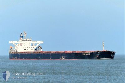
STAR PAULINE
Bulk Carrier
Current Trip
| Time Travelled | 33 days |
|---|---|
| Remaining Time | --- |
| Distance Travelled | 5603.83 nm |
| Remaining Distance | --- |
| AVG Speed | 10.5 Knots |
| MAX Speed | 15 Knots |
| AVG Wind | 8.4 knots |
| MAX Wind | 19 knots |
| MIN Temp | 25.4°C / 77.72°F |
| MAX Temp | 33°C / 91.4°F |
| Dybgang | 17.5 m |
| Position Modtaget | 4 d siden |
Current Position
| Longitude | --- |
|---|---|
| Latitude | --- |
| Status | Under way using engine |
| Fart | 11.2 Knots |
| Kurs | 313.4° |
| Område | Laccadive Sea |
| Station | T-AIS |
| Position Modtaget | 4 d siden |
Info
Information
The current position of STAR PAULINE is in Laccadive Sea with coordinates 8.29132° / 76.59615° as reported on 2024-10-03 05:35 by AIS to our vessel tracker app. The vessel's current speed is 11.2 Knots
The vessel STAR PAULINE (IMO: 9479890, MMSI: 636019668) is a Bulk Carrier that was built in 2008 ( 16 år gamle ). It's sailing under the flag of [LR] Liberia.
In this page you can find informations about the vessels current position, last detected port calls, and current voyage information. If the vessels is not in coverage by AIS you will find the latest position.
The current position of STAR PAULINE is detected by our AIS receivers and we are not responsible for the reliability of the data. The last position was recorded while the vessel was in Coverage by the Ais receivers of our vessel tracking app.
The current draught of STAR PAULINE as reported by AIS is 17.5 meters
Weather
| Temperature | 30.6°C / 87.08°F |
|---|---|
| Wind Speed | 5 knots |
| Direction | 67° ENE |
| Pressure | 1012.8 hPa |
| Humidity | 56.3 % |
| Cloud Coverage | 3 % |
Featured Company
Last Port Calls
| Port | Arrival | Departure | Time In Port |
|---|---|---|---|
| 2024-09-03 02:52 | 2024-09-04 22:41 | 1 d | |
| 2024-08-29 20:12 | 2024-08-31 10:37 | 1 d | |
| 2024-08-11 11:11 | 2024-08-13 05:23 | 1 d |
Most Visited Ports (Last year)
| Port | Arrivals | |
|---|---|---|
| 2 | ||
| 2 | ||
| 1 | ||
| 1 | ||
| 1 | ||
| 1 |
Last Trips
| Origin | Departure | Destination | Arrival | Distance | |
|---|---|---|---|---|---|
| 2024-08-31 18:37 | 2024-09-03 10:52 | 508.98 nm | |||
| 2024-08-13 13:23 | 2024-08-30 04:12 | 3654.28 nm | |||
| 2024-07-28 11:15 | 2024-08-11 19:11 | 3484.00 nm |
Events
| Tid | Hændelsen | Detaljer | Position / Dest | Info |
|---|---|---|---|---|
| 2024-10-07 23:17 | STOP Sejllads | 6.73 nm, West of MUNDRA |
22.75411 / 69.56914
IN MUN
|
Fart: 0.1 kn Kurs: 22° |
| 2024-10-07 21:58 | START Sejllads | 8.42 nm, South West of MUNDRA |
22.67839 / 69.55012
IN MUN
|
Fart: 4.1 kn Kurs: 328° |
| 2024-10-07 06:54 | STOP Sejllads | 8.54 nm, South West of MUNDRA |
22.66009 / 69.55821
IN MUN
|
Fart: 0.3 kn Kurs: 289° |
| 2024-10-03 05:41 | Status er ændret | Default Under way using engine |
8.30326 / 76.58363
IN MUN
|
Fart: 11.2 kn Kurs: 313.4° |
| 2024-10-03 05:35 | Udenfor Dækning |
8.29132 / 76.59615
Laccadive Sea
IN MUN
|
Fart: 11.2 kn Kurs: 313.4° |
|
| 2024-10-02 22:19 | Fundet i havområde | Indian part of the Laccadive Sea |
7.56701 / 77.70490
Laccadive Sea
IN MUN
|
Fart: 10.2 kn Kurs: 303.6° |
| 2024-10-02 22:19 | Status er ændret | Under way using engine Default |
7.56701 / 77.70490
IN MUN
|
Fart: 10.2 kn Kurs: 306° |
| 2024-10-02 22:08 | Indenfor Dækning |
7.56701 / 77.70490
Laccadive Sea
IN MUN
|
Fart: 10.2 kn Kurs: 303.6° |
|
| 2024-10-02 06:25 | Status er ændret | Default Under way using engine |
5.98161 / 80.09481
IN MUN
|
Fart: 10.9 kn Kurs: 304.6° |
| 2024-10-02 06:24 | Udenfor Dækning |
5.98079 / 80.09610
Laccadive Sea
IN MUN
|
Fart: 10.9 kn Kurs: 304.6° |