

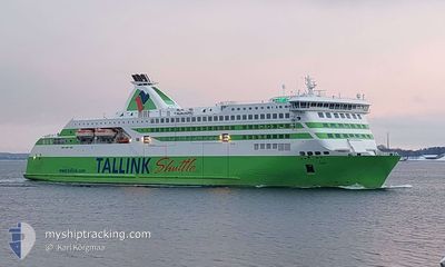
STAR I
Ro-Ro/Passenger Ship

Current Trip
| Trip Time | 10 h, 2 mins |
|---|---|
| Trip Distance | 157.76 nm |
| AVG Speed | 15.7 Knots |
| MAX Speed | 19 Knots |
| Dybgang | 6.2 m |
| AVG Wind | 11.7 knots |
| MAX Wind | 16 knots |
| MIN Temp | -2°C / 28.4°F |
| MAX Temp | --- |
| Position Modtaget | 1 m siden |
Current Position
| Longitude | --- |
|---|---|
| Latitude | --- |
| Status | Moored |
| Fart | 0.1 Knots |
| Kurs | 254° |
| Område | Baltic Sea |
| Station | T-AIS |
| Position Modtaget | 1 m siden |
Information
The current position of STAR I is in Baltic Sea with coordinates 59.72000° / 19.06717° as reported on 2025-03-13 18:16 by AIS to our vessel tracker app. The vessel's current speed is 0.1 Knots and is currently inside the port of KAPELLSKAR.
The vessel STAR I (IMO: 9364722, MMSI: 276672000) is a Ro-Ro/Passenger Ship that was built in 2007 ( 18 år gamle ). It's sailing under the flag of [EE] Estonia.
In this page you can find informations about the vessels current position, last detected port calls, and current voyage information. If the vessels is not in coverage by AIS you will find the latest position.
The current position of STAR I is detected by our AIS receivers and we are not responsible for the reliability of the data. The last position was recorded while the vessel was in Coverage by the Ais receivers of our vessel tracking app.
The current draught of STAR I as reported by AIS is 6.2 meters
Weather
| Temperature | -1.6°C / 29.12°F |
|---|---|
| Wind Speed | 10 knots |
| Direction | 359° N |
| Pressure | 999.9 hPa |
| Humidity | 68.1 % |
| Cloud Coverage | 87 % |


Featured Company
Last Port Calls
| Port | Arrival | Departure | Time In Port |
|---|---|---|---|
| 2025-03-13 06:49 | |||
| 2025-03-12 19:48 | 2025-03-12 21:47 | 1 h | |
| 2025-03-12 06:46 | 2025-03-12 08:45 | 1 h | |
| 2025-03-11 19:48 | 2025-03-11 21:39 | 1 h | |
| 2025-03-11 06:43 | 2025-03-11 08:42 | 1 h | |
| 2025-03-10 19:47 | 2025-03-10 21:34 | 1 h | |
| 2025-03-10 06:53 | 2025-03-10 08:37 | 1 h | |
| 2025-03-09 19:45 | 2025-03-09 21:59 | 2 h | |
| 2025-03-09 06:48 | 2025-03-09 08:44 | 1 h | |
| 2025-03-07 07:41 | 2025-03-08 21:55 | 1 d |
Most Visited Ports (Last year)
| Port | Arrivals | |
|---|---|---|
| 26 | ||
| 26 |
Last Trips
| Origin | Departure | Destination | Arrival | Distance | |
|---|---|---|---|---|---|
| 2025-03-12 21:47 | 2025-03-13 06:49 | 157.76 nm | |||
| 2025-03-12 08:45 | 2025-03-12 19:48 | 158.26 nm | |||
| 2025-03-11 21:39 | 2025-03-12 06:46 | 157.82 nm | |||
| 2025-03-11 08:42 | 2025-03-11 19:48 | 158.26 nm | |||
| 2025-03-10 21:34 | 2025-03-11 06:43 | 157.93 nm | |||
| 2025-03-10 08:37 | 2025-03-10 19:47 | 158.26 nm | |||
| 2025-03-09 21:59 | 2025-03-10 06:53 | 158.15 nm | |||
| 2025-03-09 08:44 | 2025-03-09 19:45 | 158.35 nm | |||
| 2025-03-08 21:55 | 2025-03-09 06:48 | 158.17 nm | |||
| 2025-03-06 20:39 | 2025-03-07 07:41 | 158.65 nm |
Events
| Tid | Hændelsen | Detaljer | Position / Dest | Info |
|---|---|---|---|---|
| 2025-03-13 06:02 | ETA er ændret | 2025/03/14 06:00 2025/03/13 06:00 |
59.72000 / 19.06717
[SE] KAPELLSKAR
|
Fart: 0.1 kn Kurs: 254° |
| 2025-03-13 06:01 | Status er ændret | Moored Under way using engine |
59.72000 / 19.06717
[SE] KAPELLSKAR
|
Fart: 0.1 kn Kurs: 254° |
| 2025-03-13 05:55 | STOP Sejllads |
59.72000 / 19.06733
[SE] KAPELLSKAR
|
Fart: 0.3 kn Kurs: 253° |
|
| 2025-03-13 05:49 | Skibe i havn |
|
59.72050 / 19.07233
[SE] KAPELLSKAR
|
Fart: 3.8 kn Kurs: 249° |
| 2025-03-13 04:38 | Ændre havområde | Swedish part of the Baltic Sea Finnish part of the Baltic Sea |
59.79233 / 19.65217
Baltic Sea
EE PLS >< SE KPS
|
Fart: 15.9 kn Kurs: 262° |
| 2025-03-13 04:34 | Ændre havområde | Finnish part of the Baltic Sea Finnish part of the Gulf of Bothnia |
59.79467 / 19.68683
Baltic Sea
EE PLS >< SE KPS
|
Fart: 15.8 kn Kurs: 262° |
| 2025-03-13 03:10 | Ændre havområde | Finnish part of the Gulf of Bothnia Finnish part of the Baltic Sea |
59.74267 / 20.41016
Gulf of Bothnia
EE PLS >< SE KPS
|
Fart: 15.4 kn Kurs: 297° |
| 2025-03-13 01:51 | Status er ændret | Under way using engine Default |
59.63900 / 21.03950
EE PLS >< SE KPS
|
Fart: 15.9 kn Kurs: 281° |
| 2025-03-13 01:39 | Status er ændret | Default Under way using engine |
59.62867 / 21.14633
EE PLS >< SE KPS
|
Fart: 15.9 kn Kurs: 282° |
| 2025-03-13 00:41 | Status er ændret | Under way using engine Default |
59.58267 / 21.63883
EE PLS >< SE KPS
|
Fart: 15.8 kn Kurs: 281° |