

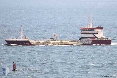
ST PIERRE
Trailing Suction Hopper Dredger

Current Trip
CONCARNEAU
| Time Travelled | 9 days |
|---|---|
| Remaining Time | --- |
| Distance Travelled | 37.63 nm |
| Remaining Distance | --- |
| AVG Speed | 8.9 Knots |
| MAX Speed | 13 Knots |
| AVG Wind | 14.9 knots |
| MAX Wind | 19 knots |
| MIN Temp | 9.8°C / 49.64°F |
| MAX Temp | 10.9°C / 51.62°F |
| Dybgang | 4 m |
| Position Modtaget | 8 d siden |
Current Position
| Longitude | --- |
|---|---|
| Latitude | --- |
| Status | Under way using engine |
| Fart | 6.3 Knots |
| Kurs | 28.8° |
| Område | Bay of Biscay |
| Station | T-AIS |
| Position Modtaget | 8 d siden |
Information
The current position of ST PIERRE is in Bay of Biscay with coordinates 47.85158° / -3.93232° as reported on 2025-03-19 16:06 by AIS to our vessel tracker app. The vessel's current speed is 6.3 Knots
The vessel ST PIERRE (IMO: 9598751, MMSI: 228024800) is a Trailing Suction Hopper Dredger that was built in 2012 ( 13 år gamle ). It's sailing under the flag of [FR] France.
In this page you can find informations about the vessels current position, last detected port calls, and current voyage information. If the vessels is not in coverage by AIS you will find the latest position.
The current position of ST PIERRE is detected by our AIS receivers and we are not responsible for the reliability of the data. The last position was recorded while the vessel was in Coverage by the Ais receivers of our vessel tracking app.
The current draught of ST PIERRE as reported by AIS is 4 meters
Weather
| Temperature | 11.9°C / 53.42°F |
|---|---|
| Wind Speed | 19 knots |
| Direction | 145° SE |
| Pressure | 996.7 hPa |
| Humidity | 85.7 % |
| Cloud Coverage | 81 % |


Featured Company
Last Port Calls
| Port | Arrival | Departure | Time In Port |
|---|---|---|---|
| 2025-03-19 05:51 | 2025-03-19 05:56 | 4 m | |
| 2025-03-17 21:12 | 2025-03-18 19:12 | 21 h | |
| 2025-03-17 15:43 | 2025-03-17 15:52 | 9 m | |
| 2025-03-17 08:46 | 2025-03-17 08:52 | 5 m | |
| 2025-03-17 03:14 | 2025-03-17 03:24 | 10 m | |
| 2025-03-16 08:29 | 2025-03-16 08:37 | 7 m | |
| 2025-03-15 14:44 | 2025-03-15 14:52 | 7 m | |
| 2025-03-14 14:33 | 2025-03-14 16:44 | 2 h | |
| 2025-03-13 14:09 | 2025-03-13 16:34 | 2 h | |
| 2025-03-11 18:24 | 2025-03-12 14:44 | 20 h |
Most Visited Ports (Last year)
| Port | Arrivals | |
|---|---|---|
| 91 | ||
| 77 | ||
| 65 | ||
| 39 | ||
| 2 |
Last Trips
| Origin | Departure | Destination | Arrival | Distance | |
|---|---|---|---|---|---|
| 2025-03-18 19:12 | 2025-03-19 05:51 | 86.13 nm | |||
| 2025-03-17 15:52 | 2025-03-17 21:12 | 42.43 nm | |||
| 2025-03-17 08:52 | 2025-03-17 15:43 | 59.49 nm | |||
| 2025-03-17 03:24 | 2025-03-17 08:46 | 41.29 nm | |||
| 2025-03-16 08:37 | 2025-03-17 03:14 | 175.67 nm | |||
| 2025-03-15 14:52 | 2025-03-16 08:29 | 142.19 nm | |||
| 2025-03-14 16:44 | 2025-03-15 14:44 | 165.94 nm | |||
| 2025-03-13 16:34 | 2025-03-14 14:33 | 273.66 nm | |||
| 2025-03-12 14:44 | 2025-03-13 14:09 | 199.33 nm | |||
| 2025-03-11 10:05 | 2025-03-11 18:24 | 84.90 nm |
Events
| Tid | Hændelsen | Detaljer | Position / Dest | Info |
|---|---|---|---|---|
| 2025-03-19 16:06 | Udenfor Dækning |
47.85158 / -3.93232
Bay of Biscay
CONCARNEAU
|
Fart: 6.3 kn Kurs: 28.8° |
|
| 2025-03-19 15:56 | START Sejllads | 6.9 nm, East of BENODET |
47.83865 / -3.94333
CONCARNEAU
|
Fart: 3.3 kn Kurs: 37° |
| 2025-03-19 15:41 | Status er ændret | Under way using engine At anchor |
47.83058 / -3.94988
CONCARNEAU
|
Fart: 2.9 kn Kurs: 118° |
| 2025-03-19 13:28 | Status er ændret | At anchor Default |
47.83705 / -3.96351
CONCARNEAU
|
Fart: 0.5 kn Kurs: 133° |
| 2025-03-19 13:22 | Status er ændret | Default At anchor |
47.83681 / -3.96382
CONCARNEAU
|
Fart: 0.7 kn Kurs: 137° |
| 2025-03-19 12:55 | Status er ændret | At anchor Default |
47.83683 / -3.96384
CONCARNEAU
|
Fart: 0.4 kn Kurs: 134° |
| 2025-03-19 12:43 | Status er ændret | Default At anchor |
47.83696 / -3.96359
CONCARNEAU
|
Fart: 0.3 kn Kurs: 138° |
| 2025-03-19 12:37 | Status er ændret | At anchor Default |
47.83689 / -3.96373
CONCARNEAU
|
Fart: 0.3 kn Kurs: 124° |
| 2025-03-19 12:34 | Status er ændret | Default At anchor |
47.83691 / -3.96372
CONCARNEAU
|
Fart: 0.4 kn Kurs: 122° |
| 2025-03-19 12:25 | Status er ændret | At anchor Default |
47.83686 / -3.96371
CONCARNEAU
|
Fart: 0.1 kn Kurs: 144° |