
SQUARE
Cargo
Current Trip
| Time Travelled | 1 day |
|---|---|
| Remaining Time | --- |
| Distance Travelled | 125.89 nm |
| Remaining Distance | --- |
| AVG Speed | 5 Knots |
| MAX Speed | 6.2 Knots |
| AVG Wind | 7 knots |
| MAX Wind | 10 knots |
| MIN Temp | 0.7°C / 33.26°F |
| MAX Temp | 4.4°C / 39.92°F |
| Dybgang | 4 m |
| Position Modtaget | 7 h, 39 m siden |
Current Position
| Longitude | --- |
|---|---|
| Latitude | --- |
| Status | Under way using engine |
| Fart | 4.9 Knots |
| Kurs | 136° |
| Område | North Sea |
| Station | T-AIS |
| Position Modtaget | 7 h, 39 m siden |
Info
Information
The current position of SQUARE is in North Sea with coordinates 49.50707° / 8.44403° as reported on 2026-02-15 00:36 by AIS to our vessel tracker app. The vessel's current speed is 4.9 Knots
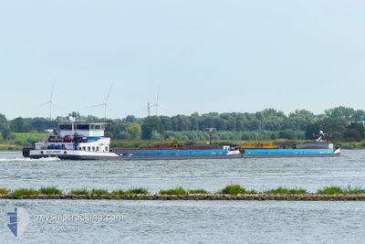
The vessel SQUARE (MMSI: 244660532) is a Cargo It's sailing under the flag of [NL] Netherlands.
In this page you can find informations about the vessels current position, last detected port calls, and current voyage information. If the vessels is not in coverage by AIS you will find the latest position.
The current position of SQUARE is detected by our AIS receivers and we are not responsible for the reliability of the data. The last position was recorded while the vessel was in Coverage by the Ais receivers of our vessel tracking app.
The current draught of SQUARE as reported by AIS is 4 meters
Weather
| Temperature | 0.8°C / 33.44°F |
|---|---|
| Wind Speed | 4 knots |
| Direction | 17° NNE |
| Pressure | 1018.9 hPa |
| Humidity | 71.8 % |
| Cloud Coverage | 75 % |
Featured Company
Last Port Calls
| Port | Arrival | Departure | Time In Port |
|---|---|---|---|
| 2026-02-13 20:05 | 2026-02-13 20:50 | 44 m | |
| 2026-02-12 10:41 | 2026-02-12 14:47 | 4 h | |
| 2026-02-11 15:54 | 2026-02-12 08:37 | 16 h | |
| 2026-02-11 13:58 | 2026-02-11 14:47 | 49 m | |
| 2026-02-11 08:40 | 2026-02-11 12:32 | 3 h | |
| 2026-02-10 20:25 | 2026-02-11 08:33 | 12 h | |
| 2026-02-09 19:09 | 2026-02-10 20:20 | 1 d | |
| 2026-02-05 10:38 | 2026-02-05 10:45 | 6 m | |
| 2026-02-04 22:25 | 2026-02-05 01:01 | 2 h | |
| 2026-02-04 20:56 | 2026-02-04 21:54 | 58 m |
Most Visited Ports (Last year)
| Port | Arrivals | |
|---|---|---|
| 82 | ||
| 39 | ||
| 25 | ||
| 23 | ||
| 16 | ||
| 15 |
Last Trips
| Origin | Departure | Destination | Arrival | Distance | |
|---|---|---|---|---|---|
| 2026-02-12 14:47 | 2026-02-13 20:05 | 177.00 nm | |||
| 2026-02-12 08:37 | 2026-02-12 10:41 | 16.17 nm | |||
| 2026-02-11 14:47 | 2026-02-11 15:54 | 9.01 nm | |||
| 2026-02-11 12:32 | 2026-02-11 13:58 | 8.02 nm | |||
| 2026-02-11 08:33 | 2026-02-11 08:40 | 0.68 nm | |||
| 2026-02-10 20:20 | 2026-02-10 20:25 | 0.49 nm | |||
| 2026-02-05 10:45 | 2026-02-09 19:09 | 558.15 nm | |||
| 2026-02-05 01:01 | 2026-02-05 10:38 | 75.64 nm | |||
| 2026-02-04 21:54 | 2026-02-04 22:25 | 2.81 nm | |||
| 2026-02-04 19:16 | 2026-02-04 20:56 | 16.45 nm |
Events
| Tid | Hændelsen | Detaljer | Position / Dest | Info |
|---|---|---|---|---|
| 2026-02-15 00:36 | Udenfor Dækning |
49.50707 / 8.44403
North Sea
HAFEN GERMERSHEIM
|
Fart: 4.9 kn Kurs: 136° |
|
| 2026-02-14 11:39 | Indenfor Dækning |
50.05517 / 7.77701
North Sea
HAFEN GERMERSHEIM
|
Fart: 4.5 kn Kurs: 145° |
|
| 2026-02-14 02:08 | Udenfor Dækning |
50.52844 / 7.29270
North Sea
HAFEN GERMERSHEIM
|
Fart: 4.5 kn Kurs: 158° |
|
| 2026-02-14 00:59 | Indenfor Dækning |
50.59256 / 7.21125
North Sea
HAFEN GERMERSHEIM
|
Fart: 4.7 kn Kurs: 158° |
|
| 2026-02-13 23:57 | Udenfor Dækning |
50.67107 / 7.19186
North Sea
HAFEN GERMERSHEIM
|
Fart: 5.1 kn Kurs: 155° |
|
| 2026-02-13 19:50 | Afsejlet fra sidste havn |
|
50.89413 / 7.01314
HAFEN GERMERSHEIM
|
Fart: 4.5 kn Kurs: 92° |
| 2026-02-13 19:12 | START Sejllads |
50.92731 / 6.96728
[DE] KOELN
|
Fart: 4.8 kn Kurs: 164° |
|
| 2026-02-13 19:07 | STOP Sejllads |
50.92991 / 6.96595
[DE] KOELN
|
Fart: 0.3 kn Kurs: 170° |
|
| 2026-02-13 19:05 | Skibe i havn |
|
50.92996 / 6.96630
[DE] KOELN
|
Fart: 0.7 kn Kurs: 170° |
| 2026-02-13 05:38 | Indenfor Dækning |
51.65816 / 6.55746
North Sea
HAFEN GERMERSHEIM
|
Fart: 5.5 kn Kurs: 81° |