
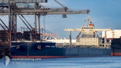
SPRING CITRUS
Cargo
Current Trip
| Time Travelled | 3 days |
|---|---|
| Remaining Time | 2 days |
| Distance Travelled | 978.44 nm |
| Remaining Distance | 916.62 nm |
| AVG Speed | 13.7 Knots |
| MAX Speed | 15.7 Knots |
| AVG Wind | 13.6 knots |
| MAX Wind | 22.8 knots |
| MIN Temp | 2.4°C / 36.32°F |
| MAX Temp | 14.4°C / 57.92°F |
| Dybgang | 17.8 m |
| Position Modtaget | 16 d siden |
Current Position
| Longitude | --- |
|---|---|
| Latitude | --- |
| Status | Under way using engine |
| Fart | 11 Knots |
| Kurs | 346° |
| Område | South China Sea |
| Station | T-AIS |
| Position Modtaget | 16 d siden |
Info
Information
The current position of SPRING CITRUS is in South China Sea with coordinates 14.50108° / 119.78815° as reported on 2025-12-22 02:59 by AIS to our vessel tracker app. The vessel's current speed is 11 Knots and is heading at the port of QINGDAO. The estimated time of arrival as calculated by MyShipTracking vessel tracking app is 2026-01-10 10:13 LT
The vessel SPRING CITRUS (IMO: 9905215, MMSI: 352986136) is a Cargo It's sailing under the flag of [PA] Panama.
In this page you can find informations about the vessels current position, last detected port calls, and current voyage information. If the vessels is not in coverage by AIS you will find the latest position.
The current position of SPRING CITRUS is detected by our AIS receivers and we are not responsible for the reliability of the data. The last position was recorded while the vessel was in Coverage by the Ais receivers of our vessel tracking app.
The current draught of SPRING CITRUS as reported by AIS is 17.8 meters
Weather
| Temperature | 19°C / 66.2°F |
|---|---|
| Wind Speed | 25 knots |
| Direction | 33° NNE |
| Pressure | 1021.7 hPa |
| Humidity | 76.8 % |
| Cloud Coverage | 100 % |
Featured Company
Last Port Calls
| Port | Arrival | Departure | Time In Port |
|---|---|---|---|
| 2026-01-01 16:24 | 2026-01-03 23:36 | 2 d | |
| 2025-12-13 07:30 | 2025-12-14 19:22 | 1 d | |
| 2025-11-03 09:59 | 2025-11-05 20:24 | 2 d |
Last Trips
| Origin | Departure | Destination | Arrival | Distance | |
|---|---|---|---|---|---|
| 2025-12-14 19:22 | 2026-01-01 16:24 | 3961.55 nm | |||
| 2025-11-05 20:24 | 2025-12-13 07:30 | 6973.50 nm | |||
| 2025-10-25 18:24 | 2025-11-03 09:59 | 2775.85 nm |
Events
| Tid | Hændelsen | Detaljer | Position / Dest | Info |
|---|---|---|---|---|
| 2026-01-03 15:36 | Afsejlet fra sidste havn |
|
38.95603 / 117.87699
CN QDG
|
Fart: 6.3 kn Kurs: 99° |
| 2026-01-03 15:29 | START Sejllads |
38.95822 / 117.85901
[CN] TIANJIN
|
Fart: 5.1 kn Kurs: 94° |
|
| 2026-01-01 08:25 | STOP Sejllads |
38.95142 / 117.85393
[CN] TIANJIN
|
Fart: Kurs: 277° |
|
| 2026-01-01 08:24 | Skibe i havn |
|
38.95142 / 117.85393
[CN] TIANJIN
|
Fart: 2.4 kn Kurs: 246° |
| 2026-01-01 05:16 | START Sejllads | 19.31 nm, South West of CAOFEIDIAN |
38.81259 / 118.25954
CN QDG
|
Fart: 3.1 kn Kurs: 16° |
| 2025-12-28 16:59 | STOP Sejllads | 19.4 nm, South West of CAOFEIDIAN |
38.80935 / 118.26020
CN QDG
|
Fart: 0.1 kn Kurs: 351° |