
SPECIALITY
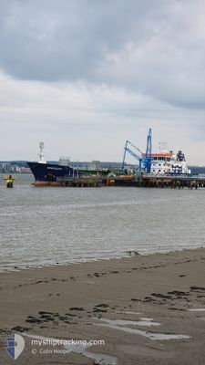
Oil/Chemical Tanker
Current Trip
ST. ANDREWS BAY
| Time Travelled | 2 days |
|---|---|
| Remaining Time | --- |
| Distance Travelled | 62.67 nm |
| Remaining Distance | --- |
| AVG Speed | 6.9 Knots |
| MAX Speed | 10.3 Knots |
| AVG Wind | 15.6 knots |
| MAX Wind | 22.8 knots |
| MIN Temp | 7.9°C / 46.22°F |
| MAX Temp | 10.4°C / 50.72°F |
| Dybgang | 5 m |
| Position Modtaget | Nu |
Current Position
| Longitude | -2.72078° |
|---|---|
| Latitude | 56.37358° |
| Status | At anchor |
| Fart | 0.2 Knots |
| Kurs | 34° |
| Område | North Sea |
| Station | T-AIS |
| Position Modtaget | Nu |
Info
Information
The current position of SPECIALITY is in North Sea with coordinates 56.37358° / -2.72078° as reported on 2024-05-01 16:41 by AIS to our vessel tracker app. The vessel's current speed is 0.2 Knots
The vessel SPECIALITY (IMO: 9285184, MMSI: 235098053) is a Oil/Chemical Tanker that was built in 2006 ( 18 år gamle ). It's sailing under the flag of [GB] United Kingdom.
In this page you can find informations about the vessels current position, last detected port calls, and current voyage information. If the vessels is not in coverage by AIS you will find the latest position.
The current position of SPECIALITY is detected by our AIS receivers and we are not responsible for the reliability of the data. The last position was recorded while the vessel was in Coverage by the Ais receivers of our vessel tracking app.
The current draught of SPECIALITY as reported by AIS is 5 meters
Weather
| Temperature | 8.8°C / 47.84°F |
|---|---|
| Wind Speed | 10 knots |
| Direction | 55° NE |
| Pressure | 1013.6 hPa |
| Humidity | 98.3 % |
| Cloud Coverage | 99 % |
Featured Company
Last Port Calls
| Port | Arrival | Departure | Time In Port |
|---|---|---|---|
| 2024-04-28 22:38 | 2024-04-29 11:14 | 12 h | |
| 2024-04-28 04:33 | 2024-04-28 16:26 | 11 h | |
| 2024-04-26 02:41 | 2024-04-26 18:26 | 15 h | |
| 2024-04-23 19:46 | 2024-04-24 06:11 | 10 h | |
| 2024-04-23 01:47 | 2024-04-23 13:29 | 11 h | |
| 2024-04-20 23:49 | 2024-04-21 16:22 | 16 h | |
| 2024-04-18 23:26 | 2024-04-19 21:33 | 22 h | |
| 2024-04-13 16:37 | 2024-04-14 15:05 | 22 h | |
| 2024-04-11 13:32 | 2024-04-12 13:24 | 23 h | |
| 2024-04-08 13:48 | 2024-04-09 10:16 | 20 h |
Last Trips
| Origin | Departure | Destination | Arrival | Distance | |
|---|---|---|---|---|---|
| 2024-04-28 17:26 | 2024-04-28 23:38 | 42.96 nm | |||
| 2024-04-26 19:26 | 2024-04-28 05:33 | 240.94 nm | |||
| 2024-04-24 07:11 | 2024-04-26 03:41 | 295.95 nm | |||
| 2024-04-23 14:29 | 2024-04-23 20:46 | 57.70 nm | |||
| 2024-04-21 17:22 | 2024-04-23 02:47 | 239.42 nm | |||
| 2024-04-19 22:33 | 2024-04-21 00:49 | 132.59 nm | |||
| 2024-04-14 17:05 | 2024-04-19 00:26 | 477.87 nm | |||
| 2024-04-12 14:24 | 2024-04-13 18:37 | 284.78 nm | |||
| 2024-04-09 11:16 | 2024-04-11 14:32 | 188.32 nm | |||
| 2024-04-05 11:51 | 2024-04-08 14:48 | 337.11 nm |
Events
| Tid | Hændelsen | Detaljer | Position / Dest | Info |
|---|---|---|---|---|
| 2024-05-01 00:02 | ETA er ændret | 2025/04/29 20:00 2024/04/29 20:00 |
56.37403 / -2.72075
ST. ANDREWS BAY
|
Fart: 0.5 kn Kurs: 148° |
| 2024-04-29 19:59 | ETA er ændret | 2024/04/29 20:00 2024/04/29 19:00 |
56.37465 / -2.71882
ST. ANDREWS BAY
|
Fart: 0.2 kn Kurs: 153° |
| 2024-04-29 19:42 | Status er ændret | At anchor Under way using engine |
56.37301 / -2.71909
ST. ANDREWS BAY
|
Fart: 1.1 kn Kurs: 241° |
| 2024-04-29 19:38 | STOP Sejllads | 7.2 nm, South East of TAYPORT |
56.37118 / -2.71810
ST. ANDREWS BAY
|
Fart: 0.1 kn Kurs: 167° |
| 2024-04-29 17:58 | Status er ændret | Under way using engine Default |
56.47251 / -2.44171
ST. ANDREWS BAY
|
Fart: 7.3 kn Kurs: 231° |
| 2024-04-29 17:41 | Indenfor Dækning |
56.47149 / -2.44407
North Sea
ST. ANDREWS BAY
|
Fart: 7.4 kn Kurs: 231.3° |
|
| 2024-04-29 13:49 | Status er ændret | Default Under way using engine |
56.87141 / -2.09563
ST. ANDREWS BAY
|
Fart: 6.7 kn Kurs: 193.5° |
| 2024-04-29 13:34 | Udenfor Dækning |
56.89957 / -2.08497
North Sea
ST. ANDREWS BAY
|
Fart: 6.7 kn Kurs: 193.5° |
|
| 2024-04-29 13:31 | Status er ændret | Under way using engine Default |
56.90503 / -2.08300
ST. ANDREWS BAY
|
Fart: 6.9 kn Kurs: 189° |
| 2024-04-29 13:27 | Status er ændret | Default Under way using engine |
56.91341 / -2.08021
ST. ANDREWS BAY
|
Fart: 6.8 kn Kurs: 190.5° |