

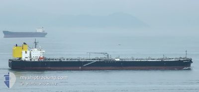
SOUTHERN LEADER
Tanker

Current Trip
| Time Travelled | 46 days |
|---|---|
| Remaining Time | --- |
| Distance Travelled | 8459.42 nm |
| Remaining Distance | --- |
| AVG Speed | 10.3 Knots |
| MAX Speed | 15.8 Knots |
| AVG Wind | 12.9 knots |
| MAX Wind | 36.3 knots |
| MIN Temp | 4.2°C / 39.56°F |
| MAX Temp | 31.5°C / 88.7°F |
| Dybgang | 12.9 m |
| Position Modtaget | 17 d siden |
Current Position
| Longitude | --- |
|---|---|
| Latitude | --- |
| Status | Under way using engine |
| Fart | 12 Knots |
| Kurs | 29.4° |
| Område | Indian Ocean |
| Station | T-AIS |
| Position Modtaget | 17 d siden |
Information
The current position of SOUTHERN LEADER is in Indian Ocean with coordinates -18.56933° / 117.81530° as reported on 2025-02-01 10:41 by AIS to our vessel tracker app. The vessel's current speed is 12 Knots and is heading at the port of KIKUMA. The estimated time of arrival as calculated by MyShipTracking vessel tracking app is 2025-02-13 03:00 LT
The vessel SOUTHERN LEADER (IMO: 9783930, MMSI: 356178000) is a Tanker It's sailing under the flag of [PA] Panama.
In this page you can find informations about the vessels current position, last detected port calls, and current voyage information. If the vessels is not in coverage by AIS you will find the latest position.
The current position of SOUTHERN LEADER is detected by our AIS receivers and we are not responsible for the reliability of the data. The last position was recorded while the vessel was in Coverage by the Ais receivers of our vessel tracking app.
The current draught of SOUTHERN LEADER as reported by AIS is 12.9 meters
Weather
| Temperature | 13.3°C / 55.94°F |
|---|---|
| Wind Speed | 11 knots |
| Direction | 21° NNE |
| Pressure | 1024.6 hPa |
| Humidity | 60.2 % |
| Cloud Coverage | 9 % |


Featured Company
Last Port Calls
| Port | Arrival | Departure | Time In Port |
|---|---|---|---|
| 2025-01-01 00:32 | 2025-01-03 07:59 | 2 d | |
| 2024-12-06 00:53 | 2024-12-06 15:33 | 14 h |
Most Visited Ports (Last year)
| Port | Arrivals | |
|---|---|---|
| 8 | ||
| 3 | ||
| 3 | ||
| 1 | ||
| 1 | ||
| 1 |
Last Trips
| Origin | Departure | Destination | Arrival | Distance | |
|---|---|---|---|---|---|
| 2024-12-06 22:33 | 2025-01-01 08:32 | 2978.10 nm | |||
| 2024-11-22 06:49 | 2024-12-06 07:53 | 1174.80 nm |
Events
| Tid | Hændelsen | Detaljer | Position / Dest | Info |
|---|---|---|---|---|
| 2025-02-18 05:21 | STOP Sejllads |
26.21766 / 127.79227
JP KIK
|
Fart: 0.1 kn Kurs: 113° |
|
| 2025-02-18 03:57 | START Sejllads |
26.22055 / 127.86059
JP KIK
|
Fart: 3.2 kn Kurs: 274° |
|
| 2025-02-17 06:33 | STOP Sejllads |
26.21821 / 127.86274
JP KIK
|
Fart: 0.3 kn Kurs: 9° |
|
| 2025-02-14 23:17 | START Sejllads | 1.36 nm, North East of KIKUMA |
34.05558 / 132.84975
JP KIK
|
Fart: 3.7 kn Kurs: 265° |
| 2025-02-14 02:21 | STOP Sejllads | 1.41 nm, North East of KIKUMA |
34.05442 / 132.85352
JP KIK
|
Fart: 0.1 kn Kurs: 217° |
| 2025-02-14 01:33 | START Sejllads | 3.01 nm, North East of KIKUMA |
34.08061 / 132.86377
JP KIK
|
Fart: 3.3 kn Kurs: 210° |
| 2025-02-13 19:09 | STOP Sejllads | 2.82 nm, North East of KIKUMA |
34.07955 / 132.85770
JP KIK
|
Fart: 0.1 kn Kurs: 46° |