
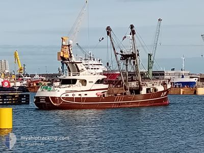
SOPHIE Z39
Fishing
Current Trip
FISHING GROUNDS
| Time Travelled | 4 days |
|---|---|
| Remaining Time | --- |
| Distance Travelled | 216.29 nm |
| Remaining Distance | --- |
| AVG Speed | 4.5 Knots |
| MAX Speed | 9.3 Knots |
| AVG Wind | 14.1 knots |
| MAX Wind | 27.7 knots |
| MIN Temp | 7.6°C / 45.68°F |
| MAX Temp | 11.1°C / 51.98°F |
| Dybgang | 0 m |
| Position Modtaget | 5 h, 46 m siden |
Current Position
| Longitude | -5.41645° |
|---|---|
| Latitude | 50.96820° |
| Status | Engaged in Fishing |
| Fart | 4.6 Knots |
| Kurs | 50° |
| Område | Celtic Sea |
| Station | T-AIS |
| Position Modtaget | 5 h, 46 m siden |
Info
Information
The current position of SOPHIE Z39 is in Celtic Sea with coordinates 50.96820° / -5.41645° as reported on 2024-04-29 07:49 by AIS to our vessel tracker app. The vessel's current speed is 4.6 Knots
The vessel SOPHIE Z39 (IMO: 9899624, MMSI: 205248000) is a Fishing It's sailing under the flag of [BE] Belgium.
In this page you can find informations about the vessels current position, last detected port calls, and current voyage information. If the vessels is not in coverage by AIS you will find the latest position.
The current position of SOPHIE Z39 is detected by our AIS receivers and we are not responsible for the reliability of the data. The last position was recorded while the vessel was in Coverage by the Ais receivers of our vessel tracking app.
Weather
| Temperature | 11°C / 51.8°F |
|---|---|
| Wind Speed | 27 knots |
| Direction | 194° SSW |
| Pressure | 1007.9 hPa |
| Humidity | 86 % |
| Cloud Coverage | 100 % |
Featured Company
Last Port Calls
| Port | Arrival | Departure | Time In Port |
|---|---|---|---|
| 2024-04-24 08:45 | 2024-04-24 17:42 | 8 h | |
| 2024-04-17 09:15 | 2024-04-17 15:00 | 5 h | |
| 2024-04-06 10:48 | 2024-04-08 09:42 | 1 d | |
| 2024-03-26 19:57 | 2024-03-30 12:05 | 3 d | |
| 2024-02-29 13:49 | 2024-03-04 09:32 | 3 d | |
| 2024-02-21 11:07 | 2024-02-21 17:53 | 6 h | |
| 2024-02-07 00:55 | 2024-02-15 12:47 | 8 d |
Most Visited Ports (Last year)
| Port | Arrivals | |
|---|---|---|
| 9 | ||
| 7 | ||
| 5 | ||
| 5 | ||
| 1 | ||
| 1 |
Last Trips
| Origin | Departure | Destination | Arrival | Distance | |
|---|---|---|---|---|---|
| 2024-04-17 16:00 | 2024-04-24 09:45 | 514.42 nm | |||
| 2024-04-08 11:42 | 2024-04-17 10:15 | 903.40 nm | |||
| 2024-03-30 13:05 | 2024-04-06 12:48 | 692.82 nm | |||
| 2024-03-04 10:32 | 2024-03-26 20:57 | 1903.48 nm | |||
| 2024-02-21 18:53 | 2024-02-29 14:49 | 797.60 nm | |||
| 2024-02-15 13:47 | 2024-02-21 12:07 | 680.48 nm | |||
| 2024-01-28 17:02 | 2024-02-07 01:55 | 1008.87 nm |
Events
| Tid | Hændelsen | Detaljer | Position / Dest | Info |
|---|---|---|---|---|
| 2024-04-29 07:49 | Udenfor Dækning |
50.96820 / -5.41645
Celtic Sea
|
Fart: 4.6 kn Kurs: 46° |
|
| 2024-04-29 05:24 | Ændre havområde | United Kingdom part of the Celtic Sea Irish part of the Celtic Sea |
50.89642 / -5.65625
Celtic Sea
|
Fart: 4.6 kn Kurs: 86° |
| 2024-04-29 05:24 | Indenfor Dækning |
50.89642 / -5.65625
Celtic Sea
|
Fart: 4.6 kn Kurs: 86° |
|
| 2024-04-26 11:16 | Udenfor Dækning |
51.48193 / -7.28569
Celtic Sea
|
Fart: 4.1 kn Kurs: 78° |
|
| 2024-04-26 05:50 | START Sejllads |
51.41146 / -7.75748
FISHING GROUNDS
|
Fart: 3.5 kn Kurs: 151° |
|
| 2024-04-26 05:46 | STOP Sejllads |
51.41293 / -7.75949
FISHING GROUNDS
|
Fart: 0.3 kn Kurs: 159° |
|
| 2024-04-26 02:46 | START Sejllads |
51.45490 / -7.66946
FISHING GROUNDS
|
Fart: 3.9 kn Kurs: 140° |
|
| 2024-04-26 02:15 | STOP Sejllads |
51.45526 / -7.67246
FISHING GROUNDS
|
Fart: 0.3 kn Kurs: 60° |
|
| 2024-04-25 22:34 | Indenfor Dækning |
51.47342 / -7.68694
Celtic Sea
|
Fart: 2.5 kn Kurs: 157° |
|
| 2024-04-25 07:55 | Udenfor Dækning |
51.33521 / -7.89405
Celtic Sea
|
Fart: 4.3 kn Kurs: 208° |