
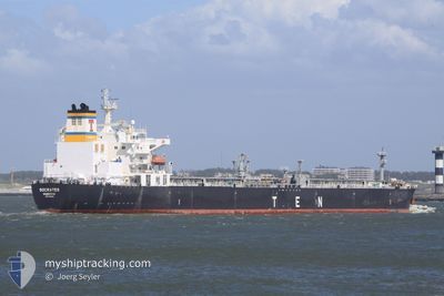
SOCRATES
Crude Oil Tanker
Current Trip
USLGB>MXSCX
| Time Travelled | 16 h, 19 mins |
|---|---|
| Remaining Time | --- |
| Distance Travelled | 1.44 nm |
| Remaining Distance | --- |
| AVG Speed | 3.7 Knots |
| MAX Speed | 3.7 Knots |
| AVG Wind | 3.2 knots |
| MAX Wind | 8.8 knots |
| MIN Temp | 26.6°C / 79.88°F |
| MAX Temp | 28.1°C / 82.58°F |
| Dybgang | 8 m |
| Position Modtaget | 26 d siden |
Current Position
| Longitude | --- |
|---|---|
| Latitude | --- |
| Status | Under way using engine |
| Fart | 9.6 Knots |
| Kurs | 172.2° |
| Område | North Pacific Ocean |
| Station | T-AIS |
| Position Modtaget | 26 d siden |
Info
Information
The current position of SOCRATES is in North Pacific Ocean with coordinates 30.99853° / -117.57577° as reported on 2024-09-25 07:14 by AIS to our vessel tracker app. The vessel's current speed is 9.6 Knots
The vessel SOCRATES (IMO: 9390692, MMSI: 636013615) is a Crude Oil Tanker that was built in 2008 ( 16 år gamle ). It's sailing under the flag of [LR] Liberia.
In this page you can find informations about the vessels current position, last detected port calls, and current voyage information. If the vessels is not in coverage by AIS you will find the latest position.
The current position of SOCRATES is detected by our AIS receivers and we are not responsible for the reliability of the data. The last position was recorded while the vessel was in Coverage by the Ais receivers of our vessel tracking app.
The current draught of SOCRATES as reported by AIS is 8 meters
Weather
| Temperature | 26.6°C / 79.88°F |
|---|---|
| Wind Speed | 2 knots |
| Direction | 293° WNW |
| Pressure | 1008.1 hPa |
| Humidity | 81.7 % |
| Cloud Coverage | 80 % |
Featured Company
Last Port Calls
| Port | Arrival | Departure | Time In Port |
|---|---|---|---|
| 2024-10-17 10:11 | 2024-10-20 16:03 | 3 d | |
| 2024-10-09 00:47 | 2024-10-11 22:43 | 2 d | |
| 2024-09-20 08:35 | 2024-09-20 17:35 | 9 h | |
| 2024-09-10 17:43 | 2024-09-12 10:19 | 1 d | |
| 2024-09-03 10:03 | 2024-09-05 16:19 | 2 d | |
| 2024-08-09 03:24 | 2024-08-18 15:37 | 9 d |
Most Visited Ports (Last year)
| Port | Arrivals | |
|---|---|---|
| 4 | ||
| 3 | ||
| 3 | ||
| 2 | ||
| 2 | ||
| 1 |
Last Trips
| Origin | Departure | Destination | Arrival | Distance | |
|---|---|---|---|---|---|
| 2024-10-11 17:43 | 2024-10-17 05:11 | 1226.96 nm | |||
| 2024-09-20 10:35 | 2024-10-08 19:47 | 2220.28 nm | |||
| 2024-09-12 05:19 | 2024-09-20 01:35 | 1997.77 nm | |||
| 2024-09-05 11:19 | 2024-09-10 12:43 | 517.35 nm | |||
| 2024-08-18 08:37 | 2024-09-03 05:03 | 1590.99 nm | |||
| 2024-07-05 07:25 | 2024-08-08 20:24 | 3413.79 nm |
Events
| Tid | Hændelsen | Detaljer | Position / Dest | Info |
|---|---|---|---|---|
| 2024-10-20 16:27 | STOP Sejllads | 0.81 nm, West of TABOGUILLA |
8.81051 / -79.53487
USLGB>MXSCX
|
Fart: 0.3 kn Kurs: 316° |
| 2024-10-20 16:07 | START Sejllads | 0.28 nm, North West of TABOGUILLA |
8.81062 / -79.52553
USLGB>MXSCX
|
Fart: 3.2 kn Kurs: 297° |
| 2024-10-20 16:03 | Afsejlet fra sidste havn |
|
8.81062 / -79.52553
USLGB>MXSCX
|
Fart: Kurs: 41° |
| 2024-10-17 10:11 | STOP Sejllads |
8.80707 / -79.52408
[PA] TABOGUILLA
|
Fart: Kurs: 41° |
|
| 2024-10-17 10:11 | Skibe i havn |
|
8.80707 / -79.52408
[PA] TABOGUILLA
|
Fart: 2.1 kn Kurs: 46° |
| 2024-10-17 08:55 | START Sejllads | 2.12 nm, East of TABOGUILLA |
8.81808 / -79.48692
USLGB>MXSCX
|
Fart: 5.6 kn Kurs: 192° |
| 2024-10-16 04:43 | STOP Sejllads | 2.2 nm, North East of TABOGUILLA |
8.82360 / -79.48745
USLGB>MXSCX
|
Fart: 0.2 kn Kurs: 303° |
| 2024-10-11 22:43 | START Sejllads | 0.8 nm, South West of SALINA CRUZ |
16.14308 / -95.20302
USLGB>MXSCX
|
Fart: 6.6 kn Kurs: 141° |
| 2024-10-11 22:43 | Afsejlet fra sidste havn |
|
16.14308 / -95.20302
USLGB>MXSCX
|
Fart: 2.9 kn Kurs: 175° |