
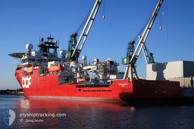
SKANDI ACHIEVER
Offshore Supply Ship
Current Trip
| Time Travelled | 11 h, 49 mins |
|---|---|
| Remaining Time | --- |
| Distance Travelled | 3.64 nm |
| Remaining Distance | --- |
| AVG Speed | 7.3 Knots |
| MAX Speed | 10.2 Knots |
| AVG Wind | 7.2 knots |
| MAX Wind | 7.4 knots |
| MIN Temp | 21.9°C / 71.42°F |
| MAX Temp | 22°C / 71.6°F |
| Dybgang | 6.4 m |
| Position Modtaget | 11 h, 19 m siden |
Current Position
| Longitude | -40.94120° |
|---|---|
| Latitude | -21.83645° |
| Status | Moored |
| Fart | 10.2 Knots |
| Kurs | 105.9° |
| Område | South Atlantic Ocean |
| Station | T-AIS |
| Position Modtaget | 11 h, 19 m siden |
Info
Information
The current position of SKANDI ACHIEVER is in South Atlantic Ocean with coordinates -21.83645° / -40.94120° as reported on 2024-07-01 18:37 by AIS to our vessel tracker app. The vessel's current speed is 10.2 Knots
The vessel SKANDI ACHIEVER (IMO: 9413810, MMSI: 710033130) is a Offshore Supply Ship that was built in 2007 ( 17 år gamle ). It's sailing under the flag of [BR] Brazil.
In this page you can find informations about the vessels current position, last detected port calls, and current voyage information. If the vessels is not in coverage by AIS you will find the latest position.
The current position of SKANDI ACHIEVER is detected by our AIS receivers and we are not responsible for the reliability of the data. The last position was recorded while the vessel was in Coverage by the Ais receivers of our vessel tracking app.
The current draught of SKANDI ACHIEVER as reported by AIS is 6.4 meters
Weather
| Temperature | 22°C / 71.6°F |
|---|---|
| Wind Speed | 7 knots |
| Direction | 127° SE |
| Pressure | 1020.5 hPa |
| Humidity | 77.6 % |
| Cloud Coverage | 96 % |
Featured Company
Last Port Calls
| Port | Arrival | Departure | Time In Port |
|---|---|---|---|
| 2024-06-12 14:20 | 2024-07-01 18:08 | 19 d | |
| 2024-05-29 09:46 | 2024-06-12 09:09 | 13 d | |
| 2024-05-29 08:33 |
Most Visited Ports (Last year)
| Port | Arrivals | |
|---|---|---|
| 11 | ||
| 6 | ||
| 1 |
Last Trips
| Origin | Departure | Destination | Arrival | Distance | |
|---|---|---|---|---|---|
| 2024-06-12 06:09 | 2024-06-12 11:20 | 6.60 nm | |||
| 2024-05-29 05:33 | 2024-05-29 06:46 | 6.45 nm |
Events
| Tid | Hændelsen | Detaljer | Position / Dest | Info |
|---|---|---|---|---|
| 2024-07-01 18:37 | Udenfor Dækning |
-21.83645 / -40.94120
South Atlantic Ocean
|
Fart: 10.2 kn Kurs: 105.9° |
|
| 2024-07-01 18:08 | Afsejlet fra sidste havn |
|
-21.84538 / -40.99822
BACIA DE CAMPOS
|
Fart: 7.5 kn Kurs: 57° |
| 2024-07-01 17:55 | START Sejllads |
-21.85874 / -41.01875
[BR] PORTO DO ACU
|
Fart: 4.3 kn Kurs: 328° |
|
| 2024-07-01 13:44 | Dybgangen er ændret | 6.4 6.2 |
-21.86063 / -41.01882
[BR] PORTO DO ACU
|
Fart: Kurs: 150° |
| 2024-07-01 13:44 | Destination er ændret | BACIA DE CAMPOS CAMPOS |
-21.86063 / -41.01882
[BR] PORTO DO ACU
|
Fart: Kurs: 150° |
| 2024-07-01 13:44 | ETA er ændret | 2025/06/17 16:50 2025/05/29 01:30 |
-21.86063 / -41.01882
[BR] PORTO DO ACU
|
Fart: Kurs: 150° |
| 2024-07-01 13:35 | Indenfor Dækning |
-21.86063 / -41.01883
South Atlantic Ocean
[BR] PORTO DO ACU
|
Fart: Kurs: 228.2° |
|
| 2024-07-01 11:22 | Udenfor Dækning |
-21.86062 / -41.01884
South Atlantic Ocean
[BR] PORTO DO ACU
|
Fart: Kurs: 228.2° |
|
| 2024-07-01 11:16 | Indenfor Dækning |
-21.86063 / -41.01883
South Atlantic Ocean
[BR] PORTO DO ACU
|
Fart: Kurs: 228.2° |