
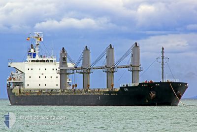
SIBI
Bulk Carrier
Current Trip
GRISIK
| Time Travelled | 42 days |
|---|---|
| Remaining Time | --- |
| Distance Travelled | 1799.34 nm |
| Remaining Distance | --- |
| AVG Speed | 8.1 Knots |
| MAX Speed | 13.5 Knots |
| AVG Wind | 8.1 knots |
| MAX Wind | 23 knots |
| MIN Temp | 24.8°C / 76.64°F |
| MAX Temp | 33.2°C / 91.76°F |
| Dybgang | 4.6 m |
| Position Modtaget | 1 d siden |
Current Position
| Longitude | 104.42677° |
|---|---|
| Latitude | 1.37155° |
| Status | Under way using engine |
| Fart | 10.7 Knots |
| Kurs | 47° |
| Område | South China Sea |
| Station | T-AIS |
| Position Modtaget | 1 d siden |
Info
Information
The current position of SIBI is in South China Sea with coordinates 1.37155° / 104.42677° as reported on 2024-05-11 07:27 by AIS to our vessel tracker app. The vessel's current speed is 10.7 Knots
The vessel SIBI (IMO: 9519224, MMSI: 463043101) is a Bulk Carrier that was built in 2009 ( 15 år gamle ). It's sailing under the flag of [PK] Pakistan.
In this page you can find informations about the vessels current position, last detected port calls, and current voyage information. If the vessels is not in coverage by AIS you will find the latest position.
The current position of SIBI is detected by our AIS receivers and we are not responsible for the reliability of the data. The last position was recorded while the vessel was in Coverage by the Ais receivers of our vessel tracking app.
The current draught of SIBI as reported by AIS is 4.6 meters
Weather
| Temperature | 29.1°C / 84.38°F |
|---|---|
| Wind Speed | 12 knots |
| Direction | 107° ESE |
| Pressure | 1009.1 hPa |
| Humidity | 75.8 % |
| Cloud Coverage | 92 % |
Featured Company
Most Visited Ports (Last year)
| Port | Arrivals | |
|---|---|---|
| 2 | ||
| 2 | ||
| 1 | ||
| 1 | ||
| 1 | ||
| 1 |
Events
| Tid | Hændelsen | Detaljer | Position / Dest | Info |
|---|---|---|---|---|
| 2024-05-11 07:32 | Status er ændret | Default Under way using engine |
1.38310 / 104.43951
GRISIK
|
Fart: 10.7 kn Kurs: 47° |
| 2024-05-11 07:27 | Udenfor Dækning |
1.37155 / 104.42677
South China Sea
GRISIK
|
Fart: 10.7 kn Kurs: 47° |
|
| 2024-05-11 07:14 | Status er ændret | Under way using engine Default |
1.34640 / 104.39915
GRISIK
|
Fart: 10 kn Kurs: 50° |
| 2024-05-11 07:12 | Status er ændret | Default Under way using engine |
1.34360 / 104.39584
GRISIK
|
Fart: 10.1 kn Kurs: 49° |
| 2024-05-11 06:56 | Ændre havområde | Malaysian part of the South China Sea Malaysian part of the Singapore Strait |
1.31335 / 104.36023
South China Sea
GRISIK
|
Fart: 10 kn Kurs: 49° |
| 2024-05-11 05:40 | Ændre havområde | Malaysian part of the Singapore Strait Indonesian part of the Singapore Strait |
1.25808 / 104.17283
Singapore Strait
GRISIK
|
Fart: 9.7 kn Kurs: 80° |
| 2024-05-11 04:14 | Ændre havområde | Indonesian part of the Singapore Strait Singaporean part of the Singapore Strait |
1.23288 / 103.94567
Singapore Strait
GRISIK
|
Fart: 9.7 kn Kurs: 80° |
| 2024-05-11 03:40 | START Sejllads | 1.53 nm, East of SINGAPORE |
1.25967 / 103.87988
GRISIK
|
Fart: 4.8 kn Kurs: 108° |
| 2024-05-11 03:37 | Dybgangen er ændret | 4.6 4.8 |
1.25850 / 103.87680
GRISIK
|
Fart: 2.8 kn Kurs: 55° |
| 2024-05-11 03:35 | Status er ændret | Under way using engine At anchor |
1.25768 / 103.87615
GRISIK
|
Fart: 1.2 kn Kurs: 36° |