
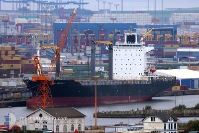
MSC SHEFFIELD III
Container Ship
Current Trip
| Trip Time | 11 days |
|---|---|
| Trip Distance | 1550.59 nm |
| AVG Speed | 10.8 Knots |
| MAX Speed | 17.1 Knots |
| Dybgang | 11.2 m |
| AVG Wind | 8.3 knots |
| MAX Wind | 17.8 knots |
| MIN Temp | 13.5°C / 56.3°F |
| MAX Temp | 26.3°C / 79.34°F |
| Position Modtaget | 5 d siden |
Current Position
| Longitude | 31.05171° |
|---|---|
| Latitude | -29.87548° |
| Status | Under way using engine |
| Fart | 6.3 Knots |
| Kurs | 239° |
| Område | Indian Ocean |
| Station | T-AIS |
| Position Modtaget | 5 d siden |
Info
Information
The current position of MSC SHEFFIELD III is in Indian Ocean with coordinates -29.87548° / 31.05171° as reported on 2024-04-28 01:30 by AIS to our vessel tracker app. The vessel's current speed is 6.3 Knots and is currently inside the port of DURBAN.
The vessel MSC SHEFFIELD III (IMO: 9275024, MMSI: 636017929) is a Container Ship that was built in 2003 ( 21 år gamle ). It's sailing under the flag of [LR] Liberia.
In this page you can find informations about the vessels current position, last detected port calls, and current voyage information. If the vessels is not in coverage by AIS you will find the latest position.
The current position of MSC SHEFFIELD III is detected by our AIS receivers and we are not responsible for the reliability of the data. The last position was recorded while the vessel was in Coverage by the Ais receivers of our vessel tracking app.
The current draught of MSC SHEFFIELD III as reported by AIS is 11.2 meters
Weather
| Temperature | 18.9°C / 66.02°F |
|---|---|
| Wind Speed | 4 knots |
| Direction | 357° N |
| Pressure | 1021.8 hPa |
| Humidity | 90.9 % |
| Cloud Coverage | --- |
Featured Company
Last Trips
| Origin | Departure | Destination | Arrival | Distance | |
|---|---|---|---|---|---|
| 2024-04-16 08:54 | 2024-04-28 03:27 | 1550.59 nm | |||
| 2024-03-30 14:55 | 2024-04-13 09:29 | 1552.13 nm | |||
| 2024-03-22 12:25 | 2024-03-30 00:02 | 1324.51 nm | |||
| 2024-03-14 03:15 | 2024-03-18 09:25 | 454.05 nm | |||
| 2024-02-28 08:55 | 2024-03-11 10:16 | 2098.31 nm |
Events
| Tid | Hændelsen | Detaljer | Position / Dest | Info |
|---|---|---|---|---|
| 2024-04-28 01:48 | STOP Sejllads |
-29.87464 / 31.04079
[ZA] DURBAN
|
Fart: 0.2 kn Kurs: 158° |
|
| 2024-04-28 01:35 | Status er ændret | Default Under way using engine |
-29.87704 / 31.04490
[ZA] DURBAN
|
Fart: 6.3 kn Kurs: 239° |
| 2024-04-28 01:30 | Status er ændret | Under way using engine Default |
-29.87548 / 31.05171
[ZA] DURBAN
|
Fart: 7.7 kn Kurs: 214° |
| 2024-04-28 01:30 | Udenfor Dækning |
-29.87548 / 31.05171
Indian Ocean
[ZA] DURBAN
|
Fart: 6.3 kn Kurs: 223.9° |
|
| 2024-04-28 01:27 | Status er ændret | Default Under way using engine |
-29.87063 / 31.05584
[ZA] DURBAN
|
Fart: 9.5 kn Kurs: 218.5° |
| 2024-04-28 01:27 | Skibe i havn |
|
-29.87063 / 31.05584
[ZA] DURBAN
|
Fart: 9.5 kn Kurs: 218.5° |
| 2024-04-28 01:22 | Status er ændret | Under way using engine Default |
-29.86018 / 31.06521
DURBAN
|
Fart: 9.8 kn Kurs: 216° |
| 2024-04-28 01:16 | Status er ændret | Default Under way using engine |
-29.84581 / 31.07688
DURBAN
|
Fart: 8.8 kn Kurs: 206.2° |
| 2024-04-28 00:27 | START Sejllads | 7.08 nm, North East of DURBAN |
-29.78806 / 31.11290
DURBAN
|
Fart: 3.5 kn Kurs: 195° |
| 2024-04-27 23:47 | Status er ændret | Under way using engine At anchor |
-29.78356 / 31.11140
DURBAN
|
Fart: 0.1 kn Kurs: 125° |