
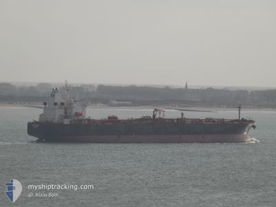
SHAHRAZAD
Crude Oil Tanker
Current Trip
| Time Travelled | 34 days |
|---|---|
| Remaining Time | 9 h, 19 mins |
| Distance Travelled | 5392.74 nm |
| Remaining Distance | 120.65 nm |
| AVG Speed | 12.4 Knots |
| MAX Speed | 12.4 Knots |
| AVG Wind | 9.4 knots |
| MAX Wind | 27 knots |
| MIN Temp | 11.9°C / 53.42°F |
| MAX Temp | 28.7°C / 83.66°F |
| Dybgang | 8.5 m |
| Position Modtaget | Nu |
Current Position
| Longitude | 7.55388° |
|---|---|
| Latitude | 57.12095° |
| Status | Under way using engine |
| Fart | 12.6 Knots |
| Kurs | 32° |
| Område | North Sea |
| Station | T-AIS |
| Position Modtaget | Nu |
Info
Information
The current position of SHAHRAZAD is in North Sea with coordinates 57.12095° / 7.55388° as reported on 2024-05-18 15:33 by AIS to our vessel tracker app. The vessel's current speed is 12.6 Knots and is heading at the port of SKAGEN. The estimated time of arrival as calculated by MyShipTracking vessel tracking app is 2024-05-19 02:53 LT
The vessel SHAHRAZAD (IMO: 9389863, MMSI: 636023086) is a Crude Oil Tanker that was built in 2009 ( 15 år gamle ). It's sailing under the flag of [LR] Liberia.
In this page you can find informations about the vessels current position, last detected port calls, and current voyage information. If the vessels is not in coverage by AIS you will find the latest position.
The current position of SHAHRAZAD is detected by our AIS receivers and we are not responsible for the reliability of the data. The last position was recorded while the vessel was in Coverage by the Ais receivers of our vessel tracking app.
The current draught of SHAHRAZAD as reported by AIS is 8.5 meters
Weather
| Temperature | 12.6°C / 54.68°F |
|---|---|
| Wind Speed | 11 knots |
| Direction | 55° NE |
| Pressure | 1015.2 hPa |
| Humidity | 81.5 % |
| Cloud Coverage | 4 % |
Featured Company
Events
| Tid | Hændelsen | Detaljer | Position / Dest | Info |
|---|---|---|---|---|
| 2024-05-18 06:12 | Ændre havområde | Danish part of the North Sea German part of the North Sea |
55.50507 / 5.81372
North Sea
SKAGEN
|
Fart: 12.3 kn Kurs: 26° |
| 2024-05-18 02:32 | Status er ændret | Under way using engine Default |
54.82323 / 5.23155
SKAGEN
|
Fart: 12.6 kn Kurs: 26° |
| 2024-05-18 01:38 | Status er ændret | Default Under way using engine |
54.65593 / 5.09120
SKAGEN
|
Fart: 12.5 kn Kurs: 25° |
| 2024-05-18 01:21 | Fundet i havområde | German part of the North Sea |
54.60173 / 5.04523
North Sea
SKAGEN
|
Fart: 12.6 kn Kurs: 25° |
| 2024-05-18 00:54 | Status er ændret | Under way using engine Default |
54.51852 / 4.97397
SKAGEN
|
Fart: 12.5 kn Kurs: 25° |
| 2024-05-18 00:37 | Indenfor Dækning |
54.52058 / 4.97575
North Sea
SKAGEN
|
Fart: 12.6 kn Kurs: 26° |
|
| 2024-05-17 23:11 | Status er ændret | Default Under way using engine |
54.19132 / 4.72853
SKAGEN
|
Fart: 12.6 kn Kurs: 17° |
| 2024-05-17 23:04 | Status er ændret | Under way using engine Default |
54.16795 / 4.71612
SKAGEN
|
Fart: 12.6 kn Kurs: 16° |
| 2024-05-17 23:04 | Udenfor Dækning |
54.16795 / 4.71612
North Sea
SKAGEN
|
Fart: 12.6 kn Kurs: 17° |
|
| 2024-05-17 22:24 | Status er ændret | Default Under way using engine |
54.03361 / 4.64957
SKAGEN
|
Fart: 12.5 kn Kurs: 16° |