
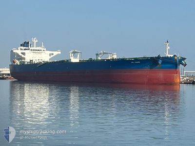
SFL FRASER
Tanker
Current Trip
GACLZ
| Time Travelled | 13 days |
|---|---|
| Remaining Time | --- |
| Distance Travelled | 3647.46 nm |
| Remaining Distance | --- |
| AVG Speed | 11.4 Knots |
| MAX Speed | 14.7 Knots |
| AVG Wind | 14 knots |
| MAX Wind | 26 knots |
| MIN Temp | 19°C / 66.2°F |
| MAX Temp | 27.8°C / 82.04°F |
| Dybgang | 9.5 m |
| Position Modtaget | 5 d siden |
Current Position
| Longitude | --- |
|---|---|
| Latitude | --- |
| Status | Under way using engine |
| Fart | 11.9 Knots |
| Kurs | 145.3° |
| Område | South Atlantic Ocean |
| Station | T-AIS |
| Position Modtaget | 5 d siden |
Info
Information
The current position of SFL FRASER is in South Atlantic Ocean with coordinates -34.85887° / 18.11221° as reported on 2025-02-24 13:52 by AIS to our vessel tracker app. The vessel's current speed is 11.9 Knots
The vessel SFL FRASER (IMO: 9874258, MMSI: 538010186) is a Tanker It's sailing under the flag of [MH] Marshall Is.
In this page you can find informations about the vessels current position, last detected port calls, and current voyage information. If the vessels is not in coverage by AIS you will find the latest position.
The current position of SFL FRASER is detected by our AIS receivers and we are not responsible for the reliability of the data. The last position was recorded while the vessel was in Coverage by the Ais receivers of our vessel tracking app.
The current draught of SFL FRASER as reported by AIS is 9.5 meters
Weather
| Temperature | 22.7°C / 72.86°F |
|---|---|
| Wind Speed | 20 knots |
| Direction | 115° ESE |
| Pressure | 1013.2 hPa |
| Humidity | 90.1 % |
| Cloud Coverage | 100 % |
Featured Company
Last Port Calls
| Port | Arrival | Departure | Time In Port |
|---|---|---|---|
| 2025-02-15 15:33 | 2025-02-17 08:02 | 1 d | |
| 2025-02-04 02:24 | 2025-02-04 22:53 | 20 h | |
| 2025-01-22 12:58 | 2025-01-26 07:04 | 3 d |
Most Visited Ports (Last year)
| Port | Arrivals | |
|---|---|---|
| 2 | ||
| 1 | ||
| 1 | ||
| 1 | ||
| 1 | ||
| 1 |
Last Trips
| Origin | Departure | Destination | Arrival | Distance | |
|---|---|---|---|---|---|
| 2025-02-04 22:53 | 2025-02-15 16:33 | 2910.65 nm | |||
| 2025-01-26 08:04 | 2025-02-04 02:24 | 1901.76 nm | |||
| 2024-12-11 20:22 | 2025-01-22 13:58 | 7336.22 nm |
Events
| Tid | Hændelsen | Detaljer | Position / Dest | Info |
|---|---|---|---|---|
| 2025-02-24 13:55 | Status er ændret | Default Under way using engine |
-34.86704 / 18.11899
GACLZ
|
Fart: 11.9 kn Kurs: 145.3° |
| 2025-02-24 13:52 | Indenfor Dækning |
-34.85887 / 18.11221
South Atlantic Ocean
|
Fart: 11.9 kn Kurs: 145.3° |
|
| 2025-02-24 13:52 | Udenfor Dækning |
-34.85887 / 18.11221
South Atlantic Ocean
|
Fart: 11.9 kn Kurs: 145.3° |
|
| 2025-02-24 13:51 | Status er ændret | Under way using engine Default |
-34.85842 / 18.11182
GACLZ
|
Fart: 11.9 kn Kurs: 143° |
| 2025-02-24 11:14 | Status er ændret | Default Under way using engine |
-34.46236 / 17.73683
GACLZ
|
Fart: 11.6 kn Kurs: 142.8° |
| 2025-02-24 11:09 | Ændre havområde | South African part of the South Atlantic Ocean Spanish (Canary Islands) part of the North Atlantic Ocean |
-34.45096 / 17.72609
South Atlantic Ocean
|
Fart: 11.6 kn Kurs: 142.8° |
| 2025-02-24 11:09 | Status er ændret | Under way using engine Default |
-34.45096 / 17.72609
GACLZ
|
Fart: 11.4 kn Kurs: 142° |
| 2025-02-24 11:09 | Udenfor Dækning |
-34.45096 / 17.72609
South Atlantic Ocean
|
Fart: 11.6 kn Kurs: 142.8° |
|
| 2025-02-24 11:05 | Indenfor Dækning |
-34.45096 / 17.72609
South Atlantic Ocean
|
Fart: 11.6 kn Kurs: 142.8° |