
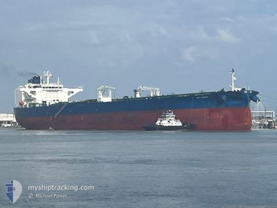
SFL ALBANY
Tanker
Current Trip
| Time Travelled | 4 days |
|---|---|
| Remaining Time | 4 days |
| Distance Travelled | 1378.83 nm |
| Remaining Distance | 1385.10 nm |
| AVG Speed | 12.8 Knots |
| MAX Speed | 15.5 Knots |
| AVG Wind | 10.7 knots |
| MAX Wind | 18.8 knots |
| MIN Temp | 25.6°C / 78.08°F |
| MAX Temp | 28.9°C / 84.02°F |
| Dybgang | 9.5 m |
| Position Modtaget | 3 d siden |
Current Position
| Longitude | -94.10509° |
|---|---|
| Latitude | 26.62173° |
| Status | Under way using engine |
| Fart | 14.2 Knots |
| Kurs | 109.1° |
| Område | Gulf of Mexico |
| Station | T-AIS |
| Position Modtaget | 3 d siden |
Info
Information
The current position of SFL ALBANY is in Gulf of Mexico with coordinates 26.62173° / -94.10509° as reported on 2024-05-10 03:06 by AIS to our vessel tracker app. The vessel's current speed is 14.2 Knots and is heading at the port of CORPUS CHRISTI. The estimated time of arrival as calculated by MyShipTracking vessel tracking app is 2024-05-18 07:25 LT
The vessel SFL ALBANY (IMO: 9874246, MMSI: 538010187) is a Tanker It's sailing under the flag of [MH] Marshall Is.
In this page you can find informations about the vessels current position, last detected port calls, and current voyage information. If the vessels is not in coverage by AIS you will find the latest position.
The current position of SFL ALBANY is detected by our AIS receivers and we are not responsible for the reliability of the data. The last position was recorded while the vessel was in Coverage by the Ais receivers of our vessel tracking app.
The current draught of SFL ALBANY as reported by AIS is 9.5 meters
Weather
| Temperature | 28.4°C / 83.12°F |
|---|---|
| Wind Speed | 19 knots |
| Direction | 81° E |
| Pressure | 1010.3 hPa |
| Humidity | 82.4 % |
| Cloud Coverage | 9 % |
Featured Company
Last Port Calls
| Port | Arrival | Departure | Time In Port |
|---|---|---|---|
| 2024-05-07 11:14 | 2024-05-09 12:10 | 2 d | |
| 2024-05-02 12:30 | 2024-05-02 13:10 | 39 m | |
| 2024-04-21 14:34 | 2024-04-24 05:28 | 2 d |
Last Trips
| Origin | Departure | Destination | Arrival | Distance | |
|---|---|---|---|---|---|
| 2024-05-02 08:10 | 2024-05-07 06:14 | 189.16 nm | |||
| 2024-04-24 01:28 | 2024-05-02 07:30 | 2026.10 nm | |||
| 2024-02-16 12:59 | 2024-04-21 10:34 | 5581.55 nm |
Events
| Tid | Hændelsen | Detaljer | Position / Dest | Info |
|---|---|---|---|---|
| 2024-05-10 03:14 | Status er ændret | Default Under way using engine |
26.61219 / -94.07444
CORPUS CHRISTI
|
Fart: 14.2 kn Kurs: 109.1° |
| 2024-05-10 03:06 | Ændre havområde | United States part of the Gulf of Mexico Bahamas part of the North Atlantic Ocean |
26.62173 / -94.10509
Gulf of Mexico
|
Fart: 14.2 kn Kurs: 109.1° |
| 2024-05-10 03:06 | Status er ændret | Under way using engine Default |
26.62173 / -94.10509
CORPUS CHRISTI
|
Fart: 14 kn Kurs: 109° |
| 2024-05-10 03:06 | Udenfor Dækning |
26.62173 / -94.10509
Gulf of Mexico
|
Fart: 14.2 kn Kurs: 109.1° |
|
| 2024-05-10 02:49 | Indenfor Dækning |
26.62173 / -94.10509
Gulf of Mexico
|
Fart: 14.2 kn Kurs: 109.1° |
|
| 2024-05-09 12:18 | START Sejllads | 1.65 nm, South East of INGLESIDE |
27.81650 / -97.20907
CORPUS CHRISTI
|
Fart: 3.9 kn Kurs: 82° |
| 2024-05-09 12:10 | Afsejlet fra sidste havn |
|
27.81609 / -97.21129
CORPUS CHRISTI
|
Fart: Kurs: 23° |
| 2024-05-07 11:38 | STOP Sejllads |
27.81850 / -97.20956
[US] INGLESIDE
|
Fart: 0.2 kn Kurs: 24° |
|
| 2024-05-07 11:14 | Skibe i havn |
|
27.81850 / -97.20956
[US] INGLESIDE
|
Fart: 8.3 kn Kurs: 260° |
| 2024-05-07 09:18 | START Sejllads | 9.8 nm, East of PORT ARANSAS |
27.78487 / -96.89422
CORPUS CHRISTI
|
Fart: 5 kn Kurs: 152° |