
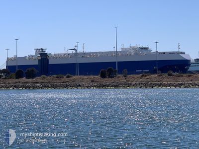
SERENITY HIGHWAY
Vehicles Carrier
Current Trip
| Time Travelled | 21 days |
|---|---|
| Remaining Time | 6 h, 44 mins |
| Distance Travelled | 5855.51 nm |
| Remaining Distance | 69.45 nm |
| AVG Speed | 12.8 Knots |
| MAX Speed | 19.7 Knots |
| AVG Wind | 15 knots |
| MAX Wind | 38 knots |
| MIN Temp | 9.9°C / 49.82°F |
| MAX Temp | 29.6°C / 85.28°F |
| Dybgang | 8 m |
| Position Modtaget | 19 h, 18 m siden |
Current Position
| Longitude | --- |
|---|---|
| Latitude | --- |
| Status | Under way using engine |
| Fart | 8.2 Knots |
| Kurs | 241.1° |
| Område | Philippine Sea |
| Station | T-AIS |
| Position Modtaget | 19 h, 18 m siden |
Information
The current position of SERENITY HIGHWAY is in Philippine Sea with coordinates 34.20269° / 137.78847° as reported on 2025-03-28 21:40 by AIS to our vessel tracker app. The vessel's current speed is 8.2 Knots and is heading at the port of NAGOYA. The estimated time of arrival as calculated by MyShipTracking vessel tracking app is 2025-03-29 23:43 LT
The vessel SERENITY HIGHWAY (IMO: 9391579, MMSI: 311002800) is a Vehicles Carrier that was built in 2008 ( 17 år gamle ). It's sailing under the flag of [BS] Bahamas.
In this page you can find informations about the vessels current position, last detected port calls, and current voyage information. If the vessels is not in coverage by AIS you will find the latest position.
The current position of SERENITY HIGHWAY is detected by our AIS receivers and we are not responsible for the reliability of the data. The last position was recorded while the vessel was in Coverage by the Ais receivers of our vessel tracking app.
The current draught of SERENITY HIGHWAY as reported by AIS is 8 meters
Weather
| Temperature | 9.9°C / 49.82°F |
|---|---|
| Wind Speed | 7 knots |
| Direction | 338° NNW |
| Pressure | 1020.1 hPa |
| Humidity | 54.6 % |
| Cloud Coverage | 100 % |
Featured Company
Last Port Calls
| Port | Arrival | Departure | Time In Port |
|---|---|---|---|
| 2025-03-07 02:44 | 2025-03-08 00:14 | 21 h | |
| 2025-03-04 08:48 | 2025-03-05 16:22 | 1 d | |
| 2025-03-02 04:26 | 2025-03-02 19:28 | 15 h | |
| 2025-02-27 16:10 | 2025-02-28 15:19 | 23 h | |
| 2025-02-20 11:16 | 2025-02-21 16:21 | 1 d | |
| 2025-02-09 21:38 | 2025-02-10 17:10 | 19 h | |
| 2025-02-08 21:50 | 2025-02-09 21:26 | 23 h | |
| 2025-02-07 20:52 | 2025-02-08 05:41 | 8 h | |
| 2025-02-06 21:08 | 2025-02-07 08:28 | 11 h | |
| 2025-01-20 23:43 | 2025-01-21 23:19 | 23 h |
Most Visited Ports (Last year)
| Port | Arrivals | |
|---|---|---|
| 5 | ||
| 5 | ||
| 5 | ||
| 4 | ||
| 2 | ||
| 2 |
Last Trips
| Origin | Departure | Destination | Arrival | Distance | |
|---|---|---|---|---|---|
| 2025-03-06 03:22 | 2025-03-07 13:14 | 524.45 nm | |||
| 2025-03-03 06:28 | 2025-03-04 19:48 | 574.28 nm | |||
| 2025-03-01 01:19 | 2025-03-02 15:26 | 586.85 nm | |||
| 2025-02-22 02:21 | 2025-02-28 02:10 | 988.76 nm | |||
| 2025-02-11 02:10 | 2025-02-20 21:16 | 3535.95 nm | |||
| 2025-02-10 06:26 | 2025-02-10 06:38 | 1.46 nm | |||
| 2025-02-08 14:41 | 2025-02-09 06:50 | 218.98 nm | |||
| 2025-02-07 17:28 | 2025-02-08 05:52 | 121.69 nm | |||
| 2025-01-21 15:19 | 2025-02-07 06:08 | 5503.34 nm | |||
| 2025-01-19 16:35 | 2025-01-20 15:43 | 223.18 nm |
Events
| Tid | Hændelsen | Detaljer | Position / Dest | Info |
|---|---|---|---|---|
| 2025-03-28 21:46 | Status er ændret | Default Under way using engine |
34.19621 / 137.77534
JPNGO
|
Fart: 8.2 kn Kurs: 241.1° |
| 2025-03-28 21:40 | Udenfor Dækning |
34.20269 / 137.78847
Philippine Sea
|
Fart: 8.2 kn Kurs: 241.1° |
|
| 2025-03-28 21:34 | Status er ændret | Under way using engine Default |
34.20869 / 137.80444
JPNGO
|
Fart: 7 kn Kurs: 287° |
| 2025-03-28 21:17 | Status er ændret | Default Under way using engine |
34.18704 / 137.82259
JPNGO
|
Fart: 9.2 kn Kurs: 64.3° |
| 2025-03-28 21:11 | Status er ændret | Under way using engine Default |
34.17686 / 137.80976
JPNGO
|
Fart: 9.5 kn Kurs: 72° |
| 2025-03-28 20:58 | Indenfor Dækning |
34.17686 / 137.80976
Philippine Sea
|
Fart: 9.2 kn Kurs: 64.3° |
|
| 2025-03-28 14:53 | Status er ændret | Default Under way using engine |
34.18191 / 137.68990
JPNGO
|
Fart: 8.5 kn Kurs: 209.1° |
| 2025-03-28 14:46 | Udenfor Dækning |
34.19480 / 137.70190
Philippine Sea
|
Fart: 8.5 kn Kurs: 209.1° |
|
| 2025-03-28 14:28 | Status er ændret | Under way using engine Default |
34.23434 / 137.72907
JPNGO
|
Fart: 8.9 kn Kurs: 210° |
| 2025-03-28 14:22 | Status er ændret | Default Under way using engine |
34.24646 / 137.73763
JPNGO
|
Fart: 8.9 kn Kurs: 209.2° |