
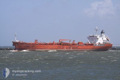
SERENE MONACO
Oil/Chemical Tanker
Current Trip
| Trip Time | 3 days |
|---|---|
| Trip Distance | 576.32 nm |
| AVG Speed | 10 Knots |
| MAX Speed | 14.4 Knots |
| Dybgang | 9.5 m |
| AVG Wind | 6.8 knots |
| MAX Wind | 15 knots |
| MIN Temp | 25.9°C / 78.62°F |
| MAX Temp | 31.1°C / 87.98°F |
| Position Modtaget | 1 d siden |
Current Position
| Longitude | 56.68555° |
|---|---|
| Latitude | 24.74323° |
| Status | Under way using engine |
| Fart | 12.6 Knots |
| Kurs | 186° |
| Område | Gulf of Oman |
| Station | T-AIS |
| Position Modtaget | 1 d siden |
Info
Information
The current position of SERENE MONACO is in Gulf of Oman with coordinates 24.74323° / 56.68555° as reported on 2024-05-13 08:20 by AIS to our vessel tracker app. The vessel's current speed is 12.6 Knots and is currently inside the port of SOHAR.
The vessel SERENE MONACO (IMO: 9309629, MMSI: 538005129) is a Oil/Chemical Tanker that was built in 2005 ( 19 år gamle ). It's sailing under the flag of [MH] Marshall Is.
In this page you can find informations about the vessels current position, last detected port calls, and current voyage information. If the vessels is not in coverage by AIS you will find the latest position.
The current position of SERENE MONACO is detected by our AIS receivers and we are not responsible for the reliability of the data. The last position was recorded while the vessel was in Coverage by the Ais receivers of our vessel tracking app.
The current draught of SERENE MONACO as reported by AIS is 9.5 meters
Weather
| Temperature | 30.3°C / 86.54°F |
|---|---|
| Wind Speed | 5 knots |
| Direction | 113° ESE |
| Pressure | 1008.8 hPa |
| Humidity | 70.1 % |
| Cloud Coverage | --- |
Featured Company
Last Port Calls
| Port | Arrival | Departure | Time In Port |
|---|---|---|---|
| 2024-05-14 13:28 | |||
| 2024-05-09 21:22 | 2024-05-11 00:52 | 1 d | |
| 2024-05-07 13:03 | 2024-05-09 17:40 | 2 d | |
| 2024-05-02 22:57 | 2024-05-05 10:58 | 2 d | |
| 2024-04-24 10:51 | 2024-04-27 12:50 | 3 d | |
| 2024-04-14 01:54 | 2024-04-14 18:43 | 16 h | |
| 2024-04-08 02:02 | 2024-04-09 21:20 | 1 d | |
| 2024-04-06 09:49 | 2024-04-07 19:11 | 1 d | |
| 2024-04-01 05:05 | 2024-04-02 00:23 | 19 h | |
| 2024-03-30 20:51 | 2024-04-01 04:33 | 1 d |
Last Trips
| Origin | Departure | Destination | Arrival | Distance | |
|---|---|---|---|---|---|
| 2024-05-11 03:52 | 2024-05-14 17:28 | 576.32 nm | |||
| 2024-05-09 20:40 | 2024-05-10 00:22 | 8.88 nm | |||
| 2024-05-05 13:58 | 2024-05-07 16:03 | 351.17 nm | |||
| 2024-04-27 18:20 | 2024-05-03 01:57 | 1396.71 nm | |||
| 2024-04-15 00:13 | 2024-04-24 16:21 | 1029.44 nm | |||
| 2024-04-10 02:50 | 2024-04-14 07:24 | 52.53 nm | |||
| 2024-04-08 00:41 | 2024-04-08 07:32 | 18.98 nm | |||
| 2024-04-02 03:23 | 2024-04-06 15:19 | 1206.88 nm | |||
| 2024-04-01 07:33 | 2024-04-01 08:05 | 2.72 nm | |||
| 2024-03-23 02:50 | 2024-03-30 23:51 | 1434.25 nm |
Events
| Tid | Hændelsen | Detaljer | Position / Dest | Info |
|---|---|---|---|---|
| 2024-05-14 13:53 | STOP Sejllads |
24.50313 / 56.63235
[OM] SOHAR
|
Fart: 0.2 kn Kurs: 300° |
|
| 2024-05-14 13:28 | Skibe i havn |
|
24.52492 / 56.62857
[OM] SOHAR
|
Fart: 8 kn Kurs: 182° |
| 2024-05-14 12:40 | START Sejllads | 4.97 nm, North of SOHAR |
24.58837 / 56.64108
OM SOH
|
Fart: 3.5 kn Kurs: 181° |
| 2024-05-14 11:45 | STOP Sejllads | 5.08 nm, North of SOHAR |
24.58907 / 56.64905
OM SOH
|
Fart: 0.3 kn Kurs: 104° |
| 2024-05-14 11:33 | START Sejllads | 5.28 nm, North of SOHAR |
24.59295 / 56.64693
OM SOH
|
Fart: 3.1 kn Kurs: 179° |
| 2024-05-13 09:48 | STOP Sejllads | 5.59 nm, North of SOHAR |
24.59823 / 56.64645
OM SOH
|
Fart: 0.3 kn Kurs: 118° |
| 2024-05-13 08:25 | Status er ændret | Default Under way using engine |
24.72728 / 56.68098
OM SOH
|
Fart: 12.6 kn Kurs: 186° |
| 2024-05-13 08:20 | Udenfor Dækning |
24.74323 / 56.68555
Gulf of Oman
|
Fart: 12.6 kn Kurs: 186° |
|
| 2024-05-13 06:56 | Ændre havområde | Omani part of the Gulf of Oman United Arab Emirates part of the Gulf of Oman |
25.03048 / 56.70282
Gulf of Oman
|
Fart: 11.7 kn Kurs: 185° |
| 2024-05-13 04:40 | START Sejllads | 10.05 nm, North East of FUJAIRAH |
25.24528 / 56.51568
OM SOH
|
Fart: 3.1 kn Kurs: 165° |