
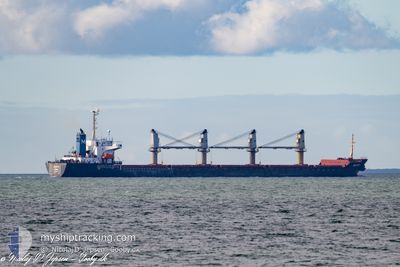
SELIN-M
Bulk Carrier
Current Trip
| Time Travelled | 18 days |
|---|---|
| Remaining Time | --- |
| Distance Travelled | 1785.57 nm |
| Remaining Distance | 191.40 nm |
| AVG Speed | 10.3 Knots |
| MAX Speed | 13.9 Knots |
| AVG Wind | 12.4 knots |
| MAX Wind | 29.9 knots |
| MIN Temp | 11.6°C / 52.88°F |
| MAX Temp | 40.1°C / 104.18°F |
| Dybgang | 5.9 m |
| Position Modtaget | 3 m siden |
Current Position
| Longitude | 28.88182° |
|---|---|
| Latitude | 40.94770° |
| Status | At anchor |
| Fart | |
| Kurs | 159° |
| Område | Sea of Marmara |
| Station | T-AIS |
| Position Modtaget | 3 m siden |
Info
Information
The current position of SELIN-M is in Sea of Marmara with coordinates 40.94770° / 28.88182° as reported on 2024-05-03 09:17 by AIS to our vessel tracker app. The vessel's current speed is 0 Knots and is heading at the port of CONSTANTA. The estimated time of arrival as calculated by MyShipTracking vessel tracking app is 2024-04-30 12:00 LT
The vessel SELIN-M (IMO: 9178551, MMSI: 370387000) is a Bulk Carrier that was built in 1998 ( 26 år gamle ). It's sailing under the flag of [PA] Panama.
In this page you can find informations about the vessels current position, last detected port calls, and current voyage information. If the vessels is not in coverage by AIS you will find the latest position.
The current position of SELIN-M is detected by our AIS receivers and we are not responsible for the reliability of the data. The last position was recorded while the vessel was in Coverage by the Ais receivers of our vessel tracking app.
The current draught of SELIN-M as reported by AIS is 5.9 meters
Weather
| Temperature | 13.8°C / 56.84°F |
|---|---|
| Wind Speed | 2 knots |
| Direction | 220° SW |
| Pressure | 1008.5 hPa |
| Humidity | 89.2 % |
| Cloud Coverage | 99 % |
Featured Company
Last Port Calls
| Port | Arrival | Departure | Time In Port |
|---|---|---|---|
| 2024-04-23 22:46 | 2024-04-24 18:03 | 19 h | |
| 2024-03-20 13:15 | 2024-04-15 00:05 | 25 d |
Most Visited Ports (Last year)
| Port | Arrivals | |
|---|---|---|
| 3 | ||
| 2 | ||
| 1 | ||
| 1 | ||
| 1 | ||
| 1 |
Last Trips
| Origin | Departure | Destination | Arrival | Distance | |
|---|---|---|---|---|---|
| 2024-04-15 03:05 | 2024-04-24 00:46 | 883.00 nm |
Events
| Tid | Hændelsen | Detaljer | Position / Dest | Info |
|---|---|---|---|---|
| 2024-05-03 07:29 | Status er ændret | At anchor Default |
40.94758 / 28.88192
RO CND
|
Fart: Kurs: 161° |
| 2024-05-03 07:26 | Status er ændret | Default At anchor |
40.94759 / 28.88193
RO CND
|
Fart: Kurs: 159° |
| 2024-05-03 06:41 | Status er ændret | At anchor Default |
40.94762 / 28.88214
RO CND
|
Fart: Kurs: 167° |
| 2024-05-03 06:38 | Status er ændret | Default At anchor |
40.94762 / 28.88213
RO CND
|
Fart: Kurs: 166° |
| 2024-05-03 06:05 | Status er ændret | At anchor Default |
40.94732 / 28.88146
RO CND
|
Fart: Kurs: 136° |
| 2024-05-03 06:02 | Status er ændret | Default At anchor |
40.94728 / 28.88140
RO CND
|
Fart: Kurs: 135° |
| 2024-05-02 23:59 | Status er ændret | At anchor Default |
40.94523 / 28.88136
RO CND
|
Fart: Kurs: 42° |
| 2024-05-02 23:56 | Status er ændret | Default At anchor |
40.94518 / 28.88137
RO CND
|
Fart: Kurs: 40° |
| 2024-05-02 18:53 | Status er ændret | At anchor Default |
40.94492 / 28.88232
RO CND
|
Fart: Kurs: 15° |
| 2024-05-02 18:50 | Status er ændret | Default At anchor |
40.94492 / 28.88230
RO CND
|
Fart: Kurs: 15° |