

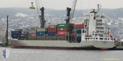
SEELAND
General Cargo

Current Trip
| Time Travelled | 3 days |
|---|---|
| Remaining Time | 1 h, 40 mins |
| Distance Travelled | 639.24 nm |
| Remaining Distance | 22.43 nm |
| AVG Speed | 7.3 Knots |
| MAX Speed | 10.9 Knots |
| AVG Wind | 9 knots |
| MAX Wind | 18 knots |
| MIN Temp | 2.1°C / 35.78°F |
| MAX Temp | 7.7°C / 45.86°F |
| Dybgang | 4.7 m |
| Position Modtaget | 1 h, 27 m siden |
Current Position
| Longitude | --- |
|---|---|
| Latitude | --- |
| Status | Under way using engine |
| Fart | 3.8 Knots |
| Kurs | 288° |
| Område | North Sea |
| Station | T-AIS |
| Position Modtaget | 1 h, 27 m siden |
Information
The current position of SEELAND is in North Sea with coordinates 54.03132° / 8.21245° as reported on 2025-03-27 09:50 by AIS to our vessel tracker app. The vessel's current speed is 3.8 Knots and is heading at the port of BUESUM. The estimated time of arrival as calculated by MyShipTracking vessel tracking app is 2025-03-27 13:57 LT
The vessel SEELAND (IMO: 9228930, MMSI: 304962000) is a General Cargo that was built in 2001 ( 24 år gamle ). It's sailing under the flag of [AG] Antigua Barbuda.
In this page you can find informations about the vessels current position, last detected port calls, and current voyage information. If the vessels is not in coverage by AIS you will find the latest position.
The current position of SEELAND is detected by our AIS receivers and we are not responsible for the reliability of the data. The last position was recorded while the vessel was in Coverage by the Ais receivers of our vessel tracking app.
The current draught of SEELAND as reported by AIS is 4.7 meters
Weather
| Temperature | 7.3°C / 45.14°F |
|---|---|
| Wind Speed | 13 knots |
| Direction | 236° SW |
| Pressure | 1020.7 hPa |
| Humidity | 83.9 % |
| Cloud Coverage | 34 % |


Featured Company
Last Port Calls
| Port | Arrival | Departure | Time In Port |
|---|---|---|---|
| 2025-03-22 18:30 | 2025-03-24 02:42 | 1 d | |
| 2025-03-19 22:43 | 2025-03-21 10:10 | 1 d | |
| 2025-03-16 18:07 | 2025-03-17 16:41 | 22 h | |
| 2025-03-15 13:22 | |||
| 2025-03-13 14:04 |
Most Visited Ports (Last year)
| Port | Arrivals | |
|---|---|---|
| 1 | ||
| 1 | ||
| 1 | ||
| 1 |
Last Trips
| Origin | Departure | Destination | Arrival | Distance | |
|---|---|---|---|---|---|
| 2025-03-21 10:10 | 2025-03-22 18:30 | 287.90 nm | |||
| 2025-03-17 16:41 | 2025-03-19 22:43 | 401.48 nm | |||
| 2025-03-15 13:22 | 2025-03-16 18:07 | 205.94 nm |
Events
| Tid | Hændelsen | Detaljer | Position / Dest | Info |
|---|---|---|---|---|
| 2025-03-27 10:04 | STOP Sejllads | 13.99 nm, South East of HELGOLAND |
54.03081 / 8.21000
DE BUM
|
Fart: 0.3 kn Kurs: 296° |
| 2025-03-27 09:50 | Status er ændret | Default Under way using engine |
54.03139 / 8.21218
DE BUM
|
Fart: 3.8 kn Kurs: 288° |
| 2025-03-27 09:50 | Status er ændret | Under way using engine Default |
54.03132 / 8.21245
DE BUM
|
Fart: 6.8 kn Kurs: 294° |
| 2025-03-27 09:50 | Udenfor Dækning |
54.03132 / 8.21245
North Sea
DE BUM
|
Fart: 3.8 kn Kurs: 294.4° |
|
| 2025-03-27 09:45 | Status er ændret | Default Under way using engine |
54.02887 / 8.22185
DE BUM
|
Fart: 7.8 kn Kurs: 293.5° |
| 2025-03-27 09:11 | Status er ændret | Under way using engine Default |
54.00258 / 8.33812
DE BUM
|
Fart: 7.3 kn Kurs: 285° |
| 2025-03-27 08:46 | Status er ændret | Default Under way using engine |
53.99033 / 8.41905
DE BUM
|
Fart: 6.8 kn Kurs: 284.1° |
| 2025-03-27 08:38 | Status er ændret | Under way using engine Default |
53.98684 / 8.44348
DE BUM
|
Fart: 6.5 kn Kurs: 284° |
| 2025-03-27 08:26 | Status er ændret | Default Under way using engine |
53.98121 / 8.47987
DE BUM
|
Fart: 6.3 kn Kurs: 283.7° |
| 2025-03-27 08:25 | Status er ændret | Under way using engine Default |
53.98092 / 8.48173
DE BUM
|
Fart: 6.3 kn Kurs: 284° |