

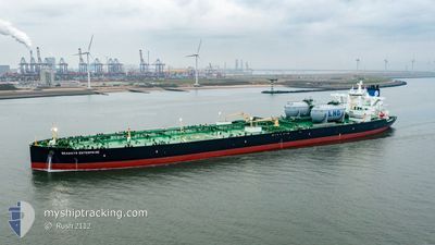
SEAWAYS ENTERPRISE
Tanker

Current Trip
| Time Travelled | 32 days |
|---|---|
| Remaining Time | --- |
| Distance Travelled | 8017.34 nm |
| Remaining Distance | --- |
| AVG Speed | 12 Knots |
| MAX Speed | 14.4 Knots |
| AVG Wind | 13.6 knots |
| MAX Wind | 24 knots |
| MIN Temp | 18.1°C / 64.58°F |
| MAX Temp | 28.3°C / 82.94°F |
| Dybgang | 20 m |
| Position Modtaget | 17 h, 34 m siden |
Current Position
| Longitude | --- |
|---|---|
| Latitude | --- |
| Status | Under way using engine |
| Fart | 14.3 Knots |
| Kurs | 184.2° |
| Område | South Atlantic Ocean |
| Station | T-AIS |
| Position Modtaget | 17 h, 34 m siden |
Information
The current position of SEAWAYS ENTERPRISE is in South Atlantic Ocean with coordinates -34.44288° / 18.05939° as reported on 2025-03-04 07:37 by AIS to our vessel tracker app. The vessel's current speed is 14.3 Knots and is heading at the port of KAOHSIUNG. The estimated time of arrival as calculated by MyShipTracking vessel tracking app is 2025-03-30 15:00 LT
The vessel SEAWAYS ENTERPRISE (IMO: 9933585, MMSI: 538010089) is a Tanker It's sailing under the flag of [MH] Marshall Is.
In this page you can find informations about the vessels current position, last detected port calls, and current voyage information. If the vessels is not in coverage by AIS you will find the latest position.
The current position of SEAWAYS ENTERPRISE is detected by our AIS receivers and we are not responsible for the reliability of the data. The last position was recorded while the vessel was in Coverage by the Ais receivers of our vessel tracking app.
The current draught of SEAWAYS ENTERPRISE as reported by AIS is 20 meters
Weather
| Temperature | 20.8°C / 69.44°F |
|---|---|
| Wind Speed | 5 knots |
| Direction | 214° SW |
| Pressure | 1010.7 hPa |
| Humidity | 91 % |
| Cloud Coverage | 100 % |


Featured Company
Most Visited Ports (Last year)
| Port | Arrivals | |
|---|---|---|
| 2 | ||
| 1 | ||
| 1 | ||
| 1 | ||
| 1 |
Last Trips
| Origin | Departure | Destination | Arrival | Distance | |
|---|---|---|---|---|---|
| 2025-01-09 00:48 | 2025-01-29 17:55 | 5300.93 nm | |||
| 2024-11-01 22:22 | 2025-01-06 09:10 | 5817.75 nm |
Events
| Tid | Hændelsen | Detaljer | Position / Dest | Info |
|---|---|---|---|---|
| 2025-03-04 07:42 | Status er ændret | Default Under way using engine |
-34.46653 / 18.05691
TW KHH
|
Fart: 14.3 kn Kurs: 184.2° |
| 2025-03-04 07:37 | Udenfor Dækning |
-34.44288 / 18.05939
South Atlantic Ocean
TW KHH
|
Fart: 14.3 kn Kurs: 184.2° |
|
| 2025-03-04 07:36 | Status er ændret | Under way using engine Default |
-34.44061 / 18.05962
TW KHH
|
Fart: 14.3 kn Kurs: 182° |
| 2025-03-04 07:27 | Status er ændret | Default Under way using engine |
-34.40646 / 18.06347
TW KHH
|
Fart: 14.3 kn Kurs: 180.5° |
| 2025-03-04 07:19 | Status er ændret | Under way using engine Default |
-34.37296 / 18.06322
TW KHH
|
Fart: 14.3 kn Kurs: 181° |
| 2025-03-04 07:12 | Status er ændret | Default Under way using engine |
-34.34657 / 18.06226
TW KHH
|
Fart: 14.2 kn Kurs: 178.3° |
| 2025-03-04 05:37 | Destination er ændret | TW KHH ZA CPT |
-33.98793 / 18.11977
TW KHH
|
Fart: 13.1 kn Kurs: 208.7° |
| 2025-03-04 05:37 | ETA er ændret | 2025/03/30 15:00 2025/03/04 04:00 |
-33.98793 / 18.11977
TW KHH
|
Fart: 13.1 kn Kurs: 208.7° |
| 2025-03-04 05:18 | Status er ændret | Under way using engine Default |
-33.92569 / 18.15945
ZA CPT
|
Fart: 12.1 kn Kurs: 208° |
| 2025-03-04 05:17 | Status er ændret | Default Under way using engine |
-33.92265 / 18.16135
ZA CPT
|
Fart: 10.8 kn Kurs: 210.1° |