
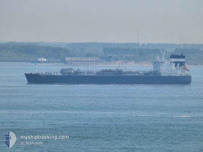
SEAMAID
Tanker
Current Trip
| Time Travelled | 2 days |
|---|---|
| Remaining Time | --- |
| Distance Travelled | 766.99 nm |
| Remaining Distance | --- |
| AVG Speed | 14.2 Knots |
| MAX Speed | 15.7 Knots |
| AVG Wind | 8.7 knots |
| MAX Wind | 18.9 knots |
| MIN Temp | 25.8°C / 78.44°F |
| MAX Temp | 30.2°C / 86.36°F |
| Dybgang | 9.5 m |
| Position Modtaget | 20 h, 34 m siden |
Current Position
| Longitude | 56.72257° |
|---|---|
| Latitude | 24.71612° |
| Status | Under way using engine |
| Fart | 14.9 Knots |
| Kurs | 198.7° |
| Område | Gulf of Oman |
| Station | T-AIS |
| Position Modtaget | 20 h, 34 m siden |
Info
Information
The current position of SEAMAID is in Gulf of Oman with coordinates 24.71612° / 56.72257° as reported on 2024-05-12 01:28 by AIS to our vessel tracker app. The vessel's current speed is 14.9 Knots and is heading at the port of PARADIP. The estimated time of arrival as calculated by MyShipTracking vessel tracking app is 2024-05-20 14:30 LT
The vessel SEAMAID (IMO: 9892834, MMSI: 215971000) is a Tanker It's sailing under the flag of [MT] Malta.
In this page you can find informations about the vessels current position, last detected port calls, and current voyage information. If the vessels is not in coverage by AIS you will find the latest position.
The current position of SEAMAID is detected by our AIS receivers and we are not responsible for the reliability of the data. The last position was recorded while the vessel was in Coverage by the Ais receivers of our vessel tracking app.
The current draught of SEAMAID as reported by AIS is 9.5 meters
Weather
| Temperature | 28.2°C / 82.76°F |
|---|---|
| Wind Speed | 13 knots |
| Direction | 188° S |
| Pressure | 1007.2 hPa |
| Humidity | 82.3 % |
| Cloud Coverage | 61 % |
Featured Company
Last Port Calls
| Port | Arrival | Departure | Time In Port |
|---|---|---|---|
| 2024-05-07 14:13 | 2024-05-10 10:17 | 2 d | |
| 2024-04-28 18:19 | 2024-05-02 00:52 | 3 d | |
| 2024-04-14 22:16 | 2024-04-16 13:49 | 1 d | |
| 2024-03-30 08:04 | 2024-04-01 06:01 | 1 d | |
| 2024-03-02 12:17 | 2024-03-02 23:00 | 10 h |
Most Visited Ports (Last year)
| Port | Arrivals | |
|---|---|---|
| 8 | ||
| 5 | ||
| 3 | ||
| 2 | ||
| 1 | ||
| 1 |
Last Trips
| Origin | Departure | Destination | Arrival | Distance | |
|---|---|---|---|---|---|
| 2024-05-02 03:52 | 2024-05-07 17:13 | 45.14 nm | |||
| 2024-04-16 19:19 | 2024-04-28 21:19 | 1345.40 nm | |||
| 2024-04-01 09:01 | 2024-04-15 03:46 | 1631.14 nm | |||
| 2024-03-02 23:00 | 2024-03-30 11:04 | 9898.10 nm | |||
| 2024-02-18 10:39 | 2024-03-02 12:17 | 2735.77 nm |
Events
| Tid | Hændelsen | Detaljer | Position / Dest | Info |
|---|---|---|---|---|
| 2024-05-12 08:01 | START Sejllads | 7.09 nm, North of SOHAR |
24.61633 / 56.67755
IN PRT
|
Fart: 4.1 kn Kurs: 49° |
| 2024-05-12 02:21 | STOP Sejllads | 6.96 nm, North of SOHAR |
24.61519 / 56.67442
IN PRT
|
Fart: 0.2 kn Kurs: 157° |
| 2024-05-12 01:36 | Status er ændret | Default Under way using engine |
24.68686 / 56.71173
IN PRT
|
Fart: 14.9 kn Kurs: 198.7° |
| 2024-05-12 01:28 | Udenfor Dækning |
24.71612 / 56.72257
Gulf of Oman
IN PRT
|
Fart: 14.9 kn Kurs: 198.7° |
|
| 2024-05-12 01:12 | Status er ændret | Under way using engine Default |
24.78332 / 56.72908
IN PRT
|
Fart: 14.7 kn Kurs: 177° |
| 2024-05-12 01:05 | Status er ændret | Default Under way using engine |
24.81305 / 56.72748
IN PRT
|
Fart: 14.6 kn Kurs: 177.4° |
| 2024-05-12 00:11 | Ændre havområde | Omani part of the Gulf of Oman United Arab Emirates part of the Gulf of Oman |
25.03211 / 56.71695
Gulf of Oman
IN PRT
|
Fart: 14.1 kn Kurs: 175.5° |
| 2024-05-11 21:28 | Ændre havområde | United Arab Emirates part of the Gulf of Oman Omani part of the Gulf of Oman |
25.67236 / 56.68219
Gulf of Oman
IN PRT
|
Fart: 14.4 kn Kurs: 178.2° |
| 2024-05-11 20:25 | Ændre havområde | Omani part of the Gulf of Oman Omani part of the Persian Gulf |
25.92364 / 56.65620
Gulf of Oman
IN PRT
|
Fart: 14.1 kn Kurs: 174.1° |
| 2024-05-11 20:25 | Indenfor Dækning |
25.92364 / 56.65620
Gulf of Oman
IN PRT
|
Fart: 14.1 kn Kurs: 174.1° |