

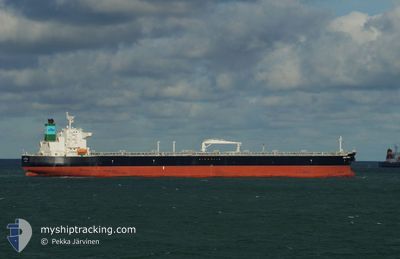
SEA PUMA
Tanker

Current Trip
| Time Travelled | 4 days |
|---|---|
| Remaining Time | --- |
| Distance Travelled | 614.01 nm |
| Remaining Distance | --- |
| AVG Speed | 10.7 Knots |
| MAX Speed | 15.3 Knots |
| AVG Wind | 7.4 knots |
| MAX Wind | 27.5 knots |
| MIN Temp | 12.7°C / 54.86°F |
| MAX Temp | 15.6°C / 60.08°F |
| Dybgang | 7.8 m |
| Position Modtaget | 3 m siden |
Current Position
| Longitude | --- |
|---|---|
| Latitude | --- |
| Status | At anchor |
| Fart | 0.1 Knots |
| Kurs | 17° |
| Område | Balearic Sea |
| Station | T-AIS |
| Position Modtaget | 3 m siden |
Information
The current position of SEA PUMA is in Balearic Sea with coordinates 41.30226° / 2.19232° as reported on 2025-03-27 20:26 by AIS to our vessel tracker app. The vessel's current speed is 0.1 Knots
The vessel SEA PUMA (IMO: 9802176, MMSI: 241627000) is a Tanker It's sailing under the flag of [GR] Greece.
In this page you can find informations about the vessels current position, last detected port calls, and current voyage information. If the vessels is not in coverage by AIS you will find the latest position.
The current position of SEA PUMA is detected by our AIS receivers and we are not responsible for the reliability of the data. The last position was recorded while the vessel was in Coverage by the Ais receivers of our vessel tracking app.
The current draught of SEA PUMA as reported by AIS is 7.8 meters
Weather
| Temperature | 13.5°C / 56.3°F |
|---|---|
| Wind Speed | 3 knots |
| Direction | 166° SSE |
| Pressure | 1015.3 hPa |
| Humidity | 77.5 % |
| Cloud Coverage | 41 % |


Featured Company
Last Trips
| Origin | Departure | Destination | Arrival | Distance | |
|---|---|---|---|---|---|
| 2025-03-19 11:08 | 2025-03-21 13:56 | 150.84 nm | |||
| 2025-03-08 09:16 | 2025-03-17 17:06 | 1655.66 nm | |||
| 2025-02-21 02:38 | 2025-03-02 10:52 | 841.50 nm | |||
| 2025-01-31 09:36 | 2025-02-19 11:47 | 5292.24 nm | |||
| 2024-12-28 09:40 | 2025-01-29 11:41 | 6123.35 nm |
Events
| Tid | Hændelsen | Detaljer | Position / Dest | Info |
|---|---|---|---|---|
| 2025-03-27 13:23 | Status er ændret | At anchor Default |
41.30653 / 2.19389
ESBCN
|
Fart: 0.1 kn Kurs: 192° |
| 2025-03-27 13:20 | Status er ændret | Default At anchor |
41.30658 / 2.19382
ESBCN
|
Fart: 0.1 kn Kurs: 191° |
| 2025-03-27 10:11 | Status er ændret | At anchor Default |
41.30291 / 2.19039
ESBCN
|
Fart: 0.1 kn Kurs: 62° |
| 2025-03-27 10:08 | Status er ændret | Default At anchor |
41.30288 / 2.19043
ESBCN
|
Fart: 0.1 kn Kurs: 62° |
| 2025-03-27 09:35 | Status er ændret | At anchor Default |
41.30262 / 2.19052
ESBCN
|
Fart: 0.1 kn Kurs: 51° |
| 2025-03-27 09:32 | Status er ændret | Default At anchor |
41.30257 / 2.19053
ESBCN
|
Fart: 0.1 kn Kurs: 52° |
| 2025-03-26 14:49 | Status er ændret | At anchor Under way using engine |
41.30219 / 2.19360
ESBCN
|
Fart: 0.1 kn Kurs: 350° |
| 2025-03-26 14:42 | STOP Sejllads | 2.75 nm, South of BARCELONA |
41.30215 / 2.19415
ESBCN
|
Fart: 0.3 kn Kurs: 357° |
| 2025-03-26 10:09 | START Sejllads | 19.89 nm, South of VALLCARCA |
40.92253 / 2.00299
ESBCN
|
Fart: 3.1 kn Kurs: 161° |
| 2025-03-25 23:27 | STOP Sejllads | 15.13 nm, South of VALLCARCA |
40.98977 / 1.92998
ESBCN
|
Fart: 0.3 kn Kurs: 295° |