
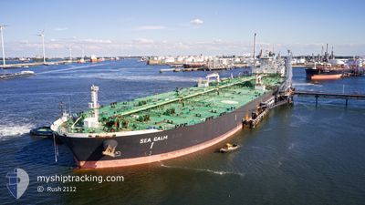
SEA CALM
Tanker
Current Trip
| Time Travelled | 14 days |
|---|---|
| Remaining Time | 3 days |
| Distance Travelled | 3830.25 nm |
| Remaining Distance | 1068.24 nm |
| AVG Speed | 11.4 Knots |
| MAX Speed | 15.2 Knots |
| AVG Wind | 6.3 knots |
| MAX Wind | 16 knots |
| MIN Temp | 11.9°C / 53.42°F |
| MAX Temp | 31.1°C / 87.98°F |
| Dybgang | 11.2 m |
| Position Modtaget | 3 d siden |
Current Position
| Longitude | 103.40771° |
|---|---|
| Latitude | 1.25163° |
| Status | Under way using engine |
| Fart | 12.8 Knots |
| Kurs | 295.5° |
| Område | Malacca Strait |
| Station | T-AIS |
| Position Modtaget | 3 d siden |
Info
Information
The current position of SEA CALM is in Malacca Strait with coordinates 1.25163° / 103.40771° as reported on 2024-05-04 21:20 by AIS to our vessel tracker app. The vessel's current speed is 12.8 Knots and is heading at the port of SINGAPORE. The estimated time of arrival as calculated by MyShipTracking vessel tracking app is 2024-05-12 08:18 LT
The vessel SEA CALM (IMO: 9629378, MMSI: 636020446) is a Tanker It's sailing under the flag of [LR] Liberia.
In this page you can find informations about the vessels current position, last detected port calls, and current voyage information. If the vessels is not in coverage by AIS you will find the latest position.
The current position of SEA CALM is detected by our AIS receivers and we are not responsible for the reliability of the data. The last position was recorded while the vessel was in Coverage by the Ais receivers of our vessel tracking app.
The current draught of SEA CALM as reported by AIS is 11.2 meters
Weather
| Temperature | 29.6°C / 85.28°F |
|---|---|
| Wind Speed | 3 knots |
| Direction | 22° NNE |
| Pressure | 1009.4 hPa |
| Humidity | 70.4 % |
| Cloud Coverage | 73 % |
Featured Company
Last Trips
| Origin | Departure | Destination | Arrival | Distance |
|---|
Events
| Tid | Hændelsen | Detaljer | Position / Dest | Info |
|---|---|---|---|---|
| 2024-05-04 21:21 | Status er ændret | Default Under way using engine |
1.25318 / 103.40450
SGSIN
|
Fart: 12.8 kn Kurs: 295.5° |
| 2024-05-04 21:20 | Udenfor Dækning |
1.25163 / 103.40771
Malacca Strait
|
Fart: 12.8 kn Kurs: 295.5° |
|
| 2024-05-04 21:04 | Ændre havområde | Malaysian part of the Malacca Strait Malaysian part of the Singapore Strait |
1.22921 / 103.46020
Malacca Strait
|
Fart: 12.9 kn Kurs: 290.9° |
| 2024-05-04 20:26 | Ændre havområde | Malaysian part of the Singapore Strait Indonesian part of the Singapore Strait |
1.19521 / 103.58723
Singapore Strait
|
Fart: 12.3 kn Kurs: 273° |
| 2024-05-04 19:52 | Ændre havområde | Indonesian part of the Singapore Strait Singaporean part of the Singapore Strait |
1.16298 / 103.69446
Singapore Strait
|
Fart: 11.7 kn Kurs: 301° |
| 2024-05-04 17:33 | START Sejllads | 2.29 nm, East of TANAH MERAH |
1.30519 / 104.05534
SGSIN
|
Fart: 3.1 kn Kurs: 210° |
| 2024-05-04 17:28 | Status er ændret | Under way using engine At anchor |
1.30694 / 104.05721
SGSIN
|
Fart: 0.5 kn Kurs: 227° |
| 2024-05-04 05:54 | Status er ændret | At anchor Default |
1.30610 / 104.05917
SGSIN
|
Fart: 0.1 kn Kurs: 272° |
| 2024-05-04 05:51 | Status er ændret | Default At anchor |
1.30611 / 104.05913
SGSIN
|
Fart: 0.1 kn Kurs: 273° |
| 2024-05-04 00:33 | Ændre havområde | Singaporean part of the Singapore Strait Malaysian part of the Singapore Strait |
1.30535 / 104.05937
Singapore Strait
|
Fart: 0.3 kn Kurs: 258.3° |