

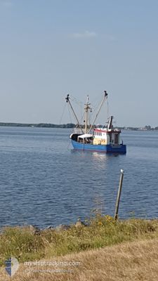
SCH10 DRIEGEBROEDERS
Fishing Vessel

Current Trip
| Trip Time | 1 day |
|---|---|
| Trip Distance | 197.09 nm |
| AVG Speed | 3.9 Knots |
| MAX Speed | 10.7 Knots |
| Dybgang | 2.4 m |
| AVG Wind | 16.9 knots |
| MAX Wind | 22.9 knots |
| MIN Temp | -2.9°C / 26.78°F |
| MAX Temp | 3°C / 37.4°F |
| Position Modtaget | 2 d siden |
Current Position
| Longitude | --- |
|---|---|
| Latitude | --- |
| Status | Engaged in Fishing |
| Fart | |
| Kurs | 46° |
| Område | North Sea |
| Station | T-AIS |
| Position Modtaget | 2 d siden |
Information
The current position of SCH10 DRIEGEBROEDERS is in North Sea with coordinates 52.95413° / 4.77992° as reported on 2025-02-19 20:20 by AIS to our vessel tracker app. The vessel's current speed is 0 Knots and is currently inside the port of DEN HELDER.
The vessel SCH10 DRIEGEBROEDERS (IMO: 8432625, MMSI: 244049000) is a Fishing Vessel that was built in 1968 ( 57 år gamle ). It's sailing under the flag of [NL] Netherlands.
In this page you can find informations about the vessels current position, last detected port calls, and current voyage information. If the vessels is not in coverage by AIS you will find the latest position.
The current position of SCH10 DRIEGEBROEDERS is detected by our AIS receivers and we are not responsible for the reliability of the data. The last position was recorded while the vessel was in Coverage by the Ais receivers of our vessel tracking app.
The current draught of SCH10 DRIEGEBROEDERS as reported by AIS is 2.4 meters
Weather
| Temperature | 3.1°C / 37.58°F |
|---|---|
| Wind Speed | 17 knots |
| Direction | 144° SE |
| Pressure | 1020.4 hPa |
| Humidity | 59 % |
| Cloud Coverage | 100 % |


Featured Company
Last Port Calls
| Port | Arrival | Departure | Time In Port |
|---|---|---|---|
| 2025-02-19 14:12 | |||
| 2025-02-12 05:53 | 2025-02-17 14:43 | 5 d | |
| 2025-02-06 09:22 | 2025-02-10 17:12 | 4 d | |
| 2025-01-23 09:39 | 2025-02-03 10:10 | 11 d | |
| 2025-01-15 12:26 | 2025-01-19 23:59 | 4 d | |
| 2025-01-15 02:17 | 2025-01-15 12:16 | 9 h | |
| 2025-01-14 13:01 | 2025-01-14 14:58 | 1 h | |
| 2024-12-17 13:01 | 2025-01-13 00:15 | 26 d | |
| 2024-12-16 16:32 | 2024-12-17 06:22 | 13 h | |
| 2024-12-12 03:51 | 2024-12-16 14:57 | 4 d |
Most Visited Ports (Last year)
| Port | Arrivals | |
|---|---|---|
| 27 | ||
| 20 | ||
| 6 | ||
| 4 | ||
| 2 | ||
| 2 |
Last Trips
| Origin | Departure | Destination | Arrival | Distance | |
|---|---|---|---|---|---|
| 2025-02-17 14:43 | 2025-02-19 14:12 | 197.09 nm | |||
| 2025-02-10 17:12 | 2025-02-12 05:53 | 157.54 nm | |||
| 2025-02-03 10:10 | 2025-02-06 09:22 | 157.34 nm | |||
| 2025-01-19 23:59 | 2025-01-23 09:39 | 281.55 nm | |||
| 2025-01-15 12:16 | 2025-01-15 12:26 | 0.92 nm | |||
| 2025-01-14 14:58 | 2025-01-15 02:17 | 58.09 nm | |||
| 2025-01-13 00:15 | 2025-01-14 13:01 | 170.42 nm | |||
| 2024-12-17 06:22 | 2024-12-17 13:01 | 58.21 nm | |||
| 2024-12-16 14:57 | 2024-12-16 16:32 | 11.75 nm | |||
| 2024-12-11 20:27 | 2024-12-12 03:51 | 68.52 nm |
Events
| Tid | Hændelsen | Detaljer | Position / Dest | Info |
|---|---|---|---|---|
| 2025-02-19 20:20 | Udenfor Dækning |
52.95413 / 4.77992
North Sea
[NL] DEN HELDER
|
Fart: Kurs: 46° |
|
| 2025-02-19 13:12 | STOP Sejllads |
52.95300 / 4.78175
[NL] DEN HELDER
|
Fart: 0.2 kn Kurs: 320° |
|
| 2025-02-19 13:12 | Skibe i havn |
|
52.95300 / 4.78175
[NL] DEN HELDER
|
Fart: 0.6 kn Kurs: 317° |
| 2025-02-19 11:59 | Indenfor Dækning |
53.05635 / 4.70464
North Sea
|
Fart: 3 kn Kurs: 323.6° |
|
| 2025-02-19 10:05 | Udenfor Dækning |
53.27446 / 4.89573
North Sea
|
Fart: 7.8 kn Kurs: 221.1° |
|
| 2025-02-19 09:27 | START Sejllads | 4.94 nm, North West of VLIELAND |
53.33988 / 4.96734
SCHEVENINGEN
|
Fart: 7.1 kn Kurs: 217.6° |
| 2025-02-19 09:25 | STOP Sejllads | 4.93 nm, North West of VLIELAND |
53.34174 / 4.96955
SCHEVENINGEN
|
Fart: 0.3 kn Kurs: 200° |
| 2025-02-19 07:17 | START Sejllads | 5.32 nm, North West of VLIELAND |
53.36725 / 4.99677
SCHEVENINGEN
|
Fart: 5.8 kn Kurs: 255.5° |
| 2025-02-19 07:07 | STOP Sejllads | 5.25 nm, North West of VLIELAND |
53.36720 / 4.99995
SCHEVENINGEN
|
Fart: 0.3 kn Kurs: 206° |
| 2025-02-18 18:26 | Indenfor Dækning |
53.39959 / 4.97454
North Sea
|
Fart: 3.5 kn Kurs: 58.8° |