
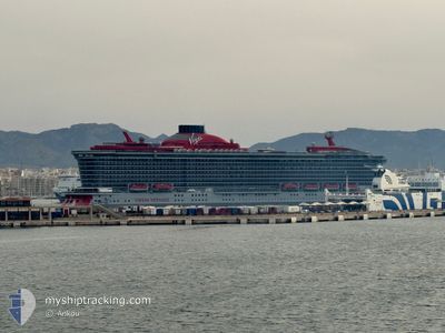
SCARLET LADY
Passenger
Current Trip
| Trip Time | 2 days |
|---|---|
| Trip Distance | 864.45 nm |
| AVG Speed | 14.6 Knots |
| MAX Speed | 14.6 Knots |
| Dybgang | 8 m |
| AVG Wind | 9.3 knots |
| MAX Wind | 16.8 knots |
| MIN Temp | 18.5°C / 65.3°F |
| MAX Temp | 27.7°C / 81.86°F |
| Position Modtaget | 1 m siden |
Current Position
| Longitude | --- |
|---|---|
| Latitude | --- |
| Status | Under way using engine |
| Fart | 6 Knots |
| Kurs | 295° |
| Område | North Atlantic Ocean |
| Station | T-AIS |
| Position Modtaget | 1 m siden |
Info
Information
The current position of SCARLET LADY is in North Atlantic Ocean with coordinates 25.77683° / -80.16563° as reported on 2025-03-08 10:11 by AIS to our vessel tracker app. The vessel's current speed is 6 Knots and is currently inside the port of MIAMI.
The vessel SCARLET LADY (IMO: 9804801, MMSI: 311000807) is a Passenger It's sailing under the flag of [BS] Bahamas.
In this page you can find informations about the vessels current position, last detected port calls, and current voyage information. If the vessels is not in coverage by AIS you will find the latest position.
The current position of SCARLET LADY is detected by our AIS receivers and we are not responsible for the reliability of the data. The last position was recorded while the vessel was in Coverage by the Ais receivers of our vessel tracking app.
The current draught of SCARLET LADY as reported by AIS is 8 meters
Weather
| Temperature | 20.2°C / 68.36°F |
|---|---|
| Wind Speed | 6 knots |
| Direction | 200° SSW |
| Pressure | 1016.5 hPa |
| Humidity | 72.4 % |
| Cloud Coverage | --- |
Featured Company
Last Port Calls
| Port | Arrival | Departure | Time In Port |
|---|---|---|---|
| 2025-03-08 04:54 | |||
| 2025-03-05 05:23 | 2025-03-05 17:00 | 11 h | |
| 2025-03-04 09:32 | 2025-03-04 19:02 | 9 h | |
| 2025-03-02 03:57 | 2025-03-02 18:54 | 14 h | |
| 2025-02-26 07:19 | 2025-02-26 18:07 | 10 h | |
| 2025-02-25 11:22 | 2025-02-25 22:31 | 11 h | |
| 2025-02-24 08:39 | 2025-02-24 18:02 | 9 h | |
| 2025-02-22 05:19 | 2025-02-22 18:47 | 13 h | |
| 2025-02-19 07:45 | 2025-02-19 17:48 | 10 h | |
| 2025-02-18 09:45 | 2025-02-18 18:58 | 9 h |
Last Trips
| Origin | Departure | Destination | Arrival | Distance | |
|---|---|---|---|---|---|
| 2025-03-05 17:00 | 2025-03-08 04:54 | 864.45 nm | |||
| 2025-03-04 19:02 | 2025-03-05 05:23 | 170.29 nm | |||
| 2025-03-02 18:54 | 2025-03-04 09:32 | 636.32 nm | |||
| 2025-02-26 18:07 | 2025-03-02 03:57 | 1131.37 nm | |||
| 2025-02-25 22:31 | 2025-02-26 07:19 | 102.98 nm | |||
| 2025-02-24 18:02 | 2025-02-25 11:22 | 277.68 nm | |||
| 2025-02-22 18:47 | 2025-02-24 08:39 | 693.02 nm | |||
| 2025-02-19 17:48 | 2025-02-22 05:19 | 843.07 nm | |||
| 2025-02-18 18:58 | 2025-02-19 07:45 | 166.38 nm | |||
| 2025-02-16 18:46 | 2025-02-18 09:45 | 637.23 nm |
Events
| Tid | Hændelsen | Detaljer | Position / Dest | Info |
|---|---|---|---|---|
| 2025-03-08 09:54 | Skibe i havn |
|
25.76233 / -80.13004
[US] MIAMI
|
Fart: 13.2 kn Kurs: 294.5° |
| 2025-03-08 07:34 | Ændre havområde | United States part of the North Atlantic Ocean Bahamas part of the North Atlantic Ocean |
25.67676 / -79.71175
North Atlantic Ocean
USMIA
|
Fart: 9.5 kn Kurs: 298.2° |
| 2025-03-08 03:55 | Status er ændret | Under way using engine Default |
25.43212 / -79.53576
USMIA
|
Fart: 7.6 kn Kurs: 169° |
| 2025-03-08 03:38 | Status er ændret | Default Under way using engine |
25.46716 / -79.54121
USMIA
|
Fart: 7.5 kn Kurs: 174.5° |
| 2025-03-08 03:30 | Destination er ændret | USMIA BSBIM |
25.48451 / -79.54336
USMIA
|
Fart: 7.5 kn Kurs: 173.2° |
| 2025-03-08 03:30 | ETA er ændret | 2025/03/08 09:30 2025/03/07 12:00 |
25.48451 / -79.54336
USMIA
|
Fart: 7.5 kn Kurs: 173.2° |
| 2025-03-08 03:29 | Status er ændret | Under way using engine Default |
25.48529 / -79.54346
BSBIM
|
Fart: 7.5 kn Kurs: 175° |
| 2025-03-08 03:13 | Status er ændret | Default Under way using engine |
25.51974 / -79.54784
BSBIM
|
Fart: 7.4 kn Kurs: 172.8° |
| 2025-03-08 03:06 | Status er ændret | Under way using engine Default |
25.53336 / -79.54931
BSBIM
|
Fart: 6.3 kn Kurs: 189° |
| 2025-03-08 03:02 | Status er ændret | Default Under way using engine |
25.54138 / -79.54889
BSBIM
|
Fart: 5.8 kn Kurs: 198.8° |