

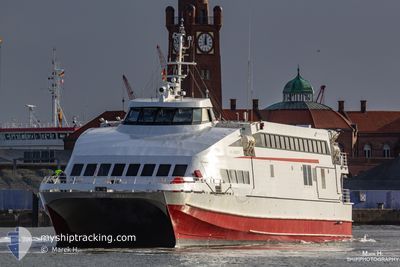
SAN GIORGIO
High speed craft

Current Trip
| Trip Time | 1 h, 46 mins |
|---|---|
| Trip Distance | 34.32 nm |
| AVG Speed | 18.1 Knots |
| MAX Speed | 18.1 Knots |
| Dybgang | 1.8 m |
| AVG Wind | 7.8 knots |
| MAX Wind | 10 knots |
| MIN Temp | 15.5°C / 59.9°F |
| MAX Temp | 15.8°C / 60.44°F |
| Position Modtaget | 8 h, 1 m siden |
Current Position
| Longitude | --- |
|---|---|
| Latitude | --- |
| Status | Moored |
| Fart | |
| Kurs | 203° |
| Område | Mediterranean Sea - Eastern Basin |
| Station | T-AIS |
| Position Modtaget | 8 h, 1 m siden |
Information
The current position of SAN GIORGIO is in Mediterranean Sea - Eastern Basin with coordinates 35.88834° / 14.50717° as reported on 2025-03-17 23:57 by AIS to our vessel tracker app. The vessel's current speed is 0 Knots and is currently inside the port of VALLETTA.
The vessel SAN GIORGIO (IMO: 9234006, MMSI: 248984000) is a High speed craft that was built in 2001 ( 24 år gamle ). It's sailing under the flag of [MT] Malta.
In this page you can find informations about the vessels current position, last detected port calls, and current voyage information. If the vessels is not in coverage by AIS you will find the latest position.
The current position of SAN GIORGIO is detected by our AIS receivers and we are not responsible for the reliability of the data. The last position was recorded while the vessel was in Coverage by the Ais receivers of our vessel tracking app.
The current draught of SAN GIORGIO as reported by AIS is 1.8 meters
Weather
| Temperature | 16°C / 60.8°F |
|---|---|
| Wind Speed | 5 knots |
| Direction | 118° ESE |
| Pressure | 1017.3 hPa |
| Humidity | 74.2 % |
| Cloud Coverage | 98 % |


Featured Company
Most Visited Ports (Last year)
| Port | Arrivals | |
|---|---|---|
| 6 |
Events
| Tid | Hændelsen | Detaljer | Position / Dest | Info |
|---|---|---|---|---|
| 2025-03-18 00:00 | Status er ændret | Default Moored |
35.88837 / 14.50714
[MT] VALLETTA
|
Fart: Kurs: 203° |
| 2025-03-17 23:57 | Status er ændret | Moored Default |
35.88834 / 14.50717
[MT] VALLETTA
|
Fart: Kurs: 203° |
| 2025-03-17 23:57 | Udenfor Dækning |
35.88834 / 14.50717
Mediterranean Sea - Eastern Basin
[MT] VALLETTA
|
Fart: Kurs: 83.7° |
|
| 2025-03-17 23:42 | Indenfor Dækning |
35.88834 / 14.50717
Mediterranean Sea - Eastern Basin
[MT] VALLETTA
|
Fart: Kurs: 83.7° |
|
| 2025-03-17 21:24 | Status er ændret | Default Moored |
35.88844 / 14.50717
[MT] VALLETTA
|
Fart: Kurs: 203° |
| 2025-03-17 21:18 | Status er ændret | Moored Default |
35.88842 / 14.50717
[MT] VALLETTA
|
Fart: Kurs: 203° |
| 2025-03-17 21:18 | Udenfor Dækning |
35.88842 / 14.50717
Mediterranean Sea - Eastern Basin
[MT] VALLETTA
|
Fart: Kurs: 83.7° |
|
| 2025-03-17 21:12 | Indenfor Dækning |
35.88842 / 14.50717
Mediterranean Sea - Eastern Basin
[MT] VALLETTA
|
Fart: Kurs: 83.7° |
|
| 2025-03-14 02:51 | Status er ændret | Default Moored |
35.88835 / 14.50718
[MT] VALLETTA
|
Fart: Kurs: 203° |
| 2025-03-14 02:48 | Udenfor Dækning |
35.88834 / 14.50717
Mediterranean Sea - Eastern Basin
[MT] VALLETTA
|
Fart: Kurs: 201.3° |